- Canton Champion Fibre Company (2308)
- Cherokee Traditions (291)
- Civil War in Southern Appalachia (165)
- Craft Revival (1942)
- George Masa Collection (137)
- Great Smoky Mountains - A Park for America (2900)
- Highlights from Western Carolina University (422)
- Horace Kephart (973)
- Journeys Through Jackson (159)
- LGBTQIA+ Archive of Jackson County (85)
- Oral Histories of Western North Carolina (316)
- Picturing Appalachia (6797)
- Stories of Mountain Folk (413)
- Travel Western North Carolina (153)
- Western Carolina University Fine Art Museum Vitreograph Collection (129)
- Western Carolina University Herbarium (92)
- Western Carolina University: Making Memories (738)
- Western Carolina University Publications (2491)
- Western Carolina University Restricted Electronic Theses and Dissertations (146)
- Western North Carolina Regional Maps (71)
- World War II in Southern Appalachia (131)
- Allanstand Cottage Industries (62)
- Appalachian National Park Association (53)
- Bennett, Kelly, 1890-1974 (1463)
- Berry, Walter (76)
- Brasstown Carvers (40)
- Carver, George Washington, 1864?-1943 (26)
- Cathey, Joseph, 1803-1874 (1)
- Champion Fibre Company (233)
- Champion Paper and Fibre Company (297)
- Cherokee Indian Fair Association (16)
- Cherokee Language Program (22)
- Crowe, Amanda (40)
- Edmonston, Thomas Benton, 1842-1907 (7)
- Ensley, A. L. (Abraham Lincoln), 1865-1948 (275)
- Fromer, Irving Rhodes, 1913-1994 (70)
- George Butz (BFS 1907) (46)
- Goodrich, Frances Louisa (120)
- Grant, George Alexander, 1891-1964 (96)
- Heard, Marian Gladys (60)
- Kephart, Calvin, 1883-1969 (15)
- Kephart, Horace, 1862-1931 (313)
- Kephart, Laura, 1862-1954 (67)
- Laney, Gideon Thomas, 1889-1976 (439)
- Masa, George, 1881-1933 (61)
- McElhinney, William Julian, 1896-1953 (44)
- Niggli, Josephina, 1910-1983 (10)
- North Carolina Park Commission (105)
- Osborne, Kezia Stradley (9)
- Owens, Samuel Robert, 1918-1995 (11)
- Penland Weavers and Potters (36)
- Roberts, Vivienne (15)
- Roth, Albert, 1890-1974 (142)
- Schenck, Carl Alwin, 1868-1955 (1)
- Sherrill's Photography Studio (2565)
- Southern Highland Handicraft Guild (127)
- Southern Highlanders, Inc. (71)
- Stalcup, Jesse Bryson (46)
- Stearns, I. K. (213)
- Thompson, James Edward, 1880-1976 (226)
- United States. Indian Arts and Crafts Board (130)
- USFS (683)
- Vance, Zebulon Baird, 1830-1894 (1)
- Weaver, Zebulon, 1872-1948 (58)
- Western Carolina College (230)
- Western Carolina Teachers College (282)
- Western Carolina University (2008)
- Western Carolina University. Mountain Heritage Center (18)
- Whitman, Walt, 1819-1892 (10)
- Wilburn, Hiram Coleman, 1880-1967 (73)
- Williams, Isadora (3)
- Cain, Doreyl Ammons (0)
- Crittenden, Lorraine (0)
- Rhodes, Judy (0)
- Smith, Edward Clark (0)
- Appalachian Region, Southern (2940)
- Asheville (N.C.) (1944)
- Avery County (N.C.) (26)
- Blount County (Tenn.) (195)
- Buncombe County (N.C.) (1680)
- Cherokee County (N.C.) (283)
- Clay County (N.C.) (556)
- Graham County (N.C.) (238)
- Great Smoky Mountains National Park (N.C. and Tenn.) (525)
- Haywood County (N.C.) (3573)
- Henderson County (N.C.) (70)
- Jackson County (N.C.) (4919)
- Knox County (Tenn.) (35)
- Knoxville (Tenn.) (13)
- Lake Santeetlah (N.C.) (10)
- Macon County (N.C.) (421)
- Madison County (N.C.) (216)
- McDowell County (N.C.) (39)
- Mitchell County (N.C.) (135)
- Polk County (N.C.) (35)
- Qualla Boundary (982)
- Rutherford County (N.C.) (78)
- Swain County (N.C.) (2185)
- Transylvania County (N.C.) (270)
- Watauga County (N.C.) (12)
- Waynesville (N.C.) (86)
- Yancey County (N.C.) (72)
- Aerial Photographs (3)
- Aerial Views (60)
- Albums (books) (4)
- Articles (1)
- Artifacts (object Genre) (228)
- Bibliographies (1)
- Biography (general Genre) (2)
- Cards (information Artifacts) (38)
- Clippings (information Artifacts) (192)
- Copybooks (instructional Materials) (3)
- Crafts (art Genres) (622)
- Depictions (visual Works) (21)
- Design Drawings (1)
- Digital Moving Image Formats (2)
- Drawings (visual Works) (185)
- Envelopes (101)
- Exhibitions (events) (1)
- Facsimiles (reproductions) (1)
- Fiction (general Genre) (4)
- Financial Records (12)
- Fliers (printed Matter) (67)
- Glass Plate Negatives (381)
- Guidebooks (2)
- Internegatives (10)
- Interviews (817)
- Land Surveys (102)
- Letters (correspondence) (1045)
- Manuscripts (documents) (618)
- Maps (documents) (177)
- Memorandums (25)
- Minutes (administrative Records) (59)
- Negatives (photographs) (6090)
- Newsletters (1290)
- Newspapers (2)
- Notebooks (8)
- Occupation Currency (1)
- Paintings (visual Works) (1)
- Pen And Ink Drawings (1)
- Periodicals (193)
- Personal Narratives (10)
- Photographs (12976)
- Plans (maps) (1)
- Poetry (6)
- Portraits (4568)
- Postcards (329)
- Programs (documents) (181)
- Publications (documents) (2444)
- Questionnaires (65)
- Relief Prints (26)
- Sayings (literary Genre) (1)
- Scrapbooks (282)
- Sheet Music (2)
- Slides (photographs) (402)
- Songs (musical Compositions) (2)
- Sound Recordings (796)
- Specimens (92)
- Speeches (documents) (18)
- Tintypes (photographs) (8)
- Transcripts (324)
- Text Messages (0)
- A.L. Ensley Collection (275)
- Appalachian Industrial School Records (7)
- Appalachian National Park Association Records (336)
- Axley-Meroney Collection (2)
- Bayard Wootten Photograph Collection (20)
- Bethel Rural Community Organization Collection (7)
- Blumer Collection (5)
- C.W. Slagle Collection (20)
- Canton Area Historical Museum (2110)
- Carlos C. Campbell Collection (462)
- Cataloochee History Project (64)
- Cherokee Studies Collection (4)
- Daisy Dame Photograph Album (5)
- Daniel Boone VI Collection (1)
- Doris Ulmann Photograph Collection (112)
- Elizabeth H. Lasley Collection (1)
- Elizabeth Woolworth Szold Fleharty Collection (4)
- Frank Fry Collection (95)
- George Masa Collection (173)
- Gideon Laney Collection (452)
- Hazel Scarborough Collection (2)
- Hiram C. Wilburn Papers (28)
- Historic Photographs Collection (236)
- Horace Kephart Collection (861)
- Humbard Collection (33)
- Hunter and Weaver Families Collection (1)
- I. D. Blumenthal Collection (4)
- Isadora Williams Collection (4)
- Jesse Bryson Stalcup Collection (47)
- Jim Thompson Collection (224)
- John B. Battle Collection (7)
- John C. Campbell Folk School Records (80)
- John Parris Collection (6)
- Judaculla Rock project (2)
- Kelly Bennett Collection (1482)
- Love Family Papers (11)
- Major Wiley Parris Civil War Letters (3)
- Map Collection (12)
- McFee-Misemer Civil War Letters (34)
- Mountain Heritage Center Collection (4)
- Norburn - Robertson - Thomson Families Collection (44)
- Pauline Hood Collection (7)
- Pre-Guild Collection (2)
- Qualla Arts and Crafts Mutual Collection (12)
- R.A. Romanes Collection (681)
- Rosser H. Taylor Collection (1)
- Samuel Robert Owens Collection (94)
- Sara Madison Collection (144)
- Sherrill Studio Photo Collection (2558)
- Smoky Mountains Hiking Club Collection (616)
- Stories of Mountain Folk - Radio Programs (374)
- The Reporter, Western Carolina University (510)
- Venoy and Elizabeth Reed Collection (16)
- WCU Gender and Sexuality Oral History Project (32)
- WCU Mountain Heritage Center Oral Histories (25)
- WCU Oral History Collection - Mountain People, Mountain Lives (71)
- WCU Students Newspapers Collection (1923)
- Western North Carolina Tomorrow Black Oral History Project (69)
- William Williams Stringfield Collection (2)
- Zebulon Weaver Collection (109)
- African Americans (390)
- Appalachian Trail (35)
- Artisans (521)
- Cherokee art (84)
- Cherokee artists -- North Carolina (10)
- Cherokee language (21)
- Cherokee pottery (101)
- Cherokee women (208)
- Church buildings (190)
- Civilian Conservation Corps (U.S.) (111)
- College student newspapers and periodicals (2012)
- Dams (108)
- Dance (1023)
- Education (222)
- Floods (63)
- Folk music (1015)
- Forced removal, 1813-1903 (2)
- Forest conservation (220)
- Forests and forestry (1197)
- Gender nonconformity (4)
- Great Smoky Mountains National Park (N.C. and Tenn.) (181)
- Hunting (46)
- Landscape photography (25)
- Logging (119)
- Maps (83)
- Mines and mineral resources (9)
- North Carolina -- Maps (18)
- Paper industry (38)
- Postcards (255)
- Pottery (135)
- Railroad trains (72)
- Rural electrification -- North Carolina, Western (3)
- School integration -- Southern States (2)
- Segregation -- North Carolina, Western (5)
- Slavery (5)
- Sports (452)
- Storytelling (243)
- Waterfalls -- Great Smoky Mountains (N.C. and Tenn.) (66)
- Weaving -- Appalachian Region, Southern (280)
- Wood-carving -- Appalachian Region, Southern (328)
- World War, 1939-1945 (173)
Western Carolinian Volume 76 Number 10

Western Carolinian Volume 76 Number 10
HL_WesternCarolinian_2010-08-20_Vol76_No10_01
Western Carolinian Volume 76 Number 10
HL_WesternCarolinian_2010-08-20_Vol76_No10_02
Western Carolinian Volume 76 Number 10
HL_WesternCarolinian_2010-08-20_Vol76_No10_03
Western Carolinian Volume 76 Number 10
HL_WesternCarolinian_2010-08-20_Vol76_No10_04
Western Carolinian Volume 76 Number 10
HL_WesternCarolinian_2010-08-20_Vol76_No10_05
Western Carolinian Volume 76 Number 10
HL_WesternCarolinian_2010-08-20_Vol76_No10_06
Western Carolinian Volume 76 Number 10
HL_WesternCarolinian_2010-08-20_Vol76_No10_07
Western Carolinian Volume 76 Number 10
HL_WesternCarolinian_2010-08-20_Vol76_No10_08
Western Carolinian Volume 76 Number 10
HL_WesternCarolinian_2010-08-20_Vol76_No10_09
Western Carolinian Volume 76 Number 10
HL_WesternCarolinian_2010-08-20_Vol76_No10_10
Western Carolinian Volume 76 Number 10
HL_WesternCarolinian_2010-08-20_Vol76_No10_11
Western Carolinian Volume 76 Number 10
HL_WesternCarolinian_2010-08-20_Vol76_No10_12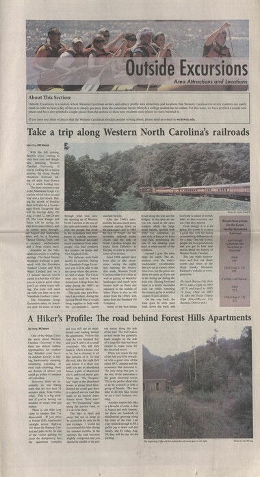
Western Carolinian Volume 76 Number 10
HL_WesternCarolinian_2010-08-20_OE_Vol76_No10_01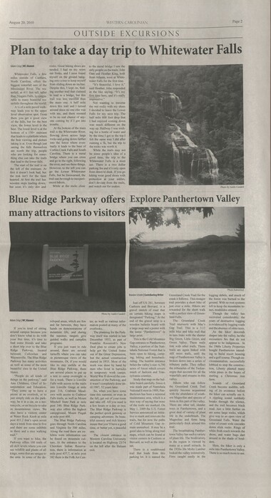
Western Carolinian Volume 76 Number 10
HL_WesternCarolinian_2010-08-20_OE_Vol76_No10_02
Western Carolinian Volume 76 Number 10
HL_WesternCarolinian_2010-08-20_OE_Vol76_No10_03
Western Carolinian Volume 76 Number 10
HL_WesternCarolinian_2010-08-20_OE_Vol76_No10_04
Western Carolinian Volume 76 Number 10
HL_WesternCarolinian_2010-08-20_OE_Vol76_No10_05
Western Carolinian Volume 76 Number 10
HL_WesternCarolinian_2010-08-20_OE_Vol76_No10_06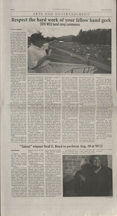
Western Carolinian Volume 76 Number 10
HL_WesternCarolinian_2010-08-20_OE_Vol76_No10_07
Western Carolinian Volume 76 Number 10
HL_WesternCarolinian_2010-08-20_OE_Vol76_No10_08Item’s are ‘child’ level descriptions to ‘parent’ objects, (e.g. one page of a whole book).
-
-
August 20, 2010 WESTERN CAROLINIAN Page 2 OUTSIDE EXCURS EONS Plan to take a day trip to Whitewater Falls Adam Crisp | WC Alumni Whitewater Falls, a few miles outside of Cashiers, North Carolina, offers the biggest waterfall east of the Mississippi River. The wa- terfall, at 411 feet tall, taller than Niagara Falls, is compa- rable to many beautiful wa- terfalls throughout the world. A % of a mile paved walk- way leads you to the upper level observation spot. From there you get a good view of the falls, but for the best view, the lower level is the best. The lower level is at the bottom of a [50+ staircase that leads to a platform where the best viewing and picture taking is at. Even though just seeing the falls themselves are worth the trp, people who are looking for some- thing else can take the trails that lead to the lower falls. The start of the trail is on the left of the staircase. At first it doesnt look bad, but the trek isnt for the faint hearted. At first the trail has wooden steps leading down, but soon its only dirt and Blue Ridge Parkway offers rocks. Good hiking shoes are needed. I had on my worn out Sinks, and I soon found myself on the ground hang- ing onto a tree to keep myself from sliding down an incline. Despite this, I kept on, find- ing another trail that claimed to lead to a bridge, but this trail was less traveld than the main one. A half mile down this trail and I turned around since no one else was with me, and there seemed to be no real chance of any- one coming by if I got into trouble. At the bottom of the main trail is the Whitewater River, flowing down across large rocks and going down further into the forest where even- tually it leads to the base of Corbin Creek Falls and South Carolina. There is a metal bridge where you can cross and go to the right, following the river, and see these things. However, to the left you can go the Lower Whitewater Falls, but be forewarned, the trail can be rough to inexperi- enced hikers. While at the rocks close to the metal bridge I saw the only people on the trails. John Oats and Heather King, both from Atlanta, were at White- water Falls for the first time. Its Beautiful, I love it, said Heather. John responded in the like saying, Its my first time here, and its really impressive. Not wanting to traverse the wet rocks with my shoes I decided to leave the Lower Falls for my next trip. The half mile 600 foot drop that I had enjoyed coming down was much different on the way up. Halfway I was wish- ing for a bottle of water and by the time I got to the top I felt the same way I did after running a 5k, but the trip to the rocks was worth it. While the trails may not be some peoples idea of a good time, the trip to the Whitewater Falls is a must see. There is a two dollar parking fee and its only open from dawn to dusk. If you go hiking wear good shoes with protection at your ankles, dont deviate from the trails, and watch out for snakes. many attractions to visitors Adam Crisp | WC Alumni If you're tired of sitting around campus because you dont know what to do with your free time, its time to find some. friends and take a short trip over to the Blue Ridge Parkway, located between Cullowhee and Waynesville. The Blue Ridge Parkway has many activities as well as some of the most beautiful sites in the United States. People do all kinds of things on the parkway, said Ann Childress, Chief of In- terpretation and Education. They come up to have a picnic at an overlook, or to just simply ride on the park- way, be it in a car, on a mo- torcycle, or on bicycle to take in mountainous views. We also have a visitors center at Water Rock Knob at mile post 451.2 thats open seven days a week from nine to five and there are some exhibits in there and a nice walking trail. If you want to hike, the Parkway offers 100 trails of all skill levels where you can see wildlife and plants of all kings, some that are unique to the area. In some of the de- veloped areas, which are few and far between, they have hands on demonstrations of mountain life, and during the summer, rangers give guided walks and campfire programs. If you just want to ride around, there are several tumoffs where you can take in picturesque views of the mountains. Or, if you would like to stay awhile at the Blue Ridge Parkway, there are several places to put up a tent to camp overnight or for a week. There is Linville Falls with access to the trails into Linville Gorge at mile post 316, Crabtree Mead- ows with access to Crabtree Falls trails, as well as Mount Mitchell State Park at mile post 340. Blue Ridge Park- way also offers the highest campground, Mount Pisgah at mile post 408. The Blue Ridge Parkway goes through North Carolina and Virginia for 500 miles, Along the road there are ex- hibits were information can be found on mountain cul- ture. At the entrance to the Cherokee Indian Reserva- tion, there is information at mile post 457.7, at mile post 382 there is the Folk Art Cen- Photo by Justin Caudell overlooks. The planning for the Park- way itself was started in late _ December 1933, as part of | Roosevelts New Deal plan to create jobs to _ help get the United States out of the Great Depression, | but the actual construction | started in 1935. Most of the | work was done by hand by | men who lived in barracks | in temporary work camps. | World War II slowed the con- Franklin struction of the Parkway, and it wasnt completely done un- _ was made part of Nantahala til 1987, 52 years later. So, when you have some time this summer, or even in the fall, get out of your room | and take off. All you need is _ a few hours or a day or two. The Blue Ridge Parkway is the perfect quick getaway or | camping adventure. Its beau- tiful scenery and rich history _ insure that you ll have a good time, or better yet, a peaceful _ | good idea to bring along trail one, The closest entrance to. Western Carolina University is located on Highway 23/74 _ on the left after the Balsam | exit, trail | parking lot. It is named the Brandon Schafer | Contributing Writer Just off US 281, between Cashiers and Brevard, is a gravel stretch of road _ that | on certain hiking maps is designated Parking. At the ter, as well as various infor- mation posted at many of the | | alarge map and a poster with end of the gravel strip is a wooden bulletin board with the name Panthertown in large print. This is the Cold Mountain Gap entrance to Panthertown Valley, a portion of the Nan- tahala National Forest that is been open to hiking, camp- ing, biking and horseback- riding. The humble entrance belies the valleys size: 6,700 acres of forest which covers much of Jackson and Tran- sylvania counties. Study that map on the bul- letin board carefully. Since it National Forest in 1989, Pan- thertown has been a minimal maintenance area, which is a nice way of saying that none of the trails are marked. On May 1, 2009 the U.S, Forest Service announced an initia- tive to mark and renovate the trails, but for now the paths of Cold Mountain Gap re- main unmarked. It may be a maps, which can be found at visitor centers in Cashiers or Brevard, as well as the inter- net, There is a southbound that leads from this Greenland Creek Trail for the creek it follows. This meager trail provides a short hike of just over a mile. Hikers are rewarded for the short walk with a perfect view of Green- land Falls. The Greenland Creek Trail intersects with Macs Gap Trail. This is a 3.13 mile bike and hike trail that in turn links with the shorter Big Green, Little Green, and Green Valley. These trails link with other trails. Those trails are again linked with still more trails, until the map of Panthertown Valley is broken down into a series of tributary paths. They reflect the tributaries of the Tuckas- eegee that account for all the waterfalls and streams in this valley. Hikers who can follow the Greenland Creek Trail quickly become acquainted with the abundance of south- ern Magnolias and species of ferns in this part of the valley. There are other tall, slender trees in Panthertown, and a great deal of variety of plant life in the underbrush. The Magnolias and ferns hang particularly thick around this trail. The breathtaking Panther- town Valley has such a variety of plant life. The biodiversity in the region is viewed by many as a small miracle. In the 1920s-30s Moltz Lumber locked the valley extensively. Fires caught easily in the Photo by Justin Caudell Explore Panthertown Valley Photo Submitted logging debris, and much of the forest was burned to the ground, With no root systems left to keep the mountains in- tact, mudslides ensued. Though the valley has recovered considerably, the years of destructive logging is evidenced by logging roads and the absence of older trees. As the hiker descends deeper into the valley, he/she encounters firs that do not appear to be indigenous. In the 1960s Liberty Properties bought Panthertown intend- ing to build resort housing and a golf course. Though en- vironmentalists successfully lobbied to stop the construc- tion, Liberty planted many white pines in the hopes of starting a Christmas tree farm, Sounds of Greenland Creek become audible, tell- ing of its existence before the hiker can actually see it, A rippling sound suddenly breaks through the silence, and the trail becomes black mud. Just a little further on are some large rocks, which give way to an open view of Greenland Falls. Water the color of cream soda cascades down slick rocks. Rings of white froth reach towards the shore, and water bugs dart around in the shade of boul- ders. Here, the hiker is only a mile into Panthertown Valley. There is so much more to see.
Object’s are ‘parent’ level descriptions to ‘children’ items, (e.g. a book with pages).
-
The Western Carolinian is Western Carolina University's student-run newspaper. The paper was published as the Cullowhee Yodel from 1924 to 1931 before changing its name to The Western Carolinian in 1933.
-
Related items
-
Western Carolinian Volume 38 Number 10
-
Cherokee Indian Fair 1941
-
Western Carolinian Volume 48 Number 09
-
Western Carolinian Volume 72 Number 10

-
Western Carolinian Volume 42 Number 63
-
The Canton Enterprise Volume 22 Number 29

-
Western Carolinian Volume 37 Number 27
-
Western Carolinian Volume 70 Number 05
-
Western Carolinian Volume 45 Number 29
-
Western Carolinian October 11, 1941
-
Cherokee Indian Fair 1946
-
Western Carolinian Volume 79 Number 05

-
Shin Seiki: Bagong Araw. New Era
-
Universal School Weaving Draft: Crackle Border
-
Western Carolinian Volume 12 Number 04
-
Western Carolinian Volume 66 (67) Number 10
-
Western Carolinian Volume 49 Number 21
-
Western Carolinian Volume 42 Number 62
-
Secretary of Agriculture report on watersheds
-
Western Carolinian Volume 72 Number 08
-
Western Carolinian Volume 60 Number 01
-
Handbook/ 1934/ Smoky Mountains Hiking Club

-
Appalachian Industrial School in the Mountains of North Carolina

-
Western Carolinian Volume 07 Number 09
-
Western Carolinian Volume 65 (66) Number 04

-
Western Carolinian Volume 36 Number 55

-
Western Carolinian Volume 36 Number 33
-
Western Carolinian Volume 45 Number 09
-
Western Carolinian November 8, 1941
-
Western Carolinian Volume 42 Number 44
-
Cullowhee Yodel Volume 05 Number 04
-
Western Carolinian Volume 64 (65) Number 16
Part of Collection
Western Carolina University Publications
-
Western Carolinian Volume 33 Number 29
-
Western Carolinian Volume 45 Number 38
-
Western Carolinian Volume 16 Number 05
-
Western Carolinian Volume 46 Number 08, October 9, 1980

-
Western Carolinian Volume 49 Number 26

-
Western Carolinian Volume 35 Number 49

-
Western Carolinian Volume 49 Number 19

-
Western Carolinian Volume 37 Number 17
-
Western Carolinian Volume 56 Number 01

-
Western Carolinian April 25, 1942

-
Cullowhee Yodel Volume 04 Number 04
-
Western Carolinian Volume 48 Number 12

-
Western Carolinian Volume 44 Number 38
-
Western Carolinian Volume 71 Number 08
-
Western Carolinian Volume 61 Number 11 (13)

-
Western Carolinian Volume 62 (63) Number 18

-
Western Carolinian Volume 46 Number 29

-
Western Carolinian Volume 70 Number 07
-
Western Carolinian Volume 41 Number 28

-
Western Carolinian Volume 75 Number 10

-
Western Carolinian Volume 68 Number 01

-
Cullowhee Yodel Volume 04 Number 09
-
Western Carolinian Volume 54 Number 23

-
Western Carolinian Volume 16 Number 06

-
Western Carolinian Volume 52 Number 13

-
Western Carolinian Volume 54 Number 16

-
Cullowhee Yodel Volume 02 Number 04

-
Western Carolinian, September 20, 1966 (Volume 32 Number 02)

-
Western Carolinian Volume 62 Number 13
-
Western Carolinian Volume 46 Number 24, July 3, 1981
-
Western Carolinian Volume 39 Number 40
-
Western Carolinia Volume 47 Number 10
