- Canton Champion Fibre Company (2308)
- Cherokee Traditions (293)
- Civil War in Southern Appalachia (165)
- Craft Revival (1942)
- Great Smoky Mountains - A Park for America (2767)
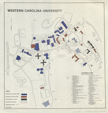
- Highlights from Western Carolina University (430)
- Horace Kephart (941)
- Journeys Through Jackson (154)
- LGBTQIA+ Archive of Jackson County (26)
- Oral Histories of Western North Carolina (314)
- Picturing Appalachia (6772)
- Stories of Mountain Folk (413)
- Travel Western North Carolina (160)
- Western Carolina University Fine Art Museum Vitreograph Collection (129)
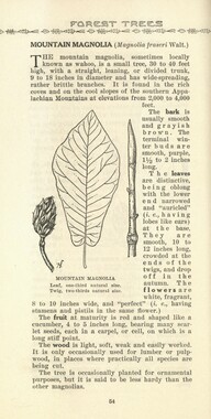
- Western Carolina University Herbarium (92)
- Western Carolina University: Making Memories (708)
- Western Carolina University Publications (2283)
- Western Carolina University Restricted Electronic Theses and Dissertations (146)
- Western North Carolina Regional Maps (71)
- World War II in Southern Appalachia (131)
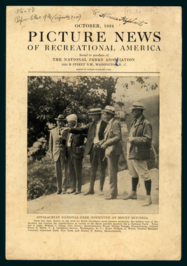
- Appalachian National Park Association (53)
- Berry, Walter (76)
- Champion Fibre Company (5)
- Fromer, Irving Rhodes, 1913-1994 (70)
- Grant, George Alexander, 1891-1964 (96)
- Kephart, Horace, 1862-1931 (23)
- Masa, George, 1881-1933 (17)
- North Carolina Park Commission (105)
- Roth, Albert, 1890-1974 (142)
- Schenck, Carl Alwin, 1868-1955 (1)
- Stearns, I. K. (2)
- Thompson, James Edward, 1880-1976 (45)
- Weaver, Zebulon, 1872-1948 (55)
- Wilburn, Hiram Coleman, 1880-1967 (72)
- Allanstand Cottage Industries (0)
- Bennett, Kelly, 1890-1974 (0)
- Brasstown Carvers (0)
- Cain, Doreyl Ammons (0)
- Carver, George Washington, 1864?-1943 (0)
- Cathey, Joseph, 1803-1874 (0)
- Champion Paper and Fibre Company (0)
- Cherokee Indian Fair Association (0)
- Cherokee Language Program (0)
- Crittenden, Lorraine (0)
- Crowe, Amanda (0)
- Edmonston, Thomas Benton, 1842-1907 (0)
- Ensley, A. L. (Abraham Lincoln), 1865-1948 (0)
- George Butz (BFS 1907) (0)
- Goodrich, Frances Louisa (0)
- Heard, Marian Gladys (0)
- Kephart, Calvin, 1883-1969 (0)
- Kephart, Laura, 1862-1954 (0)
- Laney, Gideon Thomas, 1889-1976 (0)
- McElhinney, William Julian, 1896-1953 (0)
- Niggli, Josephina, 1910-1983 (0)
- Osborne, Kezia Stradley (0)
- Owens, Samuel Robert, 1918-1995 (0)
- Penland Weavers and Potters (0)
- Rhodes, Judy (0)
- Roberts, Vivienne (0)
- Sherrill's Photography Studio (0)
- Smith, Edward Clark (0)
- Southern Highland Handicraft Guild (0)
- Southern Highlanders, Inc. (0)
- Stalcup, Jesse Bryson (0)
- United States. Indian Arts and Crafts Board (0)
- USFS (0)
- Vance, Zebulon Baird, 1830-1894 (0)
- Western Carolina College (0)
- Western Carolina Teachers College (0)
- Western Carolina University (0)
- Western Carolina University. Mountain Heritage Center (0)
- Whitman, Walt, 1819-1892 (0)
- Williams, Isadora (0)
- 1810s (1)
- 1840s (1)
- 1850s (2)
- 1860s (3)
- 1870s (4)
- 1880s (7)
- 1890s (64)
- 1900s (294)
- 1910s (227)
- 1920s (461)
- 1930s (1585)
- 1940s (82)
- 1950s (15)
- 1960s (13)
- 1970s (47)
- 1980s (14)
- 1990s (17)
- 2000s (31)
- 2010s (1)
- 1600s (0)
- 1700s (0)
- 1800s (0)
- 1820s (0)
- 1830s (0)
- 2020s (0)
- Appalachian Region, Southern (80)
- Asheville (N.C.) (1)
- Avery County (N.C.) (6)
- Blount County (Tenn.) (159)
- Buncombe County (N.C.) (204)
- Cherokee County (N.C.) (10)
- Clay County (N.C.) (3)
- Graham County (N.C.) (108)
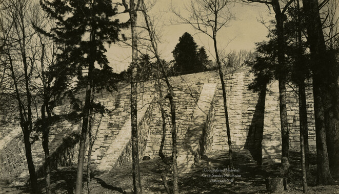
- Great Smoky Mountains National Park (N.C. and Tenn.) (438)
- Haywood County (N.C.) (263)
- Henderson County (N.C.) (13)
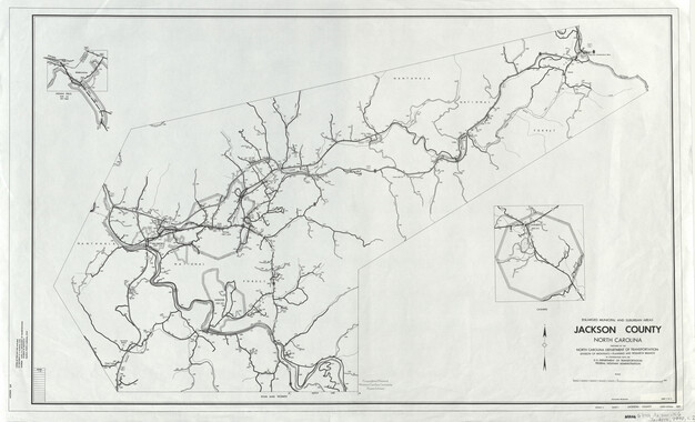
- Jackson County (N.C.) (58)
- Knox County (Tenn.) (21)
- Knoxville (Tenn.) (11)
- Lake Santeetlah (N.C.) (10)
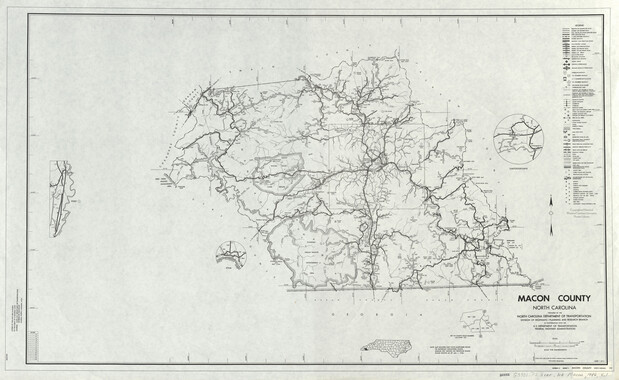
- Macon County (N.C.) (25)
- Madison County (N.C.) (14)
- McDowell County (N.C.) (5)
- Mitchell County (N.C.) (7)
- Polk County (N.C.) (2)
- Qualla Boundary (22)
- Rutherford County (N.C.) (16)
- Swain County (N.C.) (516)
- Transylvania County (N.C.) (36)
- Watauga County (N.C.) (2)
- Waynesville (N.C.) (2)
- Yancey County (N.C.) (34)
- Aerial Views (3)
- Articles (1)
- Artifacts (object Genre) (4)
- Bibliographies (1)
- Clippings (information Artifacts) (77)
- Drawings (visual Works) (174)
- Envelopes (2)
- Financial Records (9)
- Fliers (printed Matter) (34)
- Guidebooks (1)
- Interviews (12)
- Land Surveys (102)
- Letters (correspondence) (219)
- Manuscripts (documents) (91)
- Maps (documents) (86)
- Memorandums (14)
- Minutes (administrative Records) (20)
- Negatives (photographs) (282)
- Newsletters (12)
- Paintings (visual Works) (1)
- Pen And Ink Drawings (1)
- Photographs (1657)
- Portraits (40)
- Postcards (15)
- Publications (documents) (107)
- Scrapbooks (3)
- Sheet Music (1)
- Songs (musical Compositions) (2)
- Sound Recordings (7)
- Speeches (documents) (11)
- Transcripts (46)
- Aerial Photographs (0)
- Albums (books) (0)
- Biography (general Genre) (0)
- Cards (information Artifacts) (0)
- Crafts (art Genres) (0)
- Depictions (visual Works) (0)
- Design Drawings (0)
- Facsimiles (reproductions) (0)
- Fiction (general Genre) (0)
- Glass Plate Negatives (0)
- Internegatives (0)
- Newspapers (0)
- Occupation Currency (0)
- Periodicals (0)
- Personal Narratives (0)
- Plans (maps) (0)
- Poetry (0)
- Programs (documents) (0)
- Questionnaires (0)
- Slides (photographs) (0)
- Specimens (0)
- Text Messages (0)
- Tintypes (photographs) (0)
- Video Recordings (physical Artifacts) (0)
- Vitreographs (0)
- Appalachian National Park Association Records (336)
- Carlos C. Campbell Collection (282)
- Cataloochee History Project (65)
- George Masa Collection (89)
- Hiram C. Wilburn Papers (28)
- Historic Photographs Collection (236)
- Horace Kephart Collection (126)
- Humbard Collection (33)
- Jim Thompson Collection (44)
- Love Family Papers (11)
- Map Collection (12)
- R.A. Romanes Collection (10)
- Smoky Mountains Hiking Club Collection (616)
- Zebulon Weaver Collection (107)
- A.L. Ensley Collection (0)
- Appalachian Industrial School Records (0)
- Axley-Meroney Collection (0)
- Bayard Wootten Photograph Collection (0)
- Bethel Rural Community Organization Collection (0)
- Blumer Collection (0)
- C.W. Slagle Collection (0)
- Canton Area Historical Museum (0)
- Cherokee Studies Collection (0)
- Daisy Dame Photograph Album (0)
- Daniel Boone VI Collection (0)
- Doris Ulmann Photograph Collection (0)
- Elizabeth H. Lasley Collection (0)
- Elizabeth Woolworth Szold Fleharty Collection (0)
- Frank Fry Collection (0)
- Gideon Laney Collection (0)
- Hazel Scarborough Collection (0)
- Hunter and Weaver Families Collection (0)
- I. D. Blumenthal Collection (0)
- Isadora Williams Collection (0)
- Jesse Bryson Stalcup Collection (0)
- John B. Battle Collection (0)
- John C. Campbell Folk School Records (0)
- John Parris Collection (0)
- Judaculla Rock project (0)
- Kelly Bennett Collection (0)
- Major Wiley Parris Civil War Letters (0)
- McFee-Misemer Civil War Letters (0)
- Mountain Heritage Center Collection (0)
- Norburn - Robertson - Thomson Families Collection (0)
- Pauline Hood Collection (0)
- Pre-Guild Collection (0)
- Qualla Arts and Crafts Mutual Collection (0)
- Rosser H. Taylor Collection (0)
- Samuel Robert Owens Collection (0)
- Sara Madison Collection (0)
- Sherrill Studio Photo Collection (0)
- Stories of Mountain Folk - Radio Programs (0)
- The Reporter, Western Carolina University (0)
- Venoy and Elizabeth Reed Collection (0)
- WCU Gender and Sexuality Oral History Project (0)
- WCU Mountain Heritage Center Oral Histories (0)
- WCU Oral History Collection - Mountain People, Mountain Lives (0)
- WCU Students Newspapers Collection (0)
- Western North Carolina Tomorrow Black Oral History Project (0)
- William Williams Stringfield Collection (0)
- Appalachian Trail (22)
- Church buildings (9)
- Civilian Conservation Corps (U.S.) (91)
- Dams (21)
- Floods (1)
- Forest conservation (11)
- Forests and forestry (42)
- Great Smoky Mountains National Park (N.C. and Tenn.) (82)
- Hunting (2)
- Logging (25)
- Maps (74)
- North Carolina -- Maps (5)
- Postcards (15)
- Railroad trains (8)
- Sports (4)
- Storytelling (2)
- Waterfalls -- Great Smoky Mountains (N.C. and Tenn.) (39)
- African Americans (0)
- Artisans (0)
- Cherokee art (0)
- Cherokee artists -- North Carolina (0)
- Cherokee language (0)
- Cherokee pottery (0)
- Cherokee women (0)
- College student newspapers and periodicals (0)
- Dance (0)
- Education (0)
- Folk music (0)
- Forced removal, 1813-1903 (0)
- Gender nonconformity (0)
- Landscape photography (0)
- Mines and mineral resources (0)
- Paper industry (0)
- Pottery (0)
- Rural electrification -- North Carolina, Western (0)
- School integration -- Southern States (0)
- Segregation -- North Carolina, Western (0)
- Slavery (0)
- Weaving -- Appalachian Region, Southern (0)
- Wood-carving -- Appalachian Region, Southern (0)
- World War, 1939-1945 (0)
- Sound (7)
- StillImage (2172)
- Text (655)
- MovingImage (0)
Memorial to the Congress of the United States

Memorial to the Congress of the United States
NCWRA_019_12_06_15_01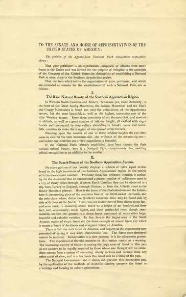
Memorial to the Congress of the United States
NCWRA_019_12_06_15_02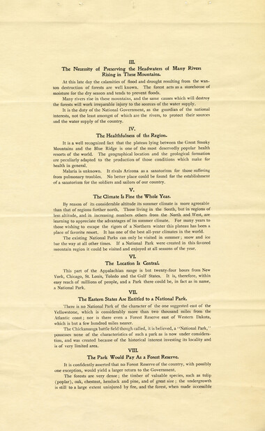
Memorial to the Congress of the United States
NCWRA_019_12_06_15_03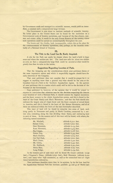
Memorial to the Congress of the United States
NCWRA_019_12_06_15_04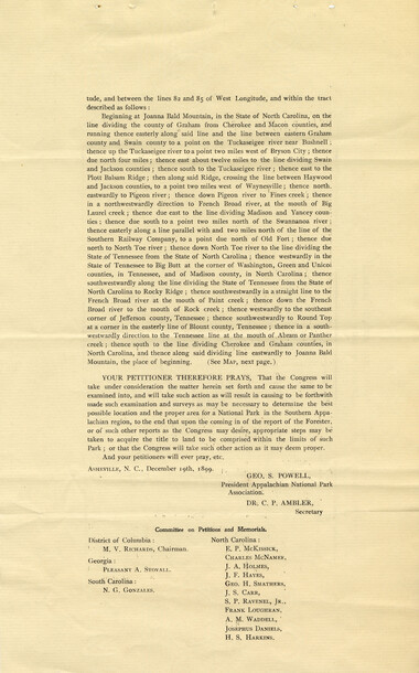
Memorial to the Congress of the United States
NCWRA_019_12_06_15_05
Memorial to the Congress of the United States
NCWRA_019_12_06_15_06
Memorial to the Congress of the United States
NCWRA_019_12_06_15_07
Memorial to the Congress of the United States
NCWRA_019_12_06_14_01
Memorial to the Congress of the United States
NCWRA_019_12_06_14_02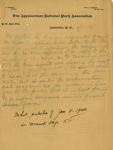
Memorial to the Congress of the United States
NCWRA_019_12_06_18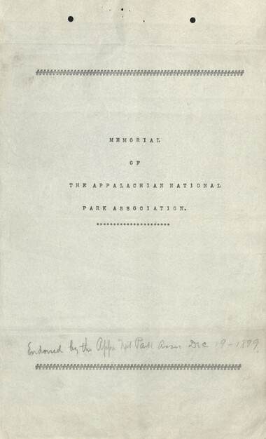
Memorial to the Congress of the United States
NCWRA_019_12_06_21_01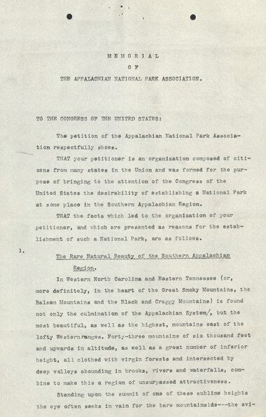
Memorial to the Congress of the United States
NCWRA_019_12_06_21_02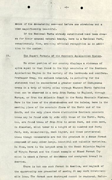
Memorial to the Congress of the United States
NCWRA_019_12_06_21_03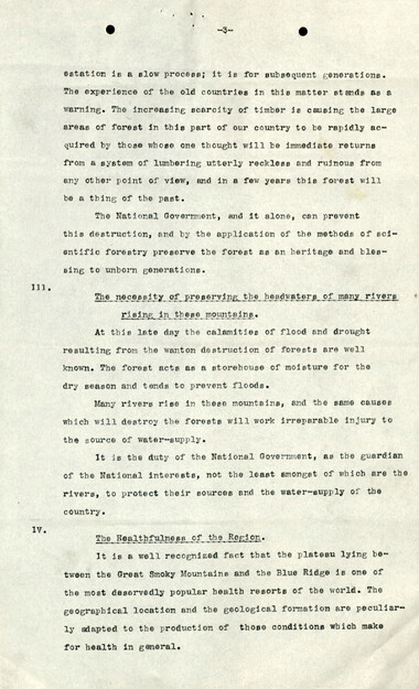
Memorial to the Congress of the United States
NCWRA_019_12_06_21_04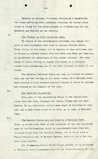
Memorial to the Congress of the United States
NCWRA_019_12_06_21_05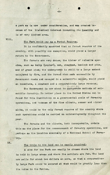
Memorial to the Congress of the United States
NCWRA_019_12_06_21_06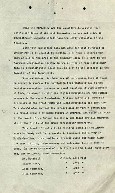
Memorial to the Congress of the United States
NCWRA_019_12_06_21_07
Memorial to the Congress of the United States
NCWRA_019_12_06_21_08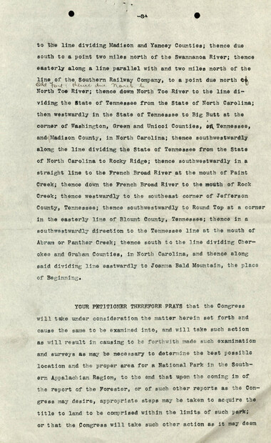
Memorial to the Congress of the United States
NCWRA_019_12_06_21_09
Memorial to the Congress of the United States
NCWRA_019_12_06_21_10
Memorial to the Congress of the United States
NCWRA_019_12_06_21_11Item’s are ‘child’ level descriptions to ‘parent’ objects, (e.g. one page of a whole book).
-
-
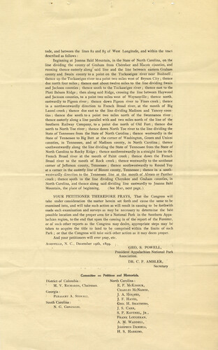
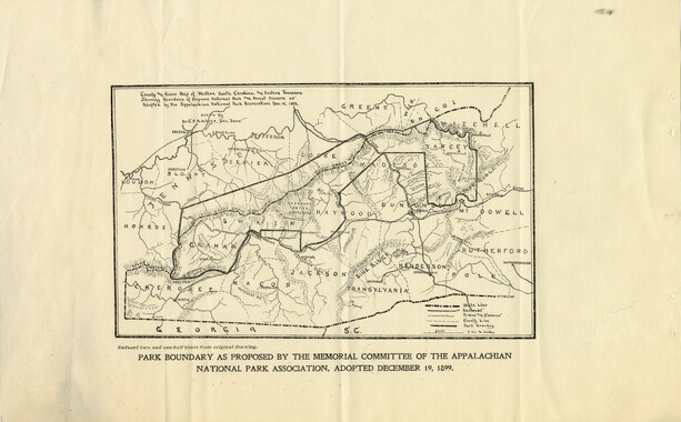
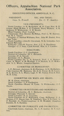
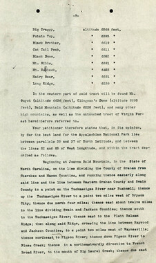
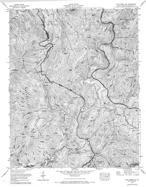
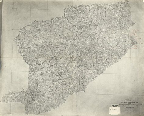
tude, and between the lines 82 and 85 of West Longitude, and within the tract described as follows : Beginning at Joanna Bald Mountain, in the State of North Carolina, on the line dividing the county of Graham from Cherokee and Macon counties, and running thence easterly along said line and the line between eastern Graham county and Swain county to a point on the Tuckaseigee river near Bushnell ; thence up the Tuckaseigee river to a point two miles west of Bryson City ; thence due north four miles ; thence east about twelve miles to the line dividing Swain and Jackson counties ; thence south to the Tuckaseigee river ; thence east to the Plott Balsam Ridge; then along said Ridge, crossing the line between Haywood and JacKson counties, to a point two miles west of Waynesville ; thence northeastwardly to Pigeon river; thence down Pigeon river to Fines creek ; thence in a northwestwardly direction to French Broad river, at the mouth of Big Laurel creek ; thence due east to the line dividing Madison and Yancey counties ; thence due south to a point two miles north of the Swannanoa river ; thence easterly along a line parallel with and two miles north of the line of the Southern Railway Company, to a point due north of Old Fort ; thence due north to North Toe river ; thence down North Toe river to the line dividing the State of Tennessee from the State of North Carolina ; thence westwardly in the State of Tennessee to Big Butt at the corner of Washington, Green and Unicoi counties, in Tennessee, and of Madison county, in North Carolina; thence southwestwardly along the line dividing the State of Tennessee from the State of North Carolina to Rocky Ridge ; thence southwestwardly in a straight line to the French Broad river at the mouth of Paint creek ; thence down the French Broad river to the mouth of Rock creek ; thence westwardly to the southeast corner of Jefferson county, Tennessee ; thence southwestwardly to Round Top at a corner in the easterly line of Blount county, Tennessee ; thence in a southwestwardly direction to the Tennessee line at the mouth of .Abram or Panther creek ; thence south to the line dividing Cherokee and Graham counties, in North Carolina, and thence along said dividing line eastwardly to Joanna Bald Mountain, the place of beginning. (See Map, next page,), YOUR PETITIONER THEREFORE PRAYS, That the Congress will take under consideration the matter herein set forth and cause the same to be examined into, and will take such action as will result in causing to be forthwith made such examination and surveys as may be necessary to determine the best possible location and the proper area for a National Park in the Southern Appalachian region, to the end that upon the coming in of the report of the Forester, or of such other reports as the Congress may desire, appropriate steps may be taken to acquire the title to land to be comprised within the limits of such Park ; or that the Congress will take such other action as it may deem proper. And your petitioners will ever pray, etc. Asheville, N. C, December 19th, 1899. , GEO. S. POWELL, President Appalachian National Park Association. DR. C. P. AMBLER, ' Secretary Committee on Petitions and Memorials. District of Columbia : North Carolina : M. V. Richards, Chairman. E. P. McKissick, ,, ' • '' ' '•■ Chari.es McNamek, Georgia : J Pleasant A. Stovall. /• A- Holf ES> J. F. Hayes, South Carolina: Gfq H Smathers> N. G. Gonzales. t g_ CarR; S. P. Ravenel, Jr., Frank Loughran, A. M. Waddell, Josephus Daniels, H. S, Harkins.
Object’s are ‘parent’ level descriptions to ‘children’ items, (e.g. a book with pages).
-
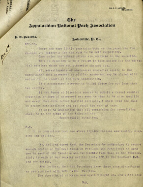
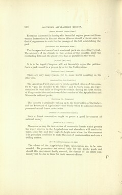
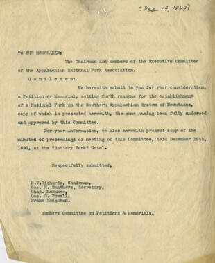
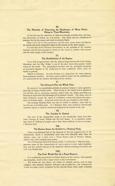
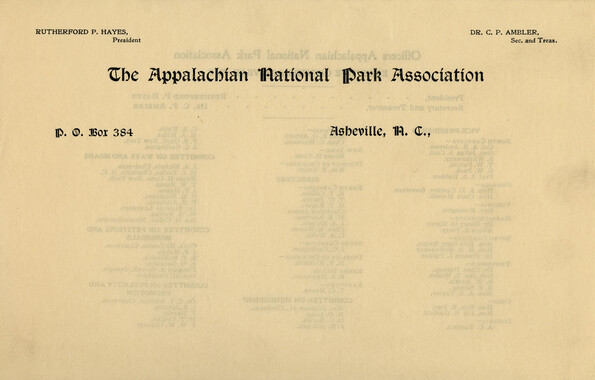
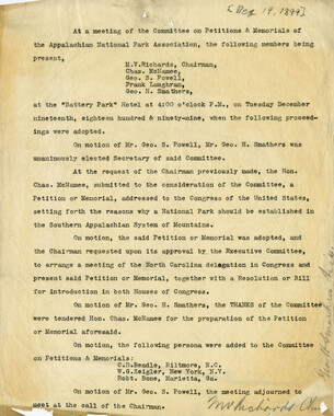
This printed “Memorial to the Congress of the United States from the Appalachian National Park Association” advocates for a national park in the southern Appalachians. The memorial, adopted by the association on December 19, 1899, includes ten bullet points listing reasons to establish a park, including “rare, natural beauty,” “superb forests,” and practical reasons, like a centralized location. The memorial is included here with a letter introducing the “Petition or Memorial,” along with map of proposed boundaries, and an earlier draft. The memorial was presented to Congress on January 4, 1900 and, on May 25, 1900, a bill was passed authorizing funds to investigate the possibility of a national park.
-


Part of Collection
Great Smoky Mountains - A Park for America