- Canton Champion Fibre Company (2308)
- Cherokee Traditions (291)
- Civil War in Southern Appalachia (165)
- Craft Revival (1942)
- Great Smoky Mountains - A Park for America (2857)
- Highlights from Western Carolina University (430)
- Horace Kephart (941)
- Journeys Through Jackson (159)
- LGBTQIA+ Archive of Jackson County (85)
- Oral Histories of Western North Carolina (314)
- Picturing Appalachia (6772)
- Stories of Mountain Folk (413)
- Travel Western North Carolina (160)
- Western Carolina University Fine Art Museum Vitreograph Collection (129)
- Western Carolina University Herbarium (92)
- Western Carolina University: Making Memories (708)
- Western Carolina University Publications (2353)
- Western Carolina University Restricted Electronic Theses and Dissertations (146)
- Western North Carolina Regional Maps (71)
- World War II in Southern Appalachia (131)
- Allanstand Cottage Industries (62)
- Appalachian National Park Association (53)
- Bennett, Kelly, 1890-1974 (1388)
- Berry, Walter (76)
- Brasstown Carvers (40)
- Carver, George Washington, 1864?-1943 (26)
- Cathey, Joseph, 1803-1874 (1)
- Champion Fibre Company (233)
- Champion Paper and Fibre Company (297)
- Cherokee Indian Fair Association (16)
- Cherokee Language Program (22)
- Crowe, Amanda (40)
- Edmonston, Thomas Benton, 1842-1907 (7)
- Ensley, A. L. (Abraham Lincoln), 1865-1948 (275)
- Fromer, Irving Rhodes, 1913-1994 (70)
- George Butz (BFS 1907) (46)
- Goodrich, Frances Louisa (120)
- Grant, George Alexander, 1891-1964 (96)
- Heard, Marian Gladys (60)
- Kephart, Calvin, 1883-1969 (15)
- Kephart, Horace, 1862-1931 (313)
- Kephart, Laura, 1862-1954 (39)
- Laney, Gideon Thomas, 1889-1976 (439)
- Masa, George, 1881-1933 (61)
- McElhinney, William Julian, 1896-1953 (44)
- Niggli, Josephina, 1910-1983 (10)
- North Carolina Park Commission (105)
- Osborne, Kezia Stradley (9)
- Owens, Samuel Robert, 1918-1995 (11)
- Penland Weavers and Potters (36)
- Roberts, Vivienne (15)
- Roth, Albert, 1890-1974 (142)
- Schenck, Carl Alwin, 1868-1955 (1)
- Sherrill's Photography Studio (2565)
- Southern Highland Handicraft Guild (127)
- Southern Highlanders, Inc. (71)
- Stalcup, Jesse Bryson (46)
- Stearns, I. K. (213)
- Thompson, James Edward, 1880-1976 (226)
- United States. Indian Arts and Crafts Board (130)
- USFS (683)
- Vance, Zebulon Baird, 1830-1894 (1)
- Weaver, Zebulon, 1872-1948 (58)
- Western Carolina College (230)
- Western Carolina Teachers College (282)
- Western Carolina University (1840)
- Western Carolina University. Mountain Heritage Center (18)
- Whitman, Walt, 1819-1892 (10)
- Wilburn, Hiram Coleman, 1880-1967 (73)
- Williams, Isadora (3)
- Cain, Doreyl Ammons (0)
- Crittenden, Lorraine (0)
- Rhodes, Judy (0)
- Smith, Edward Clark (0)
- Appalachian Region, Southern (2569)
- Asheville (N.C.) (1923)
- Avery County (N.C.) (26)
- Blount County (Tenn.) (169)
- Buncombe County (N.C.) (1672)
- Cherokee County (N.C.) (283)
- Clay County (N.C.) (555)
- Graham County (N.C.) (233)
- Great Smoky Mountains National Park (N.C. and Tenn.) (519)
- Haywood County (N.C.) (3567)
- Henderson County (N.C.) (70)
- Jackson County (N.C.) (4745)
- Knox County (Tenn.) (31)
- Knoxville (Tenn.) (12)
- Lake Santeetlah (N.C.) (10)
- Macon County (N.C.) (420)
- Madison County (N.C.) (215)
- McDowell County (N.C.) (39)
- Mitchell County (N.C.) (132)
- Polk County (N.C.) (35)
- Qualla Boundary (981)
- Rutherford County (N.C.) (76)
- Swain County (N.C.) (2117)
- Transylvania County (N.C.) (270)
- Watauga County (N.C.) (12)
- Waynesville (N.C.) (84)
- Yancey County (N.C.) (72)
- Aerial Photographs (3)
- Aerial Views (60)
- Albums (books) (4)
- Articles (1)
- Artifacts (object Genre) (228)
- Bibliographies (1)
- Biography (general Genre) (2)
- Cards (information Artifacts) (38)
- Clippings (information Artifacts) (191)
- Copybooks (instructional Materials) (3)
- Crafts (art Genres) (622)
- Depictions (visual Works) (21)
- Design Drawings (1)
- Drawings (visual Works) (185)
- Envelopes (73)
- Exhibitions (events) (1)
- Facsimiles (reproductions) (1)
- Fiction (general Genre) (4)
- Financial Records (12)
- Fliers (printed Matter) (67)
- Glass Plate Negatives (381)
- Guidebooks (2)
- Internegatives (10)
- Interviews (815)
- Land Surveys (102)
- Letters (correspondence) (1013)
- Manuscripts (documents) (618)
- Maps (documents) (177)
- Memorandums (25)
- Minutes (administrative Records) (59)
- Negatives (photographs) (5926)
- Newsletters (1290)
- Newspapers (2)
- Notebooks (8)
- Occupation Currency (1)
- Paintings (visual Works) (1)
- Pen And Ink Drawings (1)
- Periodicals (193)
- Personal Narratives (10)
- Photographs (12976)
- Plans (maps) (1)
- Poetry (5)
- Portraits (4535)
- Postcards (329)
- Programs (documents) (151)
- Publications (documents) (2305)
- Questionnaires (65)
- Sayings (literary Genre) (1)
- Scrapbooks (282)
- Sheet Music (2)
- Slides (photographs) (402)
- Songs (musical Compositions) (2)
- Sound Recordings (796)
- Specimens (92)
- Speeches (documents) (15)
- Tintypes (photographs) (8)
- Transcripts (322)
- Video Recordings (physical Artifacts) (23)
- Vitreographs (129)
- Text Messages (0)
- A.L. Ensley Collection (275)
- Appalachian Industrial School Records (7)
- Appalachian National Park Association Records (336)
- Axley-Meroney Collection (2)
- Bayard Wootten Photograph Collection (20)
- Bethel Rural Community Organization Collection (7)
- Blumer Collection (5)
- C.W. Slagle Collection (20)
- Canton Area Historical Museum (2110)
- Carlos C. Campbell Collection (373)
- Cataloochee History Project (64)
- Cherokee Studies Collection (4)
- Daisy Dame Photograph Album (5)
- Daniel Boone VI Collection (1)
- Doris Ulmann Photograph Collection (112)
- Elizabeth H. Lasley Collection (1)
- Elizabeth Woolworth Szold Fleharty Collection (4)
- Frank Fry Collection (95)
- George Masa Collection (173)
- Gideon Laney Collection (452)
- Hazel Scarborough Collection (2)
- Hiram C. Wilburn Papers (28)
- Historic Photographs Collection (236)
- Horace Kephart Collection (861)
- Humbard Collection (33)
- Hunter and Weaver Families Collection (1)
- I. D. Blumenthal Collection (4)
- Isadora Williams Collection (4)
- Jesse Bryson Stalcup Collection (47)
- Jim Thompson Collection (224)
- John B. Battle Collection (7)
- John C. Campbell Folk School Records (80)
- John Parris Collection (6)
- Judaculla Rock project (2)
- Kelly Bennett Collection (1407)
- Love Family Papers (11)
- Major Wiley Parris Civil War Letters (3)
- Map Collection (12)
- McFee-Misemer Civil War Letters (34)
- Mountain Heritage Center Collection (4)
- Norburn - Robertson - Thomson Families Collection (44)
- Pauline Hood Collection (7)
- Pre-Guild Collection (2)
- Qualla Arts and Crafts Mutual Collection (12)
- R.A. Romanes Collection (681)
- Rosser H. Taylor Collection (1)
- Samuel Robert Owens Collection (94)
- Sara Madison Collection (144)
- Sherrill Studio Photo Collection (2558)
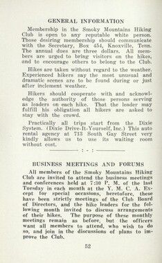
- Smoky Mountains Hiking Club Collection (616)
- Stories of Mountain Folk - Radio Programs (374)
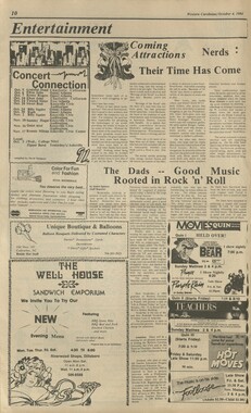
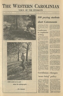
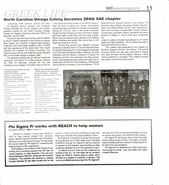
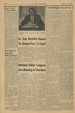
- The Reporter, Western Carolina University (510)
- Venoy and Elizabeth Reed Collection (16)
- WCU Gender and Sexuality Oral History Project (32)
- WCU Mountain Heritage Center Oral Histories (25)
- WCU Oral History Collection - Mountain People, Mountain Lives (71)
- WCU Students Newspapers Collection (1784)
- Western North Carolina Tomorrow Black Oral History Project (69)
- William Williams Stringfield Collection (2)
- Zebulon Weaver Collection (109)
- African Americans (390)
- Appalachian Trail (35)
- Artisans (521)
- Cherokee art (84)
- Cherokee artists -- North Carolina (10)
- Cherokee language (21)
- Cherokee pottery (101)
- Cherokee women (208)
- Church buildings (170)
- Civilian Conservation Corps (U.S.) (110)
- College student newspapers and periodicals (1876)
- Dams (107)
- Dance (1023)
- Education (222)
- Floods (61)
- Folk music (1015)
- Forced removal, 1813-1903 (2)
- Forest conservation (220)
- Forests and forestry (1184)
- Gender nonconformity (4)
- Great Smoky Mountains National Park (N.C. and Tenn.) (181)
- Hunting (45)
- Landscape photography (25)
- Logging (118)
- Maps (83)
- Mines and mineral resources (8)
- North Carolina -- Maps (18)
- Paper industry (38)
- Postcards (255)
- Pottery (135)
- Railroad trains (71)
- Rural electrification -- North Carolina, Western (3)
- School integration -- Southern States (2)
- Segregation -- North Carolina, Western (5)
- Slavery (5)
- Sports (452)
- Storytelling (243)
- Waterfalls -- Great Smoky Mountains (N.C. and Tenn.) (66)
- Weaving -- Appalachian Region, Southern (280)
- Wood-carving -- Appalachian Region, Southern (328)
- World War, 1939-1945 (173)
Glimpses of our National Monuments

Glimpses of our National Monuments
GSMNP_13150_46_1175_00
Glimpses of our National Monuments
GSMNP_13150_46_1175_00_a
Glimpses of our National Monuments
GSMNP_13150_46_1175_00_b
Glimpses of our National Monuments
GSMNP_13150_46_1175_00_c
Glimpses of our National Monuments
GSMNP_13150_46_1175_01
Glimpses of our National Monuments
GSMNP_13150_46_1175_02
Glimpses of our National Monuments
GSMNP_13150_46_1175_03
Glimpses of our National Monuments
GSMNP_13150_46_1175_04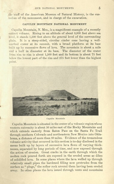
Glimpses of our National Monuments
GSMNP_13150_46_1175_05
Glimpses of our National Monuments
GSMNP_13150_46_1175_06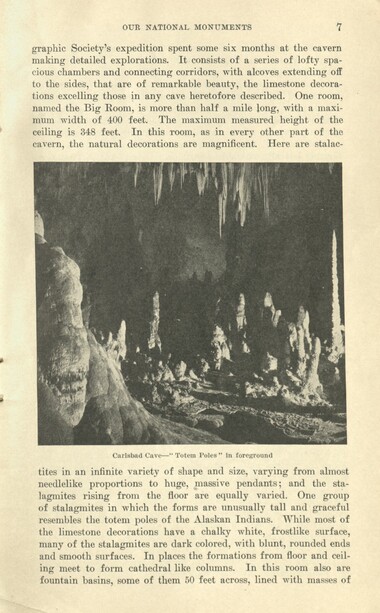
Glimpses of our National Monuments
GSMNP_13150_46_1175_07
Glimpses of our National Monuments
GSMNP_13150_46_1175_08
Glimpses of our National Monuments
GSMNP_13150_46_1175_09
Glimpses of our National Monuments
GSMNP_13150_46_1175_10
Glimpses of our National Monuments
GSMNP_13150_46_1175_11
Glimpses of our National Monuments
GSMNP_13150_46_1175_12
Glimpses of our National Monuments
GSMNP_13150_46_1175_13
Glimpses of our National Monuments
GSMNP_13150_46_1175_14
Glimpses of our National Monuments
GSMNP_13150_46_1175_15
Glimpses of our National Monuments
GSMNP_13150_46_1175_16
Glimpses of our National Monuments
GSMNP_13150_46_1175_17
Glimpses of our National Monuments
GSMNP_13150_46_1175_18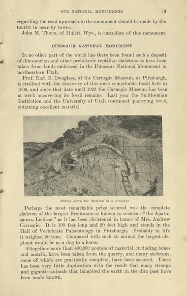
Glimpses of our National Monuments
GSMNP_13150_46_1175_19
Glimpses of our National Monuments
GSMNP_13150_46_1175_20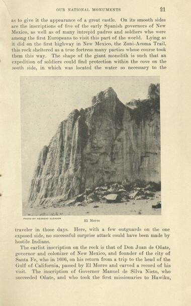
Glimpses of our National Monuments
GSMNP_13150_46_1175_21
Glimpses of our National Monuments
GSMNP_13150_46_1175_22
Glimpses of our National Monuments
GSMNP_13150_46_1175_23
Glimpses of our National Monuments
GSMNP_13150_46_1175_24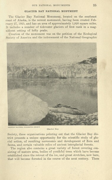
Glimpses of our National Monuments
GSMNP_13150_46_1175_25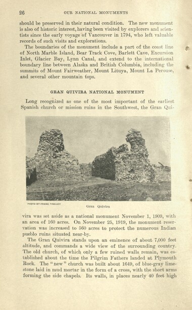
Glimpses of our National Monuments
GSMNP_13150_46_1175_26
Glimpses of our National Monuments
GSMNP_13150_46_1175_27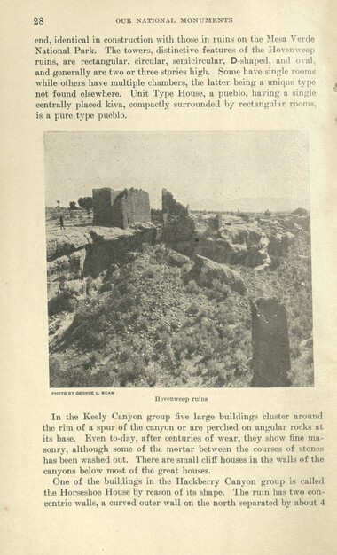
Glimpses of our National Monuments
GSMNP_13150_46_1175_28
Glimpses of our National Monuments
GSMNP_13150_46_1175_29
Glimpses of our National Monuments
GSMNP_13150_46_1175_30
Glimpses of our National Monuments
GSMNP_13150_46_1175_31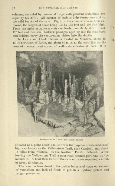
Glimpses of our National Monuments
GSMNP_13150_46_1175_32
Glimpses of our National Monuments
GSMNP_13150_46_1175_33
Glimpses of our National Monuments
GSMNP_13150_46_1175_34
Glimpses of our National Monuments
GSMNP_13150_46_1175_35
Glimpses of our National Monuments
GSMNP_13150_46_1175_36
Glimpses of our National Monuments
GSMNP_13150_46_1175_36_a
Glimpses of our National Monuments
GSMNP_13150_46_1175_37_a
Glimpses of our National Monuments
GSMNP_13150_46_1175_37
Glimpses of our National Monuments
GSMNP_13150_46_1175_38
Glimpses of our National Monuments
GSMNP_13150_46_1175_39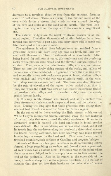
Glimpses of our National Monuments
GSMNP_13150_46_1175_40
Glimpses of our National Monuments
GSMNP_13150_46_1175_41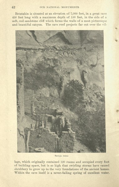
Glimpses of our National Monuments
GSMNP_13150_46_1175_42
Glimpses of our National Monuments
GSMNP_13150_46_1175_43
Glimpses of our National Monuments
GSMNP_13150_46_1175_44
Glimpses of our National Monuments
GSMNP_13150_46_1175_45
Glimpses of our National Monuments
GSMNP_13150_46_1175_46
Glimpses of our National Monuments
GSMNP_13150_46_1175_47
Glimpses of our National Monuments
GSMNP_13150_46_1175_48
Glimpses of our National Monuments
GSMNP_13150_46_1175_49
Glimpses of our National Monuments
GSMNP_13150_46_1175_50
Glimpses of our National Monuments
GSMNP_13150_46_1175_51
Glimpses of our National Monuments
GSMNP_13150_46_1175_52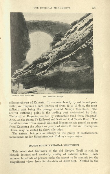
Glimpses of our National Monuments
GSMNP_13150_46_1175_53
Glimpses of our National Monuments
GSMNP_13150_46_1175_54
Glimpses of our National Monuments
GSMNP_13150_46_1175_55
Glimpses of our National Monuments
GSMNP_13150_46_1175_56
Glimpses of our National Monuments
GSMNP_13150_46_1175_57
Glimpses of our National Monuments
GSMNP_13150_46_1175_58
Glimpses of our National Monuments
GSMNP_13150_46_1175_59
Glimpses of our National Monuments
GSMNP_13150_46_1175_60
Glimpses of our National Monuments
GSMNP_13150_46_1175_61
Glimpses of our National Monuments
GSMNP_13150_46_1175_62
Glimpses of our National Monuments
GSMNP_13150_46_1175_63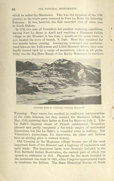
Glimpses of our National Monuments
GSMNP_13150_46_1175_64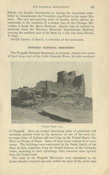
Glimpses of our National Monuments
GSMNP_13150_46_1175_65
Glimpses of our National Monuments
GSMNP_13150_46_1175_66
Glimpses of our National Monuments
GSMNP_13150_46_1175_67
Glimpses of our National Monuments
GSMNP_13150_46_1175_68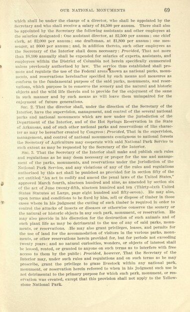
Glimpses of our National Monuments
GSMNP_13150_46_1175_69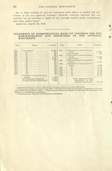
Glimpses of our National Monuments
GSMNP_13150_46_1175_70
Glimpses of our National Monuments
GSMNP_13150_46_1175_71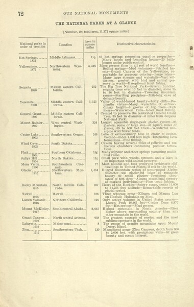
Glimpses of our National Monuments
GSMNP_13150_46_1175_72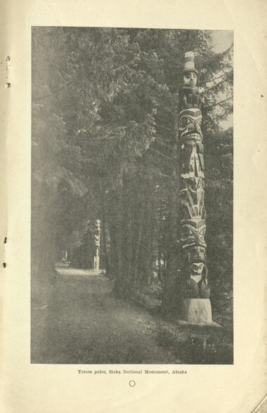
Glimpses of our National Monuments
GSMNP_13150_46_1175_73
Glimpses of our National Monuments
GSMNP_13150_46_1175_74Item’s are ‘child’ level descriptions to ‘parent’ objects, (e.g. one page of a whole book).
-
-
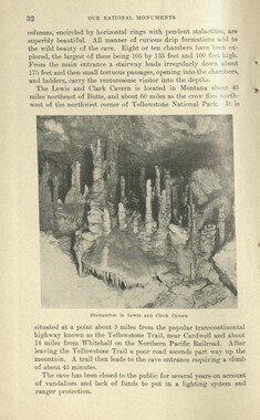
OUR NATIONAL MONUMENTS 41 Thus the neck of the peninsula wyas undermined by the floods that surged against it from both sides. In time they broke through the neck and took the short cut through the hole thus formed. The end of the peninsula was left as an island, and the upper part of the neck remains as a bridge binding the island to the mainland. . The Natural Bridges lie about 55 miles west of the town of Blanding, Utah, and are reached from that point by trail. A guide, horses, and pack outfit are necessary for the trip. Zeke Johnson, of Blanding, custodian of the monument, is an excellent outfitter and guide. The trail extends wrest across a series of canyons and, climbing a high mesa, passes through Elk Ridge between two biittes called the Bear's Ears, altitude 9,040 feet above sea level. Elk Ridge is heavily timbered with giant western yellow pine and makes an ideal camping country. The trail descends the west face of Elk Ridge to the head of White Canyon, where the bridges are located. White Canyon enters the Colorado River about 38 miles west at Dandy Crossing. On the opposite bank is the town of Hite, which has one lone resident. From Hite it is 50 miles by trail to the nearest settlement, Hanksville, Utah, from which point a road may be traversed by automobile to the main road system of western Utah. The entire trail trip across is one of unusual beauty and interest, the country being rich in coloration and forms. Blanding, Utah, is reached by automobile road from Colorado points via Mesa Verde National Park and from Thompson, Utah, on the Pikes Peak Ocean-to-Ocean Highway and the main line of the Denver & Rio Grande Western Railroad. There is automobile stage service from Thompson, which is about 130 miles south of Blanding. NAVAJO NATIONAL MONUMENT The Navajo National Monument is in northeastern Arizona, within the great but little known Navajo Indian Reservation. It was created March 20, 1909, and the area reduced by presidential proclamation of March 14, 1912, to three small areas totaling about 360 acres. Each separate trait contains the ruins of a remarkable prehistoric cave, pueblo, or cliff dwelling in a good state of preservation. These are known as Betatakin (the Navajo name of side-hill house), Kitsil (meaning broken pottery), and Inscription House. The latter ruin derives its name from an inscription scratched into the clay plaster of a wall. It reads, " S-hapeiro Ano Dom 1661." An intrepid early Spanish explorer or missionary, probably on his way to or from the Colorado River, must have entered the canyon in which this ruin is located and paused at the long-abandoned pueblo to scratch a record of his visit. It was not visited again until June, 1909.
Object’s are ‘parent’ level descriptions to ‘children’ items, (e.g. a book with pages).
-
This 80-page booklet, “Glimpses of our National Monuments” was published in 1926 by the National Park Service. The booklet begins by outlining the distinction between America’s national parks and its national monuments. Subsequent pages show and describe the monuments. Page 72 lists all the national parks to date, all in the western U.S. One argument for the Great Smoky Mountains National Park is that there were no national parks in the eastern U.S. This situation was not changed until 1934 when the Great Smoky Mountains National Park was established.
-
Related items
-
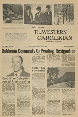
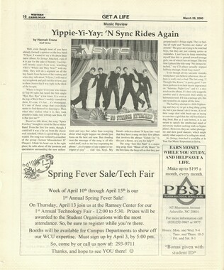
Western Carolinian Volume 34 Number 15
-
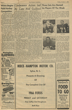
Western Carolinian Volume 44 Number 27
-
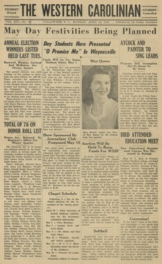
Western Carolinian Volume 54 Number 11

-
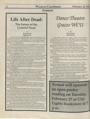
Western Carolinian Volume 40 Number 56
-
Western Carolinian Volume 65 (66) Number 12
-
Western Carolinian Volume 49 Number 10
-
Western Carolinian Volume 37 Number 15
-
Western Carolinian Volume 69 Number 12
-
Western Carolinian 1979 Fall Special Edition

-
Western Carolinian Volume 01(28) Number 03
-
Western Carolinian Volume 69 Number 09

-
Western Carolinian Volume 68 Number 06

-
Western Carolinian Volume 42 Number 32

-
Western Carolinian Volume 68 Number 09
-
Western Carolinian Volume 27 Number 23
-
Western Carolinian Volume 68 Number 09

-
Western Carolinian Volume 35 Number 37
-
Western Carolinian Volume 39 Number 12
-
Western Carolinian Volume 64 (65) Number 26
-
Western Carolinian Volume 31 Number 04
-
Western Carolinian Volume 14 Number 11
-
Western Carolinian Volume 61 Number 17
-
Western Carolinian Volume 59 Number 04
-
Western Carolinian Volume 43 Number 36
-
Western Carolinian Volume 12 Number 03
-
Western Carolinian Volume 57 Number 11
-
Western Carolinian Volume 44 Number 30
-
Western Carolinian Volume 39 Number 31

-
Western Carolinian Volume 29 Number 01
-
Western Carolinian Volume 16 Number 13
-
Western Carolinian Volume 09 October 2, 1940
-
Western Carolinian Volume 51 Number 01
Part of Collection
Great Smoky Mountains - A Park for America
-
Report of the Secretary of Agriculture in relation to the forests, rivers, and mountains of the southern Appalachian region
-
Handbook/ 1934/ Smoky Mountains Hiking Club
-
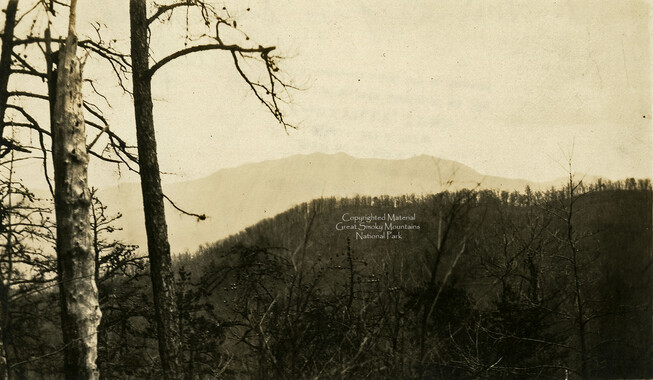
View from Grassy Bald
-
Horace Kephart and the Great Smoky Mountains National Park
-
Legislative act to give consent by Tennessee

-
Cataloochee: fields

-
Glimpses of our National Monuments
-
Senate Bill 5228: Senator Depew's speech

-
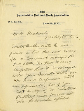
Senator Pritchard's Speech
-
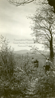
Hikers on Round Top
-
Correspondence between Zebulon Weaver, W. E. Bird, A. E. Demaray, George McCoy, J. Ross Eakin, 1934

-
Map of Cataloochee Valley

-
Senator Pritchard's Speech

-
Mount LeConte From Sugarlands
-
History and mission of the Appalachian National Park Association
-
Cataloochee tract 209a: Johnathan Woody

-
History of Mt. Sterling, N.C. and its people

-
Handbook/ 1932/ Smoky Mountains Hiking Club
-
Letters supporting Appalachian National Park movement
-
Financial receipts and expenditures, 1899

-
Clingmans Dome from Hughes Ridge
-
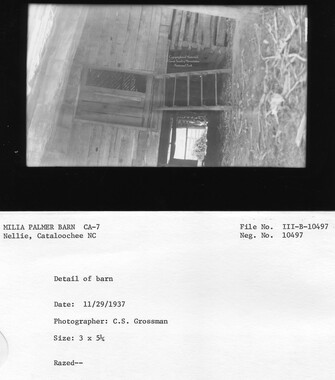
Cataloochee tract 219: Milia Palmer
-
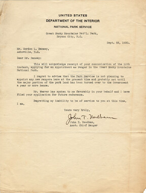
Correspondence: John T. Needham to Gordon L. Ramsey, September 22, 1930
-
Senate bill proposed
-
Rhododendrons on top of Craggy Mountain
-
Hardwood Bark, 1922
-
Beginning of history in the Great Smoky Mountains

-
Report of the Secretary of Agriculture in relation to the forests, rivers, and mountains of the southern Appalachian region

-
Mingus Creek: looking downstream

-
Cataloochee tract 214: Eldredge Caldwell – Levi

-
Park dedication: President Roosevelt

-
CCC camp at Smokemont