- Canton Champion Fibre Company (2308)
- Cherokee Traditions (291)
- Civil War in Southern Appalachia (165)
- Craft Revival (1942)
- Great Smoky Mountains - A Park for America (2946)
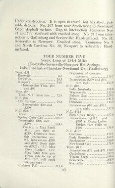
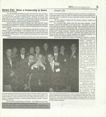
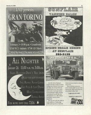
- Highlights from Western Carolina University (430)
- Horace Kephart (941)
- Journeys Through Jackson (159)
- LGBTQIA+ Archive of Jackson County (85)
- Oral Histories of Western North Carolina (314)
- Picturing Appalachia (6798)
- Stories of Mountain Folk (413)
- Travel Western North Carolina (160)
- Western Carolina University Fine Art Museum Vitreograph Collection (129)
- Western Carolina University Herbarium (92)
- Western Carolina University: Making Memories (708)
- Western Carolina University Publications (2412)
- Western Carolina University Restricted Electronic Theses and Dissertations (146)
- Western North Carolina Regional Maps (71)
- World War II in Southern Appalachia (131)
- Allanstand Cottage Industries (62)
- Appalachian National Park Association (53)
- Bennett, Kelly, 1890-1974 (1388)
- Berry, Walter (76)
- Brasstown Carvers (40)
- Carver, George Washington, 1864?-1943 (26)
- Cathey, Joseph, 1803-1874 (1)
- Champion Fibre Company (233)
- Champion Paper and Fibre Company (297)
- Cherokee Indian Fair Association (16)
- Cherokee Language Program (22)
- Crowe, Amanda (40)
- Edmonston, Thomas Benton, 1842-1907 (7)
- Ensley, A. L. (Abraham Lincoln), 1865-1948 (275)
- Fromer, Irving Rhodes, 1913-1994 (70)
- George Butz (BFS 1907) (46)
- Goodrich, Frances Louisa (120)
- Grant, George Alexander, 1891-1964 (96)
- Heard, Marian Gladys (60)
- Kephart, Calvin, 1883-1969 (15)
- Kephart, Horace, 1862-1931 (313)
- Kephart, Laura, 1862-1954 (39)
- Laney, Gideon Thomas, 1889-1976 (439)
- Masa, George, 1881-1933 (61)
- McElhinney, William Julian, 1896-1953 (44)
- Niggli, Josephina, 1910-1983 (10)
- North Carolina Park Commission (105)
- Osborne, Kezia Stradley (9)
- Owens, Samuel Robert, 1918-1995 (11)
- Penland Weavers and Potters (36)
- Roberts, Vivienne (15)
- Roth, Albert, 1890-1974 (142)
- Schenck, Carl Alwin, 1868-1955 (1)
- Sherrill's Photography Studio (2565)
- Southern Highland Handicraft Guild (127)
- Southern Highlanders, Inc. (71)
- Stalcup, Jesse Bryson (46)
- Stearns, I. K. (213)
- Thompson, James Edward, 1880-1976 (226)
- United States. Indian Arts and Crafts Board (130)
- USFS (683)
- Vance, Zebulon Baird, 1830-1894 (1)
- Weaver, Zebulon, 1872-1948 (58)
- Western Carolina College (230)
- Western Carolina Teachers College (282)
- Western Carolina University (1899)
- Western Carolina University. Mountain Heritage Center (18)
- Whitman, Walt, 1819-1892 (10)
- Wilburn, Hiram Coleman, 1880-1967 (73)
- Williams, Isadora (3)
- Cain, Doreyl Ammons (0)
- Crittenden, Lorraine (0)
- Rhodes, Judy (0)
- Smith, Edward Clark (0)
- Appalachian Region, Southern (2569)
- Asheville (N.C.) (1923)
- Avery County (N.C.) (26)
- Blount County (Tenn.) (195)
- Buncombe County (N.C.) (1672)
- Cherokee County (N.C.) (283)
- Clay County (N.C.) (555)
- Graham County (N.C.) (233)
- Great Smoky Mountains National Park (N.C. and Tenn.) (519)
- Haywood County (N.C.) (3569)
- Henderson County (N.C.) (70)
- Jackson County (N.C.) (4804)
- Knox County (Tenn.) (35)
- Knoxville (Tenn.) (13)
- Lake Santeetlah (N.C.) (10)
- Macon County (N.C.) (420)
- Madison County (N.C.) (215)
- McDowell County (N.C.) (39)
- Mitchell County (N.C.) (132)
- Polk County (N.C.) (35)
- Qualla Boundary (981)
- Rutherford County (N.C.) (76)
- Swain County (N.C.) (2135)
- Transylvania County (N.C.) (270)
- Watauga County (N.C.) (12)
- Waynesville (N.C.) (86)
- Yancey County (N.C.) (72)
- Aerial Photographs (3)
- Aerial Views (60)
- Albums (books) (4)
- Articles (1)
- Artifacts (object Genre) (228)
- Bibliographies (1)
- Biography (general Genre) (2)
- Cards (information Artifacts) (38)
- Clippings (information Artifacts) (191)
- Copybooks (instructional Materials) (3)
- Crafts (art Genres) (622)
- Depictions (visual Works) (21)
- Design Drawings (1)
- Drawings (visual Works) (185)
- Envelopes (73)
- Exhibitions (events) (1)
- Facsimiles (reproductions) (1)
- Fiction (general Genre) (4)
- Financial Records (12)
- Fliers (printed Matter) (67)
- Glass Plate Negatives (381)
- Guidebooks (2)
- Internegatives (10)
- Interviews (815)
- Land Surveys (102)
- Letters (correspondence) (1013)
- Manuscripts (documents) (618)
- Maps (documents) (177)
- Memorandums (25)
- Minutes (administrative Records) (59)
- Negatives (photographs) (6015)
- Newsletters (1290)
- Newspapers (2)
- Notebooks (8)
- Occupation Currency (1)
- Paintings (visual Works) (1)
- Pen And Ink Drawings (1)
- Periodicals (193)
- Personal Narratives (10)
- Photographs (12976)
- Plans (maps) (1)
- Poetry (5)
- Portraits (4539)
- Postcards (329)
- Programs (documents) (151)
- Publications (documents) (2364)
- Questionnaires (65)
- Relief Prints (26)
- Sayings (literary Genre) (1)
- Scrapbooks (282)
- Sheet Music (2)
- Slides (photographs) (402)
- Songs (musical Compositions) (2)
- Sound Recordings (796)
- Specimens (92)
- Speeches (documents) (15)
- Tintypes (photographs) (8)
- Transcripts (322)
- Video Recordings (physical Artifacts) (23)
- Text Messages (0)
- A.L. Ensley Collection (275)
- Appalachian Industrial School Records (7)
- Appalachian National Park Association Records (336)
- Axley-Meroney Collection (2)
- Bayard Wootten Photograph Collection (20)
- Bethel Rural Community Organization Collection (7)
- Blumer Collection (5)
- C.W. Slagle Collection (20)
- Canton Area Historical Museum (2110)
- Carlos C. Campbell Collection (462)
- Cataloochee History Project (64)
- Cherokee Studies Collection (4)
- Daisy Dame Photograph Album (5)
- Daniel Boone VI Collection (1)
- Doris Ulmann Photograph Collection (112)
- Elizabeth H. Lasley Collection (1)
- Elizabeth Woolworth Szold Fleharty Collection (4)
- Frank Fry Collection (95)
- George Masa Collection (173)
- Gideon Laney Collection (452)
- Hazel Scarborough Collection (2)
- Hiram C. Wilburn Papers (28)
- Historic Photographs Collection (236)
- Horace Kephart Collection (861)
- Humbard Collection (33)
- Hunter and Weaver Families Collection (1)
- I. D. Blumenthal Collection (4)
- Isadora Williams Collection (4)
- Jesse Bryson Stalcup Collection (47)
- Jim Thompson Collection (224)
- John B. Battle Collection (7)
- John C. Campbell Folk School Records (80)
- John Parris Collection (6)
- Judaculla Rock project (2)
- Kelly Bennett Collection (1407)
- Love Family Papers (11)
- Major Wiley Parris Civil War Letters (3)
- Map Collection (12)
- McFee-Misemer Civil War Letters (34)
- Mountain Heritage Center Collection (4)
- Norburn - Robertson - Thomson Families Collection (44)
- Pauline Hood Collection (7)
- Pre-Guild Collection (2)
- Qualla Arts and Crafts Mutual Collection (12)
- R.A. Romanes Collection (681)
- Rosser H. Taylor Collection (1)
- Samuel Robert Owens Collection (94)
- Sara Madison Collection (144)
- Sherrill Studio Photo Collection (2558)
- Smoky Mountains Hiking Club Collection (616)
- Stories of Mountain Folk - Radio Programs (374)
- The Reporter, Western Carolina University (510)
- Venoy and Elizabeth Reed Collection (16)
- WCU Gender and Sexuality Oral History Project (32)
- WCU Mountain Heritage Center Oral Histories (25)
- WCU Oral History Collection - Mountain People, Mountain Lives (71)
- WCU Students Newspapers Collection (1843)
- Western North Carolina Tomorrow Black Oral History Project (69)
- William Williams Stringfield Collection (2)
- Zebulon Weaver Collection (109)
- African Americans (390)
- Appalachian Trail (35)
- Artisans (521)
- Cherokee art (84)
- Cherokee artists -- North Carolina (10)
- Cherokee language (21)
- Cherokee pottery (101)
- Cherokee women (208)
- Church buildings (172)
- Civilian Conservation Corps (U.S.) (111)
- College student newspapers and periodicals (1933)
- Dams (107)
- Dance (1023)
- Education (222)
- Floods (61)
- Folk music (1015)
- Forced removal, 1813-1903 (2)
- Forest conservation (220)
- Forests and forestry (1184)
- Gender nonconformity (4)
- Great Smoky Mountains National Park (N.C. and Tenn.) (181)
- Hunting (45)
- Landscape photography (25)
- Logging (119)
- Maps (83)
- Mines and mineral resources (8)
- North Carolina -- Maps (18)
- Paper industry (38)
- Postcards (255)
- Pottery (135)
- Railroad trains (72)
- Rural electrification -- North Carolina, Western (3)
- School integration -- Southern States (2)
- Segregation -- North Carolina, Western (5)
- Slavery (5)
- Sports (452)
- Storytelling (243)
- Waterfalls -- Great Smoky Mountains (N.C. and Tenn.) (66)
- Weaving -- Appalachian Region, Southern (280)
- Wood-carving -- Appalachian Region, Southern (328)
- World War, 1939-1945 (173)
Early Explorers in the Great Smokies
Early Explorers in the Great Smokies
GSMNP_13150_19_1185_01
Early Explorers in the Great Smokies
GSMNP_13150_19_1185_02
Early Explorers in the Great Smokies
GSMNP_13150_19_1185_03
Early Explorers in the Great Smokies
GSMNP_13150_19_1185_04
Early Explorers in the Great Smokies
GSMNP_13150_19_1185_05
Early Explorers in the Great Smokies
GSMNP_13150_19_1185_06
Early Explorers in the Great Smokies
GSMNP_13150_19_1185_07
Early Explorers in the Great Smokies
GSMNP_13150_19_1185_08
Early Explorers in the Great Smokies
GSMNP_13150_19_1185_09
Early Explorers in the Great Smokies
GSMNP_13150_19_1185_10
Early Explorers in the Great Smokies
GSMNP_13150_19_1185_11
Early Explorers in the Great Smokies
GSMNP_13150_19_1185_12
Early Explorers in the Great Smokies
GSMNP_13150_19_1185_13
Early Explorers in the Great Smokies
GSMNP_13150_19_1185_14
Early Explorers in the Great Smokies
GSMNP_13150_19_1185_15
Early Explorers in the Great Smokies
GSMNP_13150_19_1185_16Item’s are ‘child’ level descriptions to ‘parent’ objects, (e.g. one page of a whole book).
-
-
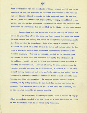
Early Explorers in the Great Smokies 59 Various accounts in histories and elsewhere have stated that John Sevier crossed over the tops of the Smokies in his warfare against the Indians, but the evidence does not seem to bear this out. In telling of the 1781 campaign against the Erati, Edmund Kirke recounts in abundant detail what purports to be the first ascent of Clingman's Dome by a white man. That there might be no mistake as to the peak meant, it is described as being "higher than any peak but one among the Appalachians".15 From its summit Sevier's party was able to "trace the courses of the Holston, the Watauga and his own Nolichucky, and nearer the silvery windings of the Tennessee as it rushed past the strongholds of the Chickamaugas".16 Though such a range of vision is seldom granted ordinary eyes, the account might be accepted did Kirke not state that "the summit was carpeted with a deep, green sward sprinkled with heather and rhododendron".17 When one has visited the top of Clingman's Dome and rested in the dim twilight that filters through the dense tops of as thick a stand of balsam as Smoky can present, one comes to the conclusion that Kirke was romancing, and knew not whereof he spoke. Regarding the same campaign, Ramsey's account indicates that Sevier's forces crossed the Balsam Mountains at Balsam Gap and followed the course of the headwaters of the Tuckasegee River to the Indian towns, skirting the eastern boundaries of the Smokies rather than actually penetrating these mountains.18 For some decades following the Revolution the records of Smoky exploration are the records of various surveys, which, interesting enough in their own sphere, do not offer much detail of the mountains themselves. But in order that this account be as complete as may be, reference should be made to them. When Tennessee was admitted into the Union as a state in 1796, its eastern border corresponded with the line of the territory ceded to the United States by North Carolina, and the boundary was described in the same terms. Commissioners were appointed immediately by both states to settle the exact location of the state line, but their labors ceased just as they reached the eastern end of the Smokies, the terminus of their survey being designated by a large marked stone set by the side of the Cataloochee Turnpike.19 More than twenty years were to pass before the state line survey "Edmund Kirke, The Rear-Guard of the Revolution (New York, 1887),295. ™lbid., 297. vibid., 298. 18 J. M. G. Ramsey, Annuals of Tennessee (Philadelphia, 1853), 269. 19 State of North Carolina vs State of Tennessee. Report of the U. S. Supreme Court, October term, 1914, p. 6.
Object’s are ‘parent’ level descriptions to ‘children’ items, (e.g. a book with pages).
-
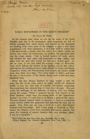
This article titled, “Early Explorers in the Great Smokies” was written by Paul Fink and published in the East Tennessee Historical Society’s Publications. Fink signed, dated, and inscribed this copy to George Masa. Born Masahara Iizuka and raised in Japan, George Masa (1881-1933) was active in the Appalachian Trail Club and in the movement to establish the Great Smoky Mountains National Park. Paul M. Fink (1892-1980), a hiker and advocate of the Great Smoky Mountains National Park, served on the Tennessee Nomenclature Committee. Working with George Masa and others, he was largely responsible for routing the Appalachian Trail through the Great Smokies and nearby mountain ranges.
-
Related items
-
The Canton Enterprise Volume 41 Number 03
-
Western Carolinian Volume 27 Number 04 (05)
-
Western Carolinian Volume 40 Number 52
-
Western Carolinian Volume 69 Number 07
-
Neo-Blackness 1977
-
Western Carolinian Volume 70 Number 13

-
Western Carolinian Volume 35 Number 06
-
Western Carolinian Volume 64 (65) Number 11 (13)
-
Western Carolinian Volume 42 Number 24
-
Western Carolinian Volume 34 Number 36
-
Western Carolinian Volume 34 Number 37
-
Western Carolinian Volume 71 Number 08
-
Western Carolinian Volume 70 Number 13

-
Western Carolinian Volume 45 Number 06

-
Western Carolinian Volume 63 Number 10
-
Western Carolinian Volume 60 Number 01
-
Guide to the Great Smoky Mountains National Park
-
Western Carolinian Volume 70 Number 04
-
Western Carolinian Volume 65 (66) Number 17
-
Western Carolinian Volume 42 Number 60
-
Western Carolinian Volume 31 Number 06

-
Western Carolinian Volume 61 Number 09 (11)
-
Western Carolinian Volume 62 Number 04
-
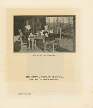
Appalachian School, January 1924
-
Western Carolinian Volume 58 Number 08
-
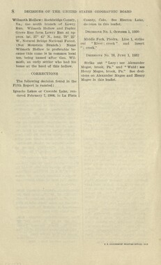
Nomenclature Decisions of the United States Geographic Board
-
Western Carolinian Volume 48 Number 17
-
Western Carolinian Volume 62 (63) Number 21 (22)
-
Western Carolinian Volume 55 Number 17

-
Western Carolinian Volume 69 Number 09

-
Western Carolinian Volume 37 Number 05
-
Western Carolinian Volume 56 Number 01

Part of Collection
Great Smoky Mountains - A Park for America
-
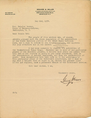
Correspondence between Guy Weaver and Zebulon Weaver, May 1934
-
Requests for information on Appalachian National Park
-
Cataloochee tract 248: J. A. Conrad

-
Julian Gocek letters and photographs

-
Correspondence: Horace Kephart to Zebulon Weaver, December 24, 1924
-
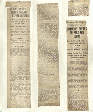
Appalachian National Park Association Newspaper Clippings, 1902-1907, 1925, 1928

-
Great Smoky Mountains National Park / Land of the Everlasting Hills
-
Hardwood Bark, 1924

-
Photo Album of the Great Smokey Mountains
-
Senatorial Committee meeting report
-
Low Gap from Cosby, Tennessee
-
Senate Act 5228
-
Civilian Conservation Corps Annual: District "C"

-
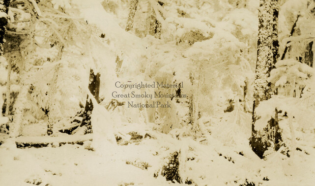
Snow covered balsams on Mount LeConte
-
Report of the Secretary of Agriculture in relation to the forests, rivers, and mountains of the southern Appalachian region
-
Great Smoky Mountains National Park / Land of the Everlasting Hills
-
Financial receipts and expenditures, 1902

-
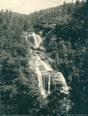
Whitewater Falls, Sapphire, N.C.
-
Memorial presentation to Congress

-
Climatic Treatment of Disease: Western North Carolina as a Health Resort

-
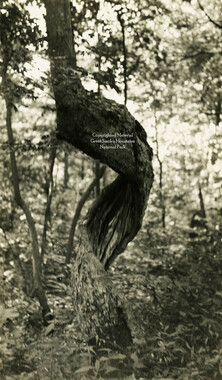
Twisted tree
-
Cataloochee tract 231: W. G. B. Messer

-
Report of the Secretary of Agriculture in relation to the forests, rivers, and mountains of the southern Appalachian region

-
Blanket Mountain

-
Minutes of Meetings of the Appalachian National Park Association
-
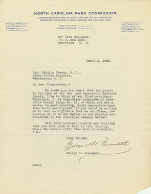
Correspondence: George H. Bramlett to Zebulon Weaver, March 2, 1932
-
Handbook/ 1933/ Smoky Mountains Hiking Club

-
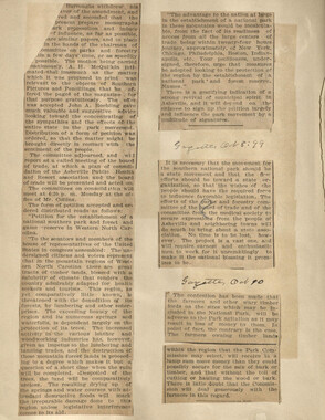
Appalachian National Park Association Newspaper Clippings, 1899-1902
-
Scrapbook by A. H. McQuilkin
-
Nature Magazine: Carolina number

-
Correspondence between Zebulon Weaver, Fred L. Weede, W. H. Woodbury, David C. Chapman, Mark Squires, Junius G. Adams, March 1932
-
Complete Report Submitted to Governor Clyde R. Hoey
