- Canton Champion Fibre Company (2308)
- Cherokee Traditions (291)
- Civil War in Southern Appalachia (165)
- Craft Revival (1942)
- Great Smoky Mountains - A Park for America (2857)
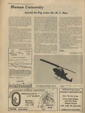
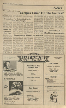
- Highlights from Western Carolina University (430)
- Horace Kephart (941)
- Journeys Through Jackson (154)
- LGBTQIA+ Archive of Jackson County (85)
- Oral Histories of Western North Carolina (314)
- Picturing Appalachia (6772)
- Stories of Mountain Folk (413)
- Travel Western North Carolina (160)
- Western Carolina University Fine Art Museum Vitreograph Collection (129)
- Western Carolina University Herbarium (92)
- Western Carolina University: Making Memories (708)
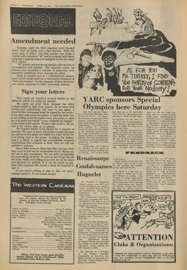
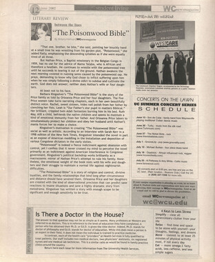
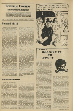
- Western Carolina University Publications (2353)
- Western Carolina University Restricted Electronic Theses and Dissertations (146)
- Western North Carolina Regional Maps (71)
- World War II in Southern Appalachia (131)
- Allanstand Cottage Industries (62)
- Appalachian National Park Association (53)
- Bennett, Kelly, 1890-1974 (1388)
- Berry, Walter (76)
- Brasstown Carvers (40)
- Carver, George Washington, 1864?-1943 (26)
- Cathey, Joseph, 1803-1874 (1)
- Champion Fibre Company (233)
- Champion Paper and Fibre Company (297)
- Cherokee Indian Fair Association (16)
- Cherokee Language Program (22)
- Crowe, Amanda (40)
- Edmonston, Thomas Benton, 1842-1907 (7)
- Ensley, A. L. (Abraham Lincoln), 1865-1948 (275)
- Fromer, Irving Rhodes, 1913-1994 (70)
- George Butz (BFS 1907) (46)
- Goodrich, Frances Louisa (120)
- Grant, George Alexander, 1891-1964 (96)
- Heard, Marian Gladys (60)
- Kephart, Calvin, 1883-1969 (15)
- Kephart, Horace, 1862-1931 (313)
- Kephart, Laura, 1862-1954 (39)
- Laney, Gideon Thomas, 1889-1976 (439)
- Masa, George, 1881-1933 (61)
- McElhinney, William Julian, 1896-1953 (44)
- Niggli, Josephina, 1910-1983 (10)
- North Carolina Park Commission (105)
- Osborne, Kezia Stradley (9)
- Owens, Samuel Robert, 1918-1995 (11)
- Penland Weavers and Potters (36)
- Roberts, Vivienne (15)
- Roth, Albert, 1890-1974 (142)
- Schenck, Carl Alwin, 1868-1955 (1)
- Sherrill's Photography Studio (2565)
- Southern Highland Handicraft Guild (127)
- Southern Highlanders, Inc. (71)
- Stalcup, Jesse Bryson (46)
- Stearns, I. K. (213)
- Thompson, James Edward, 1880-1976 (226)
- United States. Indian Arts and Crafts Board (130)
- USFS (683)
- Vance, Zebulon Baird, 1830-1894 (1)
- Weaver, Zebulon, 1872-1948 (58)
- Western Carolina College (230)
- Western Carolina Teachers College (282)
- Western Carolina University (1840)
- Western Carolina University. Mountain Heritage Center (18)
- Whitman, Walt, 1819-1892 (10)
- Wilburn, Hiram Coleman, 1880-1967 (73)
- Williams, Isadora (3)
- Cain, Doreyl Ammons (0)
- Crittenden, Lorraine (0)
- Rhodes, Judy (0)
- Smith, Edward Clark (0)
- Appalachian Region, Southern (2569)
- Asheville (N.C.) (1923)
- Avery County (N.C.) (26)
- Blount County (Tenn.) (169)
- Buncombe County (N.C.) (1672)
- Cherokee County (N.C.) (283)
- Clay County (N.C.) (555)
- Graham County (N.C.) (233)
- Great Smoky Mountains National Park (N.C. and Tenn.) (519)
- Haywood County (N.C.) (3567)
- Henderson County (N.C.) (70)
- Jackson County (N.C.) (4740)
- Knox County (Tenn.) (31)
- Knoxville (Tenn.) (12)
- Lake Santeetlah (N.C.) (10)
- Macon County (N.C.) (420)
- Madison County (N.C.) (215)
- McDowell County (N.C.) (39)
- Mitchell County (N.C.) (132)
- Polk County (N.C.) (35)
- Qualla Boundary (981)
- Rutherford County (N.C.) (76)
- Swain County (N.C.) (2117)
- Transylvania County (N.C.) (270)
- Watauga County (N.C.) (12)
- Waynesville (N.C.) (84)
- Yancey County (N.C.) (72)
- Aerial Photographs (3)
- Aerial Views (60)
- Albums (books) (4)
- Articles (1)
- Artifacts (object Genre) (228)
- Bibliographies (1)
- Biography (general Genre) (2)
- Cards (information Artifacts) (38)
- Clippings (information Artifacts) (191)
- Crafts (art Genres) (622)
- Depictions (visual Works) (21)
- Design Drawings (1)
- Drawings (visual Works) (184)
- Envelopes (73)
- Facsimiles (reproductions) (1)
- Fiction (general Genre) (4)
- Financial Records (12)
- Fliers (printed Matter) (67)
- Glass Plate Negatives (381)
- Guidebooks (2)
- Internegatives (10)
- Interviews (815)
- Land Surveys (102)
- Letters (correspondence) (1013)
- Manuscripts (documents) (618)
- Maps (documents) (177)
- Memorandums (25)
- Minutes (administrative Records) (59)
- Negatives (photographs) (5926)
- Newsletters (1285)
- Newspapers (2)
- Occupation Currency (1)
- Paintings (visual Works) (1)
- Pen And Ink Drawings (1)
- Periodicals (193)
- Personal Narratives (10)
- Photographs (12976)
- Plans (maps) (1)
- Poetry (5)
- Portraits (4535)
- Postcards (329)
- Programs (documents) (151)
- Publications (documents) (2305)
- Questionnaires (65)
- Scrapbooks (282)
- Sheet Music (2)
- Slides (photographs) (402)
- Songs (musical Compositions) (2)
- Sound Recordings (796)
- Specimens (92)
- Speeches (documents) (15)
- Tintypes (photographs) (8)
- Transcripts (322)
- Video Recordings (physical Artifacts) (23)
- Vitreographs (129)
- Text Messages (0)
- A.L. Ensley Collection (275)
- Appalachian Industrial School Records (7)
- Appalachian National Park Association Records (336)
- Axley-Meroney Collection (2)
- Bayard Wootten Photograph Collection (20)
- Bethel Rural Community Organization Collection (7)
- Blumer Collection (5)
- C.W. Slagle Collection (20)
- Canton Area Historical Museum (2110)
- Carlos C. Campbell Collection (373)
- Cataloochee History Project (64)
- Cherokee Studies Collection (4)
- Daisy Dame Photograph Album (5)
- Daniel Boone VI Collection (1)
- Doris Ulmann Photograph Collection (112)
- Elizabeth H. Lasley Collection (1)
- Elizabeth Woolworth Szold Fleharty Collection (4)
- Frank Fry Collection (95)
- George Masa Collection (173)
- Gideon Laney Collection (452)
- Hazel Scarborough Collection (2)
- Hiram C. Wilburn Papers (28)
- Historic Photographs Collection (236)
- Horace Kephart Collection (861)
- Humbard Collection (33)
- Hunter and Weaver Families Collection (1)
- I. D. Blumenthal Collection (4)
- Isadora Williams Collection (4)
- Jesse Bryson Stalcup Collection (47)
- Jim Thompson Collection (224)
- John B. Battle Collection (7)
- John C. Campbell Folk School Records (80)
- John Parris Collection (6)
- Judaculla Rock project (2)
- Kelly Bennett Collection (1407)
- Love Family Papers (11)
- Major Wiley Parris Civil War Letters (3)
- Map Collection (12)
- McFee-Misemer Civil War Letters (34)
- Mountain Heritage Center Collection (4)
- Norburn - Robertson - Thomson Families Collection (44)
- Pauline Hood Collection (7)
- Pre-Guild Collection (2)
- Qualla Arts and Crafts Mutual Collection (12)
- R.A. Romanes Collection (681)
- Rosser H. Taylor Collection (1)
- Samuel Robert Owens Collection (94)
- Sara Madison Collection (144)
- Sherrill Studio Photo Collection (2558)
- Smoky Mountains Hiking Club Collection (616)
- Stories of Mountain Folk - Radio Programs (374)
- The Reporter, Western Carolina University (510)
- Venoy and Elizabeth Reed Collection (16)
- WCU Gender and Sexuality Oral History Project (32)
- WCU Mountain Heritage Center Oral Histories (25)
- WCU Oral History Collection - Mountain People, Mountain Lives (71)
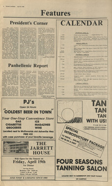
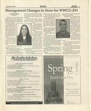
- WCU Students Newspapers Collection (1784)
- Western North Carolina Tomorrow Black Oral History Project (69)
- William Williams Stringfield Collection (2)
- Zebulon Weaver Collection (109)
- African Americans (390)
- Appalachian Trail (35)
- Artisans (521)
- Cherokee art (84)
- Cherokee artists -- North Carolina (10)
- Cherokee language (21)
- Cherokee pottery (101)
- Cherokee women (208)
- Church buildings (170)
- Civilian Conservation Corps (U.S.) (110)
- College student newspapers and periodicals (1876)
- Dams (107)
- Dance (1023)
- Education (222)
- Floods (61)
- Folk music (1015)
- Forced removal, 1813-1903 (2)
- Forest conservation (220)
- Forests and forestry (1184)
- Gender nonconformity (4)
- Great Smoky Mountains National Park (N.C. and Tenn.) (181)
- Hunting (45)
- Landscape photography (25)
- Logging (118)
- Maps (83)
- Mines and mineral resources (8)
- North Carolina -- Maps (18)
- Paper industry (38)
- Postcards (255)
- Pottery (135)
- Railroad trains (71)
- Rural electrification -- North Carolina, Western (3)
- School integration -- Southern States (2)
- Segregation -- North Carolina, Western (5)
- Slavery (5)
- Sports (452)
- Storytelling (243)
- Waterfalls -- Great Smoky Mountains (N.C. and Tenn.) (66)
- Weaving -- Appalachian Region, Southern (280)
- Wood-carving -- Appalachian Region, Southern (328)
- World War, 1939-1945 (173)
Great Smoky Mountains National Park

Great Smoky Mountains National Park
HL_F443_G7_G7293_00
Great Smoky Mountains National Park
HL_F443_G7_G7293_01
Great Smoky Mountains National Park
HL_F443_G7_G7293_02
Great Smoky Mountains National Park
HL_F443_G7_G7293_03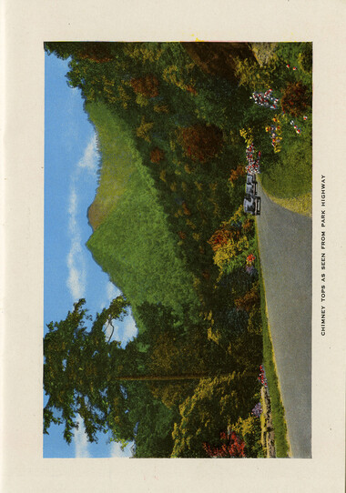
Great Smoky Mountains National Park
HL_F443_G7_G7293_04
Great Smoky Mountains National Park
HL_F443_G7_G7293_05
Great Smoky Mountains National Park
HL_F443_G7_G7293_06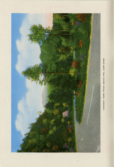
Great Smoky Mountains National Park
HL_F443_G7_G7293_07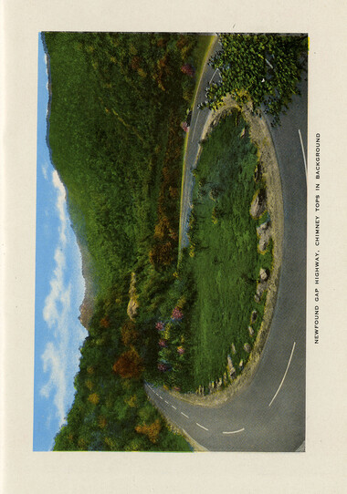
Great Smoky Mountains National Park
HL_F443_G7_G7293_08
Great Smoky Mountains National Park
HL_F443_G7_G7293_09
Great Smoky Mountains National Park
HL_F443_G7_G7293_10
Great Smoky Mountains National Park
HL_F443_G7_G7293_11
Great Smoky Mountains National Park
HL_F443_G7_G7293_12
Great Smoky Mountains National Park
HL_F443_G7_G7293_13
Great Smoky Mountains National Park
HL_F443_G7_G7293_14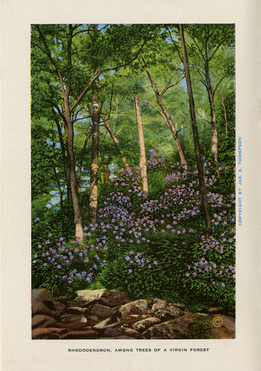
Great Smoky Mountains National Park
HL_F443_G7_G7293_15
Great Smoky Mountains National Park
HL_F443_G7_G7293_16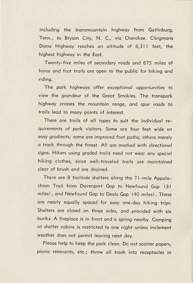
Great Smoky Mountains National Park
HL_F443_G7_G7293_17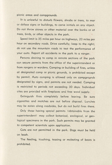
Great Smoky Mountains National Park
HL_F443_G7_G7293_18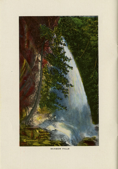
Great Smoky Mountains National Park
HL_F443_G7_G7293_19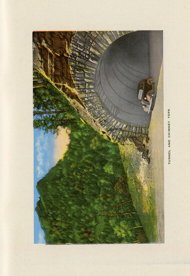
Great Smoky Mountains National Park
HL_F443_G7_G7293_20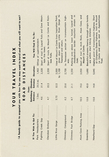
Great Smoky Mountains National Park
HL_F443_G7_G7293_21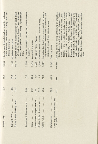
Great Smoky Mountains National Park
HL_F443_G7_G7293_22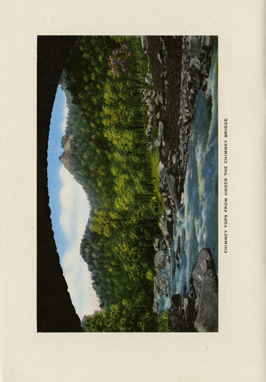
Great Smoky Mountains National Park
HL_F443_G7_G7293_23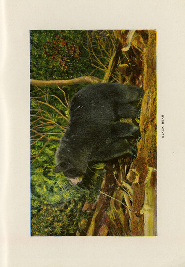
Great Smoky Mountains National Park
HL_F443_G7_G7293_24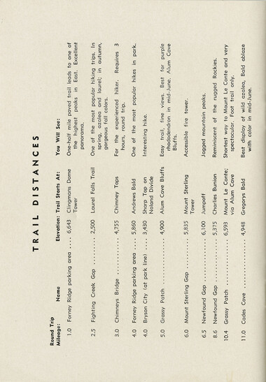
Great Smoky Mountains National Park
HL_F443_G7_G7293_25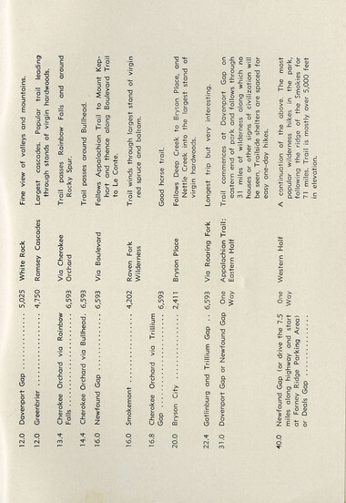
Great Smoky Mountains National Park
HL_F443_G7_G7293_26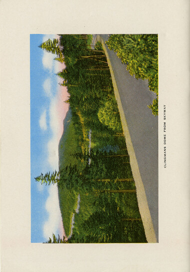
Great Smoky Mountains National Park
HL_F443_G7_G7293_27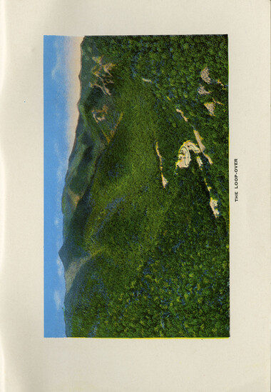
Great Smoky Mountains National Park
HL_F443_G7_G7293_28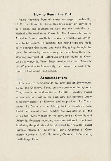
Great Smoky Mountains National Park
HL_F443_G7_G7293_29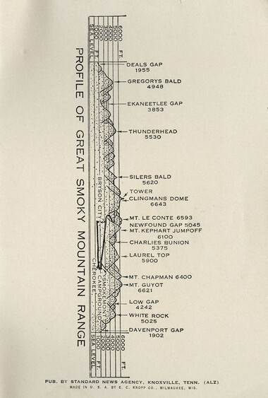
Great Smoky Mountains National Park
HL_F443_G7_G7293_30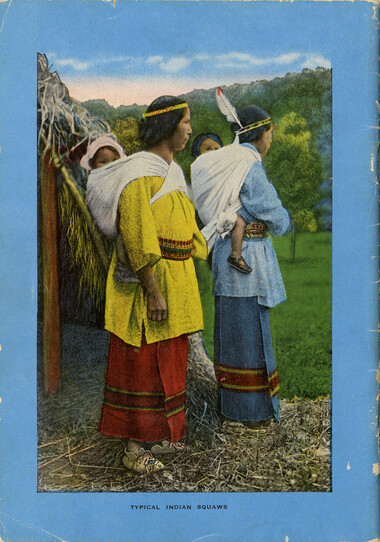
Great Smoky Mountains National Park
HL_F443_G7_G7293_31Item’s are ‘child’ level descriptions to ‘parent’ objects, (e.g. one page of a whole book).
-
-
including the transmountain highway from Gatlinburg, Tenn., to Bryson City, N. C, via Cherokee. Clingmans Dome Highway reaches an altitude of 6,311 feet, the highest highway in the East. Twenty-five miles of secondary roads and 675 miles of horse and foot trails are open to the public for hiking and riding. The park highways offer exceptional opportunities to view the grandeur of the Great Smokies. The transpark highway crosses the mountain range, and spur roads to trails lead to many points of interest. There are trails of all types to suit the individual requirements of park visitors. Some are four feet wide on easy gradients; some are improved foot paths; others merely a track through the forest. All are marked with directional signs. Hikers using graded trails need not wear any special hiking clothes, since well-traveled trails are maintained clear of brush and are drained. There are 8 trailside shelters along the 71-mile Appalachian Trail from Davenport Gap to Newfound Gap (31 miles), and Newfound Gap to Deals Gap (40 miles). These are nearly equally spaced for easy one-day hiking trips. Shelters are closed on three sides, and provided with six bunks. A fireplace is in front and a spring nearby. Camping at shelter cabins is restricted to one night unless inclement weather does not permit leaving next day. Please help to keep the park clean. Do not scatter papers, picnic remnants, etc.; throw all trash into receptacles in
Object’s are ‘parent’ level descriptions to ‘children’ items, (e.g. a book with pages).
-
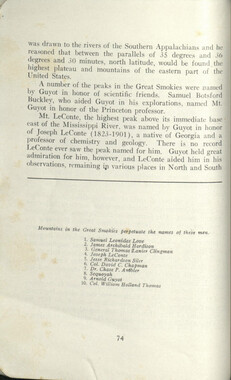
This 32-page booklet, simply titled, “Great Smoky National Park” was produced between 1935 and 1945. The booklet begins with a description of how the park was created, beginning with the 1899 effort by the Appalachian National Park Association to Congressional approval in 1926 and the significant financial donation made by the Rockefeller family. The booklet includes mention of mountain people and the Cherokee people living on the adjacent Qualla Boundary. Other topics include plant and animal life, weather, elevations, camping, trails, and trail rules. A “Travel Index” lists distances to various peaks from two park entrances and a schematic map shows relative elevations. Fifteen full-page, hand-colored photographs depict scenes in the park, including two of the “loop-over” road.
-
Related items
-
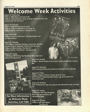
Western Carolinian Volume 64 (65) Number 01 Fall Sports Preview
-
Cherokee Indian Fair 1948
-
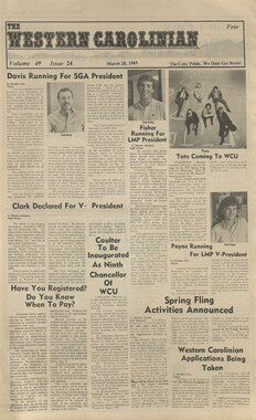
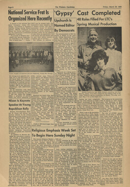
Western Carolinian Volume 49 Number 24, March 28, 1985
-
Western Carolinian Volume 49 Number 26
-
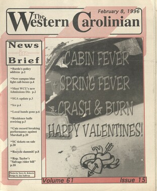
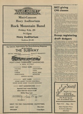
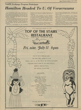
Western Carolinian Volume 61 Number 15
-
Western Carolinian Volume 45 Number 21
-
Western Carolinian Volume 45 Number 35
-
Guide to the Great Smoky Mountains National Park
-
Western Carolinian Volume 43 Number 07
-
Western Carolinian Volume 39 Number 53
-
Western Carolinian Volume 67 Number 01
-
Western Carolinian Volume 37 Number 40 (41)
-
Western Carolinian Volume 49 Number 23, February 21, 1985
-
Western Carolinian Volume 46 Number 05

-
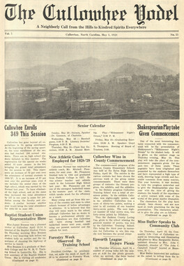
Cullowhee Yodel Volume 05 Number 11
-
Western Carolinian Volume 55 Number 08

-
Western Carolinian Volume 49 Number 26
-
Western Carolinian Volume 64 (65) Number 18
-
Western Carolinian Volume 45 (46) Number 23

-
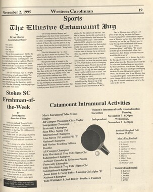
Western Carolinian, November 2, 1995 (Volume 61 Number 10)
-
Western Carolinian Volume 30 Number 18
-
Western Carolinian Volume 59 Number 11 (12)

-
Cullowhee State Normal School, Session 1925-1926: A Preliminary Announcement
-
Glimpses of our National Monuments
-
Western Carolinian Volume 52 Number 04

-
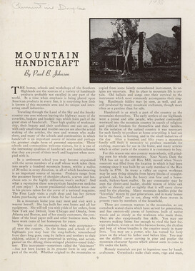
Mountain Handicraft By Paul B. Johnson
-
Western Carolinian Volume 43 Number 19

-
Western Carolinian Volume 66 (67) Number 02
-
Western Carolinia Volume 47 Number 04
-
Western Carolinian Volume 19 Number 08
-
Kephart the Hunter
-
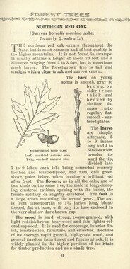
Common forest trees of North Carolina
Part of Collection
Great Smoky Mountains - A Park for America
-
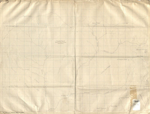
Map of Great Smoky Mountains region
-
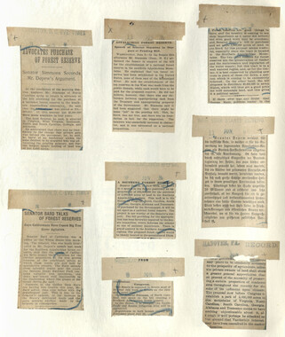
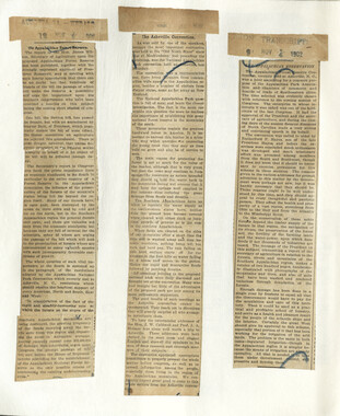
Appalachian National Park Association Newspaper Clippings, 1902-1907, 1925, 1928
-
Dry Sluice Gap view

-
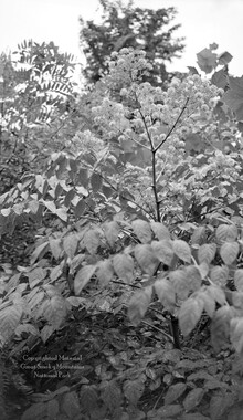
Yellow poplar

-
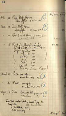
Financial record of Cash Receipts and Expenditures

-
Just the High Spots of Knoxville and East Tennessee

-
Appalachian Park Commission and Arno Cammerer on Gregory Bald
-
Report of the Secretary of Agriculture in relation to the forests, rivers, and mountains of the southern Appalachian region

-
Inventory of Horace Kephart collection

-
Correspondence to various Boards of Trade
-
Appalachian National Park Association Newspaper Clippings, 1902-1907, 1925, 1928
-
Appalachian Trail Club bulletin
-
Wilburn photograph album

-
Legislation on behalf of the Appalachian National Park
-
Appalachian National Park Association Newspaper Clippings, 1899-1902
-
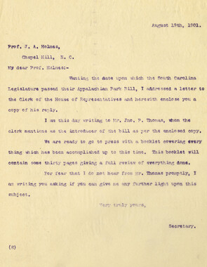
Correspondence regarding the election of officers

-
Appalachian National Park Association Newspaper Clippings, 1899-1902

-
Correspondence: M. V. Richards to A. H. McQuilkin

-
Appalachian National Park Association Newspaper Clippings, 1902-1907, 1925, 1928
-
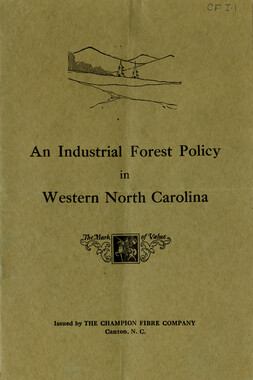
Industrial Forest Policy in Western North Carolina
-
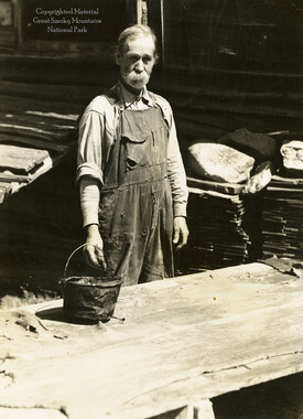
Milas Messer tanning leather
-
Weeks Law Silver Jubilee

-
Minutes of Meetings of the Appalachian National Park Association

-
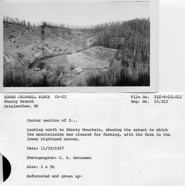
Cataloochee tract 215: George H. Caldwell
-
Editorials to support an Appalachian National Park

-
Glimpses of the Plant of the Champion Fibre Co., Canton, North Carolina

-
Financial record of Cash Receipts and Expenditures
-
Hercules Club or Devil’s Walking Stick
-
Financial record of Cash Receipts and Expenditures

-
Trees of the Great Smoky Mountains National Park

-
Requests for information on Appalachian National Park
-
Civilian Conservation Corps Annual: District "C"