Western Carolina University (20)
View all
- Canton Champion Fibre Company (2308)
- Cherokee Traditions (293)
- Civil War in Southern Appalachia (165)
- Craft Revival (1942)
- Great Smoky Mountains - A Park for America (2767)
- Highlights from Western Carolina University (430)
- Horace Kephart (941)
- Journeys Through Jackson (154)
- LGBTQIA+ Archive of Jackson County (24)
- Oral Histories of Western North Carolina (314)
- Picturing Appalachia (6772)
- Stories of Mountain Folk (413)
- Travel Western North Carolina (160)
- Western Carolina University Fine Art Museum Vitreograph Collection (129)
- Western Carolina University Herbarium (92)
- Western Carolina University: Making Memories (708)
- Western Carolina University Publications (2283)
- Western Carolina University Restricted Electronic Theses and Dissertations (146)
- Western North Carolina Regional Maps (71)
- World War II in Southern Appalachia (131)
University of North Carolina Asheville (6)
View all
- 1950s (6)
- 1960s (11)
- 1970s (8)
- 1980s (14)
- 1990s (5)
- 2000s (38)
- 2010s (4)
- 1600s (0)
- 1700s (0)
- 1800s (0)
- 1810s (0)
- 1820s (0)
- 1830s (0)
- 1840s (0)
- 1850s (0)
- 1860s (0)
- 1870s (0)
- 1880s (0)
- 1890s (0)
- 1900s (0)
- 1910s (0)
- 1920s (0)
- 1930s (0)
- 1940s (0)
- 2020s (0)
- Buncombe County (N.C.) (5)
- Clay County (N.C.) (3)
- Graham County (N.C.) (2)
- Haywood County (N.C.) (3)
- Henderson County (N.C.) (1)
- Jackson County (N.C.) (27)
- Macon County (N.C.) (15)
- McDowell County (N.C.) (3)
- Polk County (N.C.) (1)
- Swain County (N.C.) (3)
- Transylvania County (N.C.) (1)
- Yancey County (N.C.) (2)
- Appalachian Region, Southern (0)
- Asheville (N.C.) (0)
- Avery County (N.C.) (0)
- Blount County (Tenn.) (0)
- Cherokee County (N.C.) (0)
- Great Smoky Mountains National Park (N.C. and Tenn.) (0)
- Knox County (Tenn.) (0)
- Knoxville (Tenn.) (0)
- Lake Santeetlah (N.C.) (0)
- Madison County (N.C.) (0)
- Mitchell County (N.C.) (0)
- Qualla Boundary (0)
- Rutherford County (N.C.) (0)
- Watauga County (N.C.) (0)
- Waynesville (N.C.) (0)
- Specimens (92)
- Aerial Photographs (0)
- Aerial Views (0)
- Albums (books) (0)
- Articles (0)
- Artifacts (object Genre) (0)
- Biography (general Genre) (0)
- Cards (information Artifacts) (0)
- Clippings (information Artifacts) (0)
- Crafts (art Genres) (0)
- Depictions (visual Works) (0)
- Design Drawings (0)
- Drawings (visual Works) (0)
- Envelopes (0)
- Facsimiles (reproductions) (0)
- Fiction (general Genre) (0)
- Financial Records (0)
- Fliers (printed Matter) (0)
- Glass Plate Negatives (0)
- Guidebooks (0)
- Internegatives (0)
- Interviews (0)
- Land Surveys (0)
- Letters (correspondence) (0)
- Manuscripts (documents) (0)
- Maps (documents) (0)
- Memorandums (0)
- Minutes (administrative Records) (0)
- Negatives (photographs) (0)
- Newsletters (0)
- Newspapers (0)
- Occupation Currency (0)
- Paintings (visual Works) (0)
- Pen And Ink Drawings (0)
- Periodicals (0)
- Personal Narratives (0)
- Photographs (0)
- Plans (maps) (0)
- Poetry (0)
- Portraits (0)
- Postcards (0)
- Programs (documents) (0)
- Publications (documents) (0)
- Questionnaires (0)
- Scrapbooks (0)
- Sheet Music (0)
- Slides (photographs) (0)
- Sound Recordings (0)
- Speeches (documents) (0)
- Text Messages (0)
- Tintypes (photographs) (0)
- Transcripts (0)
- Video Recordings (physical Artifacts) (0)
- Vitreographs (0)
- StillImage (92)
- MovingImage (0)
- Sound (0)
- Text (0)
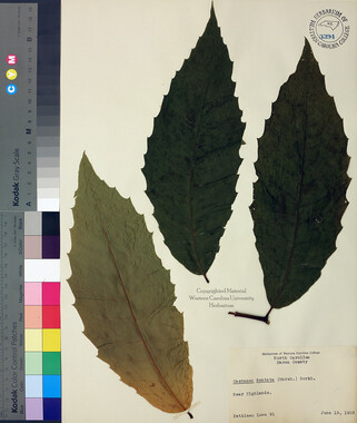
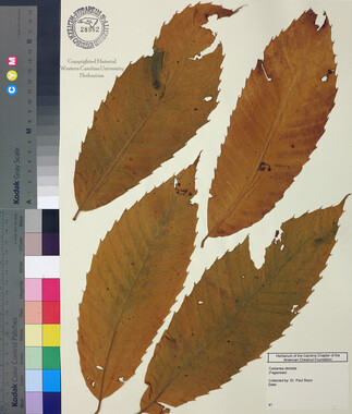
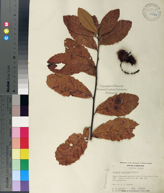
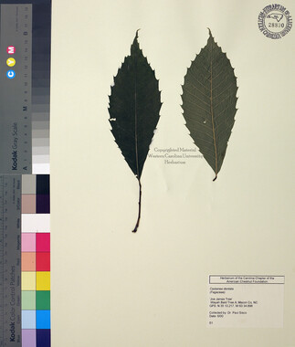
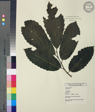
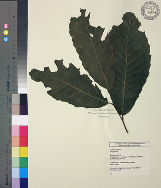
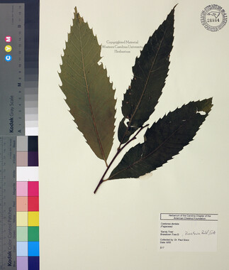
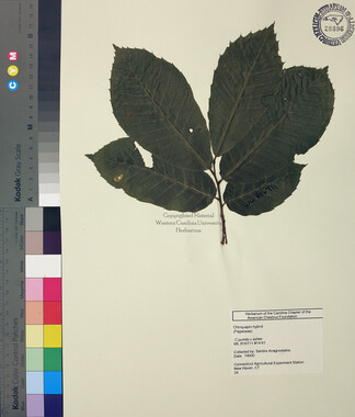
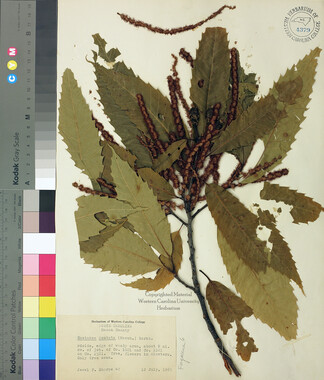
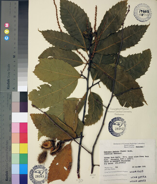
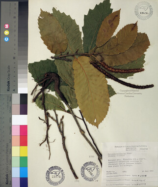
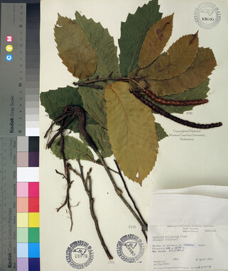
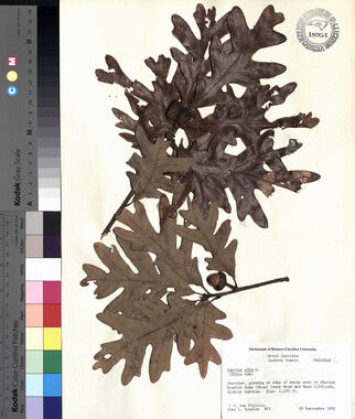
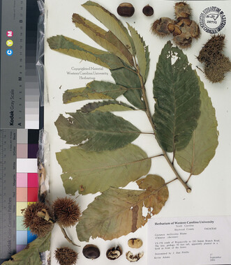
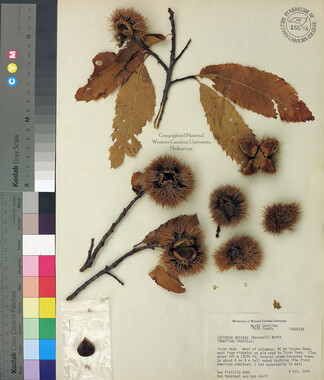
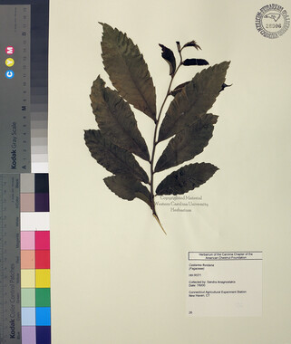
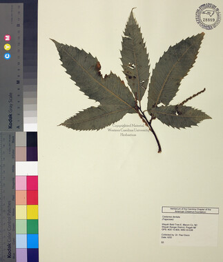
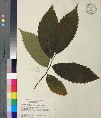
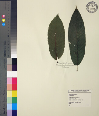
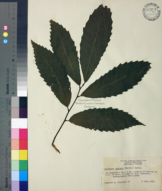
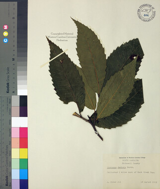
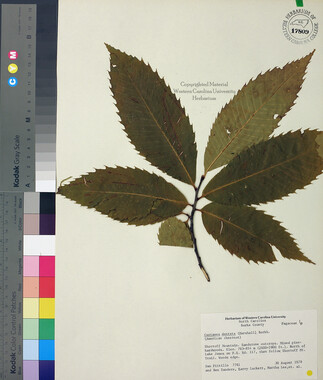
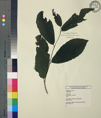
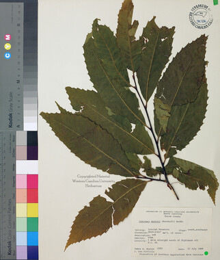
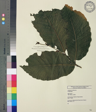
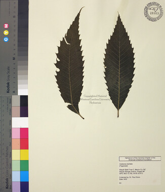
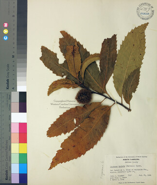
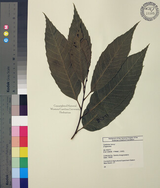
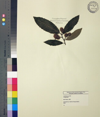
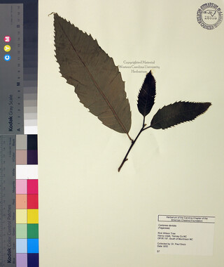
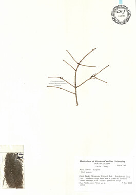
Castanea dentata
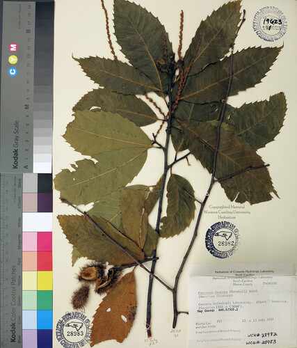


Castanea dentata
WCUH_28982
Item
Item’s are ‘child’ level descriptions to ‘parent’ objects, (e.g. one page of a whole book).
-
Castanea dentata (Marshall) Borkh. Dryman Fork Basin. 83-C, south slope Sheep Rock Knob. Elevation 1128 m (3700'). Fruit in separate collection. Map Coord: 671.0/498.0; Coweeta Hydrologic Laboratory. Albert Mountain. Elevation 1524 m (5000'). Map Coord: 660.5/505.2 ; Albert Mountain/App Trail. Elevation 1524 m (5000'). Map Coord: 660.4/504.5 .
-
Object
Object’s are ‘parent’ level descriptions to ‘children’ items, (e.g. a book with pages).
-
Castanea dentata (Marsh) Borkh. Dryman Fork Basin. 83-C, south slope Sheep Rock Knob. Elevation 1128 m (3700'). Fruit in separate collection. Map Coord: 671.0/498.0; Coweeta Hydrologic Laboratory. Albert Mountain. Elevation 1524 m (5000'). Map Coord: 660.5/505.2 [flowering specimen]; Albert Mountain/App Trail. Elevation 1524 m (5000'). Map Coord: 660.4/504.5 [fruiting specimen].
-


Part of Collection
Western Carolina University Herbarium