- Canton Champion Fibre Company (2308)
- Cherokee Traditions (292)
- Civil War in Southern Appalachia (165)
- Craft Revival (1942)
- Great Smoky Mountains - A Park for America (2766)
- Highlights from Western Carolina University (430)
- Horace Kephart (941)
- Journeys Through Jackson (154)
- LGBTQIA+ Archive of Jackson County (85)
- Oral Histories of Western North Carolina (314)
- Picturing Appalachia (6772)
- Stories of Mountain Folk (413)
- Travel Western North Carolina (160)
- Western Carolina University Fine Art Museum Vitreograph Collection (129)
- Western Carolina University Herbarium (92)
- Western Carolina University: Making Memories (708)
- Western Carolina University Publications (2283)
- Western Carolina University Restricted Electronic Theses and Dissertations (146)
- Western North Carolina Regional Maps (71)
- World War II in Southern Appalachia (131)
- Appalachian National Park Association (53)
- Berry, Walter (76)
- Champion Fibre Company (5)
- Fromer, Irving Rhodes, 1913-1994 (70)
- Grant, George Alexander, 1891-1964 (96)
- Kephart, Horace, 1862-1931 (23)
- Masa, George, 1881-1933 (17)
- North Carolina Park Commission (105)
- Roth, Albert, 1890-1974 (142)
- Schenck, Carl Alwin, 1868-1955 (1)
- Stearns, I. K. (2)
- Thompson, James Edward, 1880-1976 (45)
- Weaver, Zebulon, 1872-1948 (55)
- Wilburn, Hiram Coleman, 1880-1967 (72)
- Allanstand Cottage Industries (0)
- Bennett, Kelly, 1890-1974 (0)
- Brasstown Carvers (0)
- Cain, Doreyl Ammons (0)
- Carver, George Washington, 1864?-1943 (0)
- Cathey, Joseph, 1803-1874 (0)
- Champion Paper and Fibre Company (0)
- Cherokee Indian Fair Association (0)
- Cherokee Language Program (0)
- Crittenden, Lorraine (0)
- Crowe, Amanda (0)
- Edmonston, Thomas Benton, 1842-1907 (0)
- Ensley, A. L. (Abraham Lincoln), 1865-1948 (0)
- George Butz (BFS 1907) (0)
- Goodrich, Frances Louisa (0)
- Heard, Marian Gladys (0)
- Kephart, Calvin, 1883-1969 (0)
- Kephart, Laura, 1862-1954 (0)
- Laney, Gideon Thomas, 1889-1976 (0)
- McElhinney, William Julian, 1896-1953 (0)
- Niggli, Josephina, 1910-1983 (0)
- Osborne, Kezia Stradley (0)
- Owens, Samuel Robert, 1918-1995 (0)
- Penland Weavers and Potters (0)
- Rhodes, Judy (0)
- Roberts, Vivienne (0)
- Sherrill's Photography Studio (0)
- Smith, Edward Clark (0)
- Southern Highland Handicraft Guild (0)
- Southern Highlanders, Inc. (0)
- Stalcup, Jesse Bryson (0)
- United States. Indian Arts and Crafts Board (0)
- USFS (0)
- Vance, Zebulon Baird, 1830-1894 (0)
- Western Carolina College (0)
- Western Carolina Teachers College (0)
- Western Carolina University (0)
- Western Carolina University. Mountain Heritage Center (0)
- Whitman, Walt, 1819-1892 (0)
- Williams, Isadora (0)
- 1810s (1)
- 1840s (1)
- 1850s (2)
- 1860s (3)
- 1870s (4)
- 1880s (7)
- 1890s (64)
- 1900s (294)
- 1910s (227)
- 1920s (461)
- 1930s (1585)
- 1940s (82)
- 1950s (15)
- 1960s (13)
- 1970s (47)
- 1980s (14)
- 1990s (16)
- 2000s (31)
- 2010s (1)
- 1600s (0)
- 1700s (0)
- 1800s (0)
- 1820s (0)
- 1830s (0)
- 2020s (0)
- Appalachian Region, Southern (81)
- Asheville (N.C.) (3)
- Avery County (N.C.) (6)
- Blount County (Tenn.) (159)
- Buncombe County (N.C.) (204)
- Cherokee County (N.C.) (10)
- Clay County (N.C.) (3)
- Graham County (N.C.) (108)
- Great Smoky Mountains National Park (N.C. and Tenn.) (447)
- Haywood County (N.C.) (262)
- Henderson County (N.C.) (13)
- Jackson County (N.C.) (58)
- Knox County (Tenn.) (21)
- Knoxville (Tenn.) (11)
- Lake Santeetlah (N.C.) (10)
- Macon County (N.C.) (25)
- Madison County (N.C.) (14)
- McDowell County (N.C.) (5)
- Mitchell County (N.C.) (7)
- Polk County (N.C.) (2)
- Qualla Boundary (22)
- Rutherford County (N.C.) (16)
- Swain County (N.C.) (516)
- Transylvania County (N.C.) (36)
- Watauga County (N.C.) (2)
- Waynesville (N.C.) (2)
- Yancey County (N.C.) (34)
- Aerial Views (3)
- Articles (1)
- Artifacts (object Genre) (4)
- Bibliographies (1)
- Clippings (information Artifacts) (77)
- Drawings (visual Works) (174)
- Envelopes (2)
- Financial Records (9)
- Fliers (printed Matter) (34)
- Guidebooks (1)
- Interviews (15)
- Land Surveys (102)
- Letters (correspondence) (219)
- Manuscripts (documents) (90)
- Maps (documents) (86)
- Memorandums (14)
- Minutes (administrative Records) (20)
- Negatives (photographs) (282)
- Newsletters (12)
- Paintings (visual Works) (1)
- Pen And Ink Drawings (1)
- Photographs (1657)
- Portraits (91)
- Postcards (15)
- Publications (documents) (107)
- Scrapbooks (3)
- Sheet Music (1)
- Songs (musical Compositions) (2)
- Sound Recordings (7)
- Speeches (documents) (11)
- Transcripts (46)
- Aerial Photographs (0)
- Albums (books) (0)
- Biography (general Genre) (0)
- Cards (information Artifacts) (0)
- Crafts (art Genres) (0)
- Depictions (visual Works) (0)
- Design Drawings (0)
- Facsimiles (reproductions) (0)
- Fiction (general Genre) (0)
- Glass Plate Negatives (0)
- Internegatives (0)
- Newspapers (0)
- Occupation Currency (0)
- Periodicals (0)
- Personal Narratives (0)
- Plans (maps) (0)
- Poetry (0)
- Programs (documents) (0)
- Questionnaires (0)
- Slides (photographs) (0)
- Specimens (0)
- Text Messages (0)
- Tintypes (photographs) (0)
- Video Recordings (physical Artifacts) (0)
- Vitreographs (0)
- Appalachian National Park Association Records (336)
- Carlos C. Campbell Collection (282)
- Cataloochee History Project (64)
- George Masa Collection (89)
- Hiram C. Wilburn Papers (28)
- Historic Photographs Collection (236)
- Horace Kephart Collection (126)
- Humbard Collection (33)
- Jim Thompson Collection (44)
- Love Family Papers (11)
- Map Collection (12)
- R.A. Romanes Collection (10)
- Smoky Mountains Hiking Club Collection (616)
- Zebulon Weaver Collection (107)
- A.L. Ensley Collection (0)
- Appalachian Industrial School Records (0)
- Axley-Meroney Collection (0)
- Bayard Wootten Photograph Collection (0)
- Bethel Rural Community Organization Collection (0)
- Blumer Collection (0)
- C.W. Slagle Collection (0)
- Canton Area Historical Museum (0)
- Cherokee Studies Collection (0)
- Daisy Dame Photograph Album (0)
- Daniel Boone VI Collection (0)
- Doris Ulmann Photograph Collection (0)
- Elizabeth H. Lasley Collection (0)
- Elizabeth Woolworth Szold Fleharty Collection (0)
- Frank Fry Collection (0)
- Gideon Laney Collection (0)
- Hazel Scarborough Collection (0)
- Hunter and Weaver Families Collection (0)
- I. D. Blumenthal Collection (0)
- Isadora Williams Collection (0)
- Jesse Bryson Stalcup Collection (0)
- John B. Battle Collection (0)
- John C. Campbell Folk School Records (0)
- John Parris Collection (0)
- Judaculla Rock project (0)
- Kelly Bennett Collection (0)
- Major Wiley Parris Civil War Letters (0)
- McFee-Misemer Civil War Letters (0)
- Mountain Heritage Center Collection (0)
- Norburn - Robertson - Thomson Families Collection (0)
- Pauline Hood Collection (0)
- Pre-Guild Collection (0)
- Qualla Arts and Crafts Mutual Collection (0)
- Rosser H. Taylor Collection (0)
- Samuel Robert Owens Collection (0)
- Sara Madison Collection (0)
- Sherrill Studio Photo Collection (0)
- Stories of Mountain Folk - Radio Programs (0)
- The Reporter, Western Carolina University (0)
- Venoy and Elizabeth Reed Collection (0)
- WCU Gender and Sexuality Oral History Project (0)
- WCU Mountain Heritage Center Oral Histories (0)
- WCU Oral History Collection - Mountain People, Mountain Lives (0)
- WCU Students Newspapers Collection (0)
- Western North Carolina Tomorrow Black Oral History Project (0)
- William Williams Stringfield Collection (0)
- Appalachian Trail (22)
- Church buildings (9)
- Civilian Conservation Corps (U.S.) (91)
- Dams (21)
- Floods (1)
- Forest conservation (11)
- Forests and forestry (42)
- Great Smoky Mountains National Park (N.C. and Tenn.) (82)
- Hunting (2)
- Logging (29)
- Maps (73)
- North Carolina -- Maps (5)
- Postcards (15)
- Railroad trains (8)
- Sports (4)
- Storytelling (2)
- Waterfalls -- Great Smoky Mountains (N.C. and Tenn.) (39)
- African Americans (0)
- Artisans (0)
- Cherokee art (0)
- Cherokee artists -- North Carolina (0)
- Cherokee language (0)
- Cherokee pottery (0)
- Cherokee women (0)
- College student newspapers and periodicals (0)
- Dance (0)
- Education (0)
- Folk music (0)
- Forced removal, 1813-1903 (0)
- Gender nonconformity (0)
- Landscape photography (0)
- Mines and mineral resources (0)
- Paper industry (0)
- Pottery (0)
- Rural electrification -- North Carolina, Western (0)
- School integration -- Southern States (0)
- Segregation -- North Carolina, Western (0)
- Slavery (0)
- Weaving -- Appalachian Region, Southern (0)
- Wood-carving -- Appalachian Region, Southern (0)
- World War, 1939-1945 (0)
- Sound (7)
- StillImage (2172)
- Text (654)
- MovingImage (0)
Appalachian Trail in the Unaka and the Pisgah National Forests
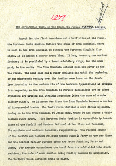
Appalachian Trail in the Unaka and the Pisgah National Forests
GSMNP_13150_14_1099_01
Appalachian Trail in the Unaka and the Pisgah National Forests
GSMNP_13150_14_1099_02
Appalachian Trail in the Unaka and the Pisgah National Forests
GSMNP_13150_14_1099_03
Appalachian Trail in the Unaka and the Pisgah National Forests
GSMNP_13150_14_1099_04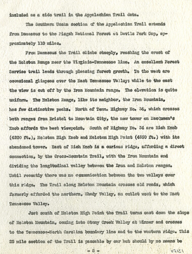
Appalachian Trail in the Unaka and the Pisgah National Forests
GSMNP_13150_14_1099_05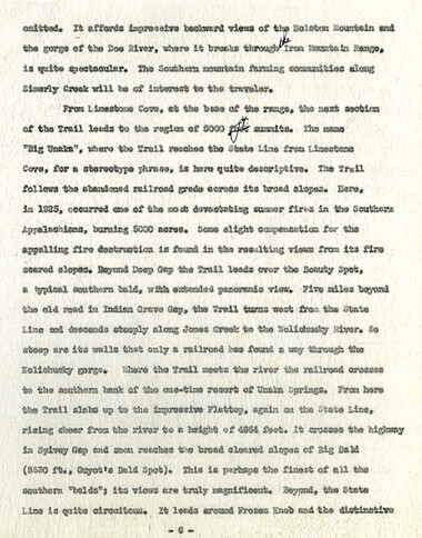
Appalachian Trail in the Unaka and the Pisgah National Forests
GSMNP_13150_14_1099_06
Appalachian Trail in the Unaka and the Pisgah National Forests
GSMNP_13150_14_1099_07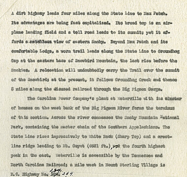
Appalachian Trail in the Unaka and the Pisgah National Forests
GSMNP_13150_14_1099_08Item’s are ‘child’ level descriptions to ‘parent’ objects, (e.g. one page of a whole book).
-
-
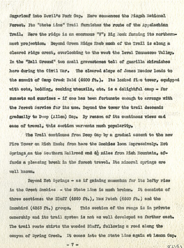
Sugarloaf into Devil’s Fork Gap. Here commences the Pisgah National Forest. Its “State Line” Trail furnishes the route of the Appalachian Trail. Here the ridge is an enormous “V”, Big Rock forming its northern- most projections. Beyond Green Ridge Knob much of the Trail is along a cleared ridge crest, overlooking to the west the level Tennessee Valley. In the “Ball Ground” two small gravestones tell of guerilla skirmishes here during the Civil War. The cleared slope of Jones Meadow leads to the summit of Camp Creek Bald (4500 ft.). Its locked fire tower, equipped with cots, bedding, cooking utensils, etc. is a delightful camp – for sunsets and sunrises – if one has been fortunate enough to arrange with the Forest Service for its use. Beyond the tower the trail descends gradually to Deep (Allen) Gap. By reason of its continuous views and ease of travel, this section warrants much popularity. The Trail continues from Deep Gap by a gradual ascent to the new Fire Tower on Rich Knob; from here the Smokies look impressively. Hot Springs, on the Southern Railroad and 4 ½ miles from Rich Mountain, af- fords a pleasing break in the forest travel. Its mineral springs are well known. Beyond Hot Springs – as if gaining momentum for its lofty rise in the Great Smokies - the State Line is much broken. It consists of three sections: the Bluff (4640 ft.), Max Patch (4800 ft.) and the Snowbird (4265 ft.) groups. This section of the range is in private ownership and its trail system is not as well developed as farther east. The trail route skirts the wooded Bluff, following a road along the canyon of Spring Creek. It comes into the State Line again at Lemon Gap.
Object’s are ‘parent’ level descriptions to ‘children’ items, (e.g. a book with pages).
-
Created around 1934, this unsigned manuscript titled, “The Appalachian Trail in the Unaka and the Pisgah National Forests,” is most likely by Myron Haliburton Avery (1899–1952), who was president of the Potomac Appalachian Trail Club and chairman of the board of the Appalachian Trail Conference. The paper discusses the Unaka Range and Pisgah Forest and the history of each region. The manuscript was collected by George Masa. Known for his photography, George Masa (1881-1933) was active in the Appalachian Trail Club and in the movement to establish the Great Smoky Mountains National Park.
-
Related items
-
Isadora Williams Weaving Notebook II
-
Memoirs of Ruth Hooper

-
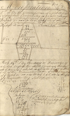
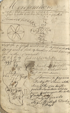
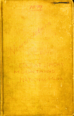
Nomenclature notebook: N.C. portion/ Great Smoky Mountains National Park

-
Cataloochee tract 261: A. C. Bennett

-
Off and On by Maharajah
-
Southern Highlanders, Inc. list of common stockholders
-
William Twaddell Copybook, 1758
-
William Twaddell Copybook, 1758
-
Views in the Great Smoky Mountains National Park

-
Hospital Corps; 105's Battery B - 61st F. A. -- 1st Cal. Div.
-
William Twaddell copybook, 1761-1762

-
Anderson Copy Book

-
Nomenclature notebook: N.C. portion/ Great Smoky Mountains National Park

-
Anderson Copy Book
-
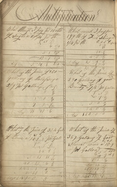
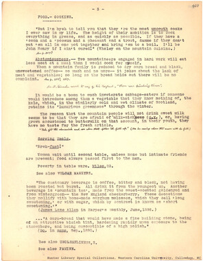
Food -- Cooking
-
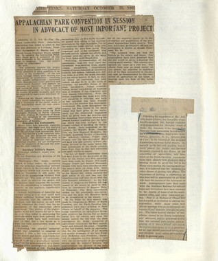
Activities of the Appalachian National Park Association and the Appalachian National Forest Reserve Association: 1899-1906
-
Anderson Copy Book

-
Anderson Copy Book
-
William Twaddell Copybook, 1758
-
Anderson Copy Book
-
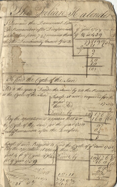
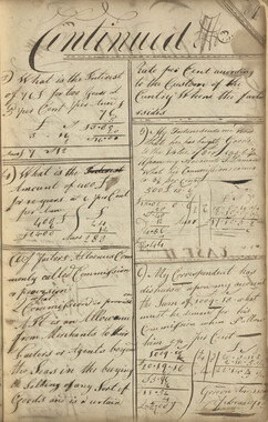
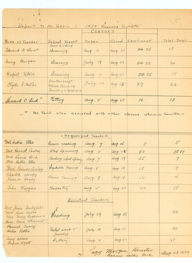
Weaving Institute, 1937
-
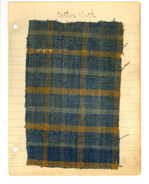
Woven cloth sample notebook
-
Ditty Bags -- Pouches

-
William Twaddell copybook, 1761-1762
-
Civil War Diary of Absalom Joshua Burum

-
Anderson Copy Book
-
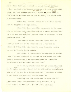
Allanstand Cottage Industries history, draft
-
Nomenclature notebook: N.C. portion/ Great Smoky Mountains National Park
-
Views in the Great Smoky Mountains National Park

-
Civil War Diary of Absalom Joshua Burum

-
Horace Kephart Journal 17

Part of Collection
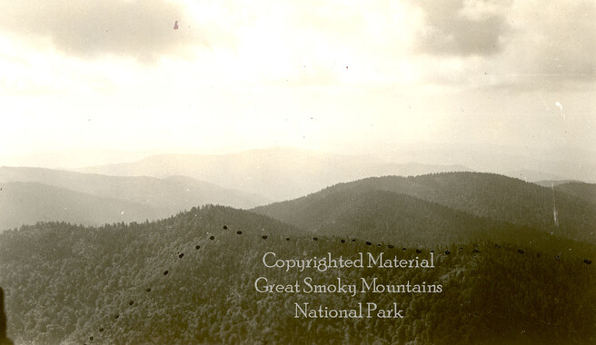
Great Smoky Mountains - A Park for America
-
Civilian Conservation Corps Annual: District "C"
-
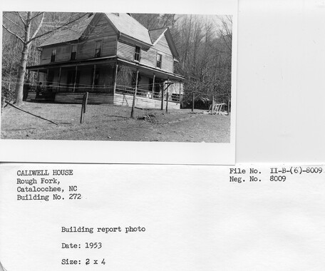
Cataloochee tract 201: J. L. Caldwell
-
National Parks Bulletin, 1925
-
Duck Hawk Peaks

-
Minutes of Meetings of the Appalachian National Park Association
-
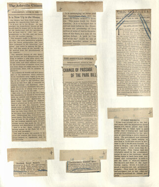
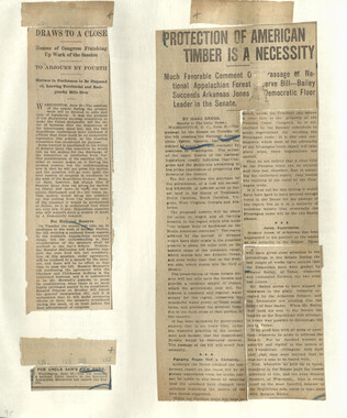
Appalachian National Park Association Newspaper Clippings, 1899-1902
-
Study for the Preservation of Mountain Culture in Field Museum of History

-
Cataloochee tract 248: J. A. Conrad

-
Appalachian National Park Association Newspaper Clippings, 1899-1902
-
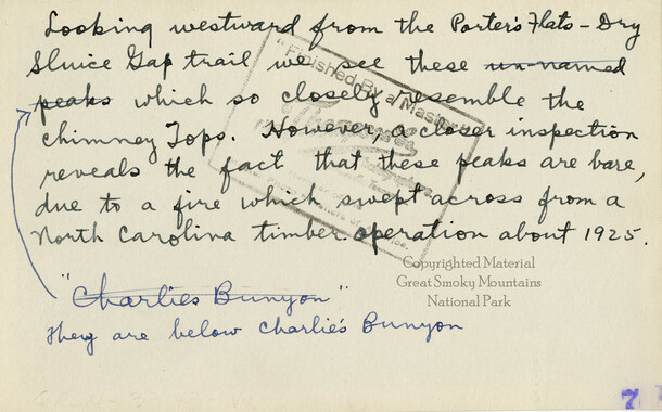
Mountain landscape from the Porters Flats
-
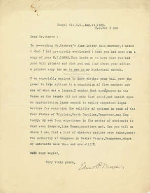
Correspondence between Edward P. Moses and Zebulon Weaver
-
Glimpses of our National Monuments
-
Cataloochee tract 209a: Johnathan Woody
-
Financial report, 1900

-
Minutes of Meetings of the Appalachian National Park Association
-
Photo Album of the Great Smokey Mountains

-
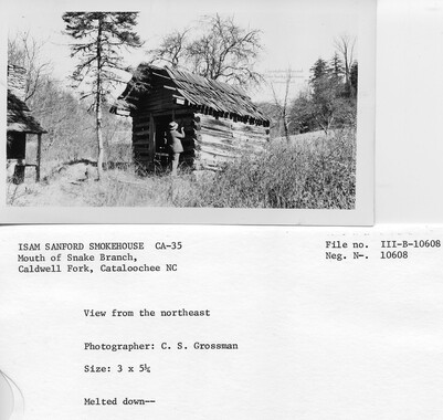
Cataloochee tract 208: James Caldwell

-
Map of Cataloochee Valley

-
Cataloochee tract 238 and 238a: D. H. Burris

-
Minutes of Meetings of the Appalachian National Park Association

-
Ramsey Prong Trail
-
Cataloochee tract 292: J. L. C. Messer
-
Photo Album of the Great Smokey Mountains

-
Cataloochee tract 214: Eldredge Caldwell – Levi
-
Appalachian National Park Association Newspaper Clippings, 1902-1907, 1925, 1928
-
Yellow Creek Mountain

-
Tri-Corner Knob from Mount Guyot
-
Appalachian National Park Association Newspaper Clippings, 1899-1902

-
Cataloochee tract 219: Milia Palmer

-
Correspondence regarding the destruction of United States forests

-
Study for the Preservation of Mountain Culture in Field Museum of History

-
Correspondence regarding the estate of Horace Kephart