- Canton Champion Fibre Company (2308)
- Cherokee Traditions (293)
- Civil War in Southern Appalachia (165)
- Craft Revival (1942)
- Great Smoky Mountains - A Park for America (2767)
- Highlights from Western Carolina University (430)
- Horace Kephart (941)
- Journeys Through Jackson (154)
- LGBTQIA+ Archive of Jackson County (24)
- Oral Histories of Western North Carolina (314)
- Picturing Appalachia (6772)
- Stories of Mountain Folk (413)
- Travel Western North Carolina (160)
- Western Carolina University Fine Art Museum Vitreograph Collection (129)
- Western Carolina University Herbarium (92)
- Western Carolina University: Making Memories (708)
- Western Carolina University Publications (2283)
- Western Carolina University Restricted Electronic Theses and Dissertations (146)
- Western North Carolina Regional Maps (71)
- World War II in Southern Appalachia (131)
- Appalachian National Park Association (53)
- Berry, Walter (76)
- Champion Fibre Company (5)
- Fromer, Irving Rhodes, 1913-1994 (70)
- Grant, George Alexander, 1891-1964 (96)
- Kephart, Horace, 1862-1931 (23)
- Masa, George, 1881-1933 (17)
- North Carolina Park Commission (105)
- Roth, Albert, 1890-1974 (142)
- Schenck, Carl Alwin, 1868-1955 (1)
- Stearns, I. K. (2)
- Thompson, James Edward, 1880-1976 (45)
- Weaver, Zebulon, 1872-1948 (55)
- Wilburn, Hiram Coleman, 1880-1967 (72)
- Allanstand Cottage Industries (0)
- Bennett, Kelly, 1890-1974 (0)
- Brasstown Carvers (0)
- Cain, Doreyl Ammons (0)
- Carver, George Washington, 1864?-1943 (0)
- Cathey, Joseph, 1803-1874 (0)
- Champion Paper and Fibre Company (0)
- Cherokee Indian Fair Association (0)
- Cherokee Language Program (0)
- Crittenden, Lorraine (0)
- Crowe, Amanda (0)
- Edmonston, Thomas Benton, 1842-1907 (0)
- Ensley, A. L. (Abraham Lincoln), 1865-1948 (0)
- George Butz (BFS 1907) (0)
- Goodrich, Frances Louisa (0)
- Heard, Marian Gladys (0)
- Kephart, Calvin, 1883-1969 (0)
- Kephart, Laura, 1862-1954 (0)
- Laney, Gideon Thomas, 1889-1976 (0)
- McElhinney, William Julian, 1896-1953 (0)
- Niggli, Josephina, 1910-1983 (0)
- Osborne, Kezia Stradley (0)
- Owens, Samuel Robert, 1918-1995 (0)
- Penland Weavers and Potters (0)
- Rhodes, Judy (0)
- Roberts, Vivienne (0)
- Sherrill's Photography Studio (0)
- Smith, Edward Clark (0)
- Southern Highland Handicraft Guild (0)
- Southern Highlanders, Inc. (0)
- Stalcup, Jesse Bryson (0)
- United States. Indian Arts and Crafts Board (0)
- USFS (0)
- Vance, Zebulon Baird, 1830-1894 (0)
- Western Carolina College (0)
- Western Carolina Teachers College (0)
- Western Carolina University (0)
- Western Carolina University. Mountain Heritage Center (0)
- Whitman, Walt, 1819-1892 (0)
- Williams, Isadora (0)
- 1810s (1)
- 1840s (1)
- 1850s (2)
- 1860s (3)
- 1870s (4)
- 1880s (7)
- 1890s (64)
- 1900s (294)
- 1910s (227)
- 1920s (461)
- 1930s (1585)
- 1940s (82)
- 1950s (15)
- 1960s (13)
- 1970s (47)
- 1980s (14)
- 1990s (17)
- 2000s (31)
- 2010s (1)
- 1600s (0)
- 1700s (0)
- 1800s (0)
- 1820s (0)
- 1830s (0)
- 2020s (0)
- Appalachian Region, Southern (80)
- Asheville (N.C.) (1)
- Avery County (N.C.) (6)
- Blount County (Tenn.) (159)
- Buncombe County (N.C.) (204)
- Cherokee County (N.C.) (10)
- Clay County (N.C.) (3)
- Graham County (N.C.) (108)
- Great Smoky Mountains National Park (N.C. and Tenn.) (416)
- Haywood County (N.C.) (263)
- Henderson County (N.C.) (13)
- Jackson County (N.C.) (58)
- Knox County (Tenn.) (21)
- Knoxville (Tenn.) (11)
- Lake Santeetlah (N.C.) (10)
- Macon County (N.C.) (25)
- Madison County (N.C.) (14)
- McDowell County (N.C.) (5)
- Mitchell County (N.C.) (7)
- Polk County (N.C.) (2)
- Qualla Boundary (22)
- Rutherford County (N.C.) (16)
- Swain County (N.C.) (516)
- Transylvania County (N.C.) (36)
- Watauga County (N.C.) (2)
- Waynesville (N.C.) (2)
- Yancey County (N.C.) (34)
- Aerial Views (3)
- Articles (1)
- Artifacts (object Genre) (4)
- Clippings (information Artifacts) (77)
- Drawings (visual Works) (174)
- Envelopes (2)
- Financial Records (9)
- Fliers (printed Matter) (34)
- Guidebooks (1)
- Interviews (11)
- Land Surveys (102)
- Letters (correspondence) (219)
- Manuscripts (documents) (91)
- Maps (documents) (69)
- Memorandums (14)
- Minutes (administrative Records) (20)
- Negatives (photographs) (282)
- Newsletters (12)
- Paintings (visual Works) (1)
- Pen And Ink Drawings (1)
- Photographs (1657)
- Portraits (39)
- Postcards (15)
- Publications (documents) (107)
- Scrapbooks (3)
- Sound Recordings (7)
- Speeches (documents) (11)
- Transcripts (46)
- Aerial Photographs (0)
- Albums (books) (0)
- Biography (general Genre) (0)
- Cards (information Artifacts) (0)
- Crafts (art Genres) (0)
- Depictions (visual Works) (0)
- Design Drawings (0)
- Facsimiles (reproductions) (0)
- Fiction (general Genre) (0)
- Glass Plate Negatives (0)
- Internegatives (0)
- Newspapers (0)
- Occupation Currency (0)
- Periodicals (0)
- Personal Narratives (0)
- Plans (maps) (0)
- Poetry (0)
- Programs (documents) (0)
- Questionnaires (0)
- Sheet Music (0)
- Slides (photographs) (0)
- Specimens (0)
- Text Messages (0)
- Tintypes (photographs) (0)
- Video Recordings (physical Artifacts) (0)
- Vitreographs (0)
- Appalachian National Park Association Records (336)
- Carlos C. Campbell Collection (282)
- Cataloochee History Project (65)
- George Masa Collection (89)
- Hiram C. Wilburn Papers (28)
- Historic Photographs Collection (236)
- Horace Kephart Collection (126)
- Humbard Collection (33)
- Jim Thompson Collection (44)
- Love Family Papers (11)
- Map Collection (12)
- R.A. Romanes Collection (10)
- Smoky Mountains Hiking Club Collection (616)
- Zebulon Weaver Collection (107)
- A.L. Ensley Collection (0)
- Appalachian Industrial School Records (0)
- Axley-Meroney Collection (0)
- Bayard Wootten Photograph Collection (0)
- Bethel Rural Community Organization Collection (0)
- Blumer Collection (0)
- C.W. Slagle Collection (0)
- Canton Area Historical Museum (0)
- Cherokee Studies Collection (0)
- Daisy Dame Photograph Album (0)
- Daniel Boone VI Collection (0)
- Doris Ulmann Photograph Collection (0)
- Elizabeth H. Lasley Collection (0)
- Elizabeth Woolworth Szold Fleharty Collection (0)
- Frank Fry Collection (0)
- Gideon Laney Collection (0)
- Hazel Scarborough Collection (0)
- Hunter and Weaver Families Collection (0)
- I. D. Blumenthal Collection (0)
- Isadora Williams Collection (0)
- Jesse Bryson Stalcup Collection (0)
- John B. Battle Collection (0)
- John C. Campbell Folk School Records (0)
- John Parris Collection (0)
- Judaculla Rock project (0)
- Kelly Bennett Collection (0)
- Major Wiley Parris Civil War Letters (0)
- McFee-Misemer Civil War Letters (0)
- Mountain Heritage Center Collection (0)
- Norburn - Robertson - Thomson Families Collection (0)
- Pauline Hood Collection (0)
- Pre-Guild Collection (0)
- Qualla Arts and Crafts Mutual Collection (0)
- Rosser H. Taylor Collection (0)
- Samuel Robert Owens Collection (0)
- Sara Madison Collection (0)
- Sherrill Studio Photo Collection (0)
- Stories of Mountain Folk - Radio Programs (0)
- The Reporter, Western Carolina University (0)
- Venoy and Elizabeth Reed Collection (0)
- WCU Gender and Sexuality Oral History Project (0)
- WCU Mountain Heritage Center Oral Histories (0)
- WCU Oral History Collection - Mountain People, Mountain Lives (0)
- WCU Students Newspapers Collection (0)
- Western North Carolina Tomorrow Black Oral History Project (0)
- William Williams Stringfield Collection (0)
- Appalachian Trail (22)
- Church buildings (9)
- Civilian Conservation Corps (U.S.) (91)
- Dams (21)
- Floods (1)
- Forest conservation (11)
- Forests and forestry (42)
- Great Smoky Mountains National Park (N.C. and Tenn.) (64)
- Hunting (2)
- Logging (25)
- Maps (74)
- North Carolina -- Maps (5)
- Postcards (15)
- Railroad trains (8)
- Sports (4)
- Storytelling (2)
- Waterfalls -- Great Smoky Mountains (N.C. and Tenn.) (39)
- African Americans (0)
- Artisans (0)
- Cherokee art (0)
- Cherokee artists -- North Carolina (0)
- Cherokee language (0)
- Cherokee pottery (0)
- Cherokee women (0)
- College student newspapers and periodicals (0)
- Dance (0)
- Education (0)
- Folk music (0)
- Forced removal, 1813-1903 (0)
- Gender nonconformity (0)
- Landscape photography (0)
- Mines and mineral resources (0)
- Paper industry (0)
- Pottery (0)
- Rural electrification -- North Carolina, Western (0)
- School integration -- Southern States (0)
- Segregation -- North Carolina, Western (0)
- Slavery (0)
- Weaving -- Appalachian Region, Southern (0)
- Wood-carving -- Appalachian Region, Southern (0)
- World War, 1939-1945 (0)
- Sound (7)
- StillImage (2172)
- Text (655)
- MovingImage (0)
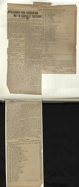
Appalachian National Park Association Newspaper Clippings, 1899-1902

Appalachian National Park Association Newspaper Clippings, 1899-1902
NCWRA_019_02_000
Appalachian National Park Association Newspaper Clippings, 1899-1902
NCWRA_019_02_001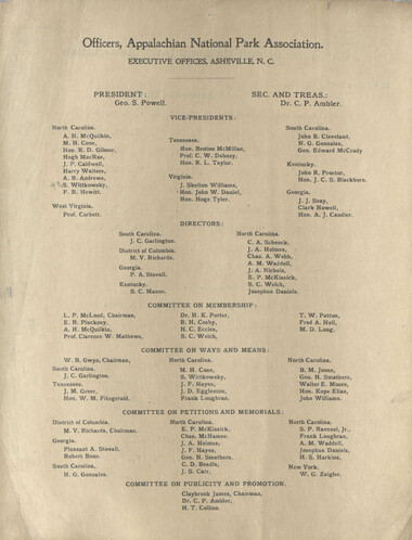
Appalachian National Park Association Newspaper Clippings, 1899-1902
NCWRA_019_02_002
Appalachian National Park Association Newspaper Clippings, 1899-1902
NCWRA_019_02_003
Appalachian National Park Association Newspaper Clippings, 1899-1902
NCWRA_019_02_004
Appalachian National Park Association Newspaper Clippings, 1899-1902
NCWRA_019_02_005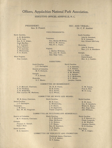
Appalachian National Park Association Newspaper Clippings, 1899-1902
NCWRA_019_02_006
Appalachian National Park Association Newspaper Clippings, 1899-1902
NCWRA_019_02_007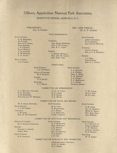
Appalachian National Park Association Newspaper Clippings, 1899-1902
NCWRA_019_02_008
Appalachian National Park Association Newspaper Clippings, 1899-1902
NCWRA_019_02_009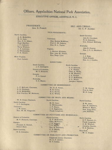
Appalachian National Park Association Newspaper Clippings, 1899-1902
NCWRA_019_02_010
Appalachian National Park Association Newspaper Clippings, 1899-1902
NCWRA_019_02_011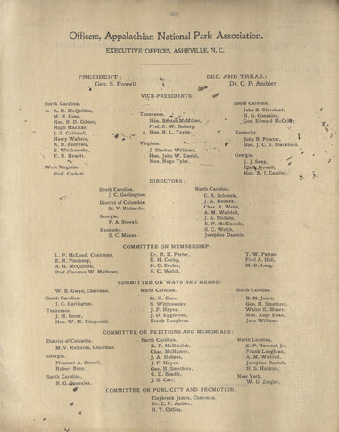
Appalachian National Park Association Newspaper Clippings, 1899-1902
NCWRA_019_02_012
Appalachian National Park Association Newspaper Clippings, 1899-1902
NCWRA_019_02_013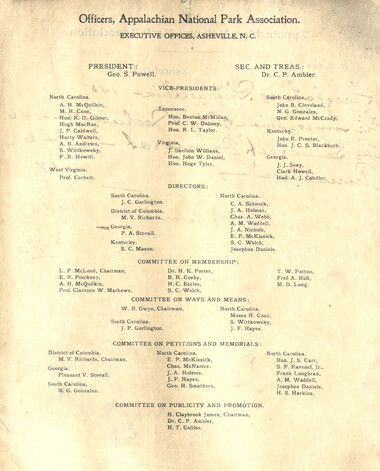
Appalachian National Park Association Newspaper Clippings, 1899-1902
NCWRA_019_02_014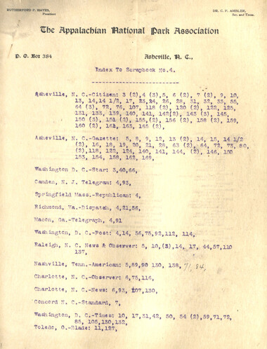
Appalachian National Park Association Newspaper Clippings, 1899-1902
NCWRA_019_02_015
Appalachian National Park Association Newspaper Clippings, 1899-1902
NCWRA_019_02_016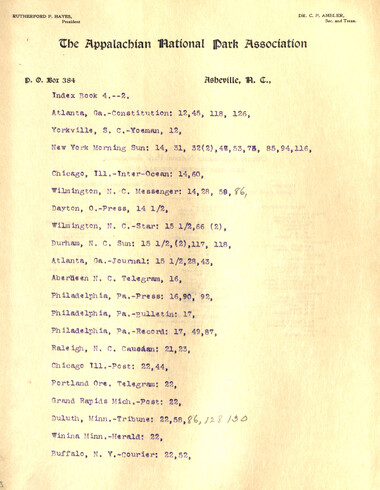
Appalachian National Park Association Newspaper Clippings, 1899-1902
NCWRA_019_02_017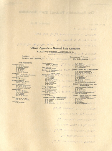
Appalachian National Park Association Newspaper Clippings, 1899-1902
NCWRA_019_02_018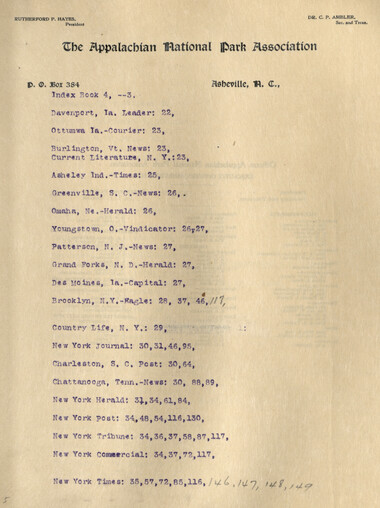
Appalachian National Park Association Newspaper Clippings, 1899-1902
NCWRA_019_02_019
Appalachian National Park Association Newspaper Clippings, 1899-1902
NCWRA_019_02_020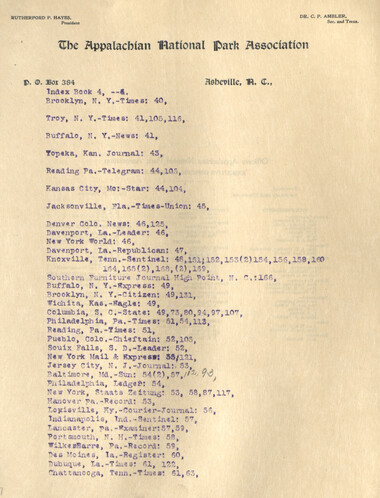
Appalachian National Park Association Newspaper Clippings, 1899-1902
NCWRA_019_02_021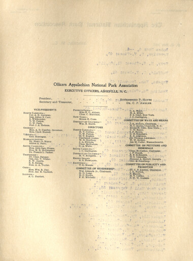
Appalachian National Park Association Newspaper Clippings, 1899-1902
NCWRA_019_02_022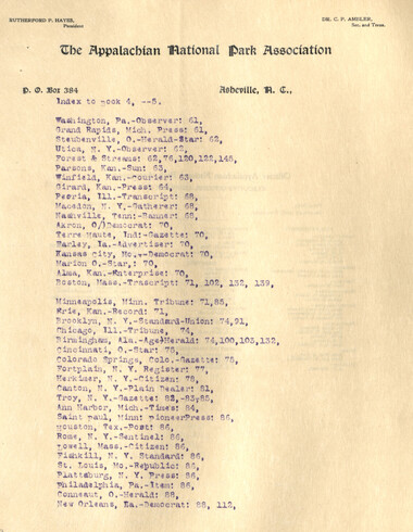
Appalachian National Park Association Newspaper Clippings, 1899-1902
NCWRA_019_02_023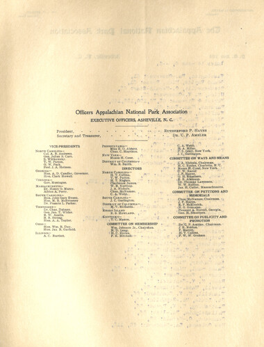
Appalachian National Park Association Newspaper Clippings, 1899-1902
NCWRA_019_02_024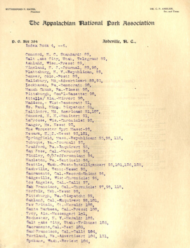
Appalachian National Park Association Newspaper Clippings, 1899-1902
NCWRA_019_02_025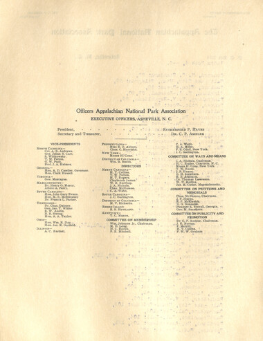
Appalachian National Park Association Newspaper Clippings, 1899-1902
NCWRA_019_02_026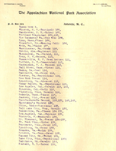
Appalachian National Park Association Newspaper Clippings, 1899-1902
NCWRA_019_02_027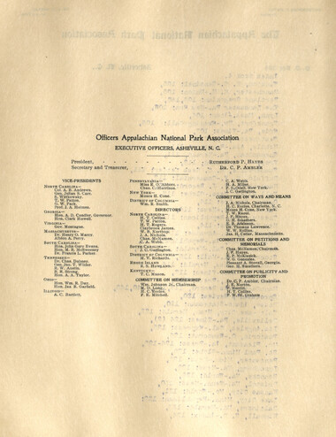
Appalachian National Park Association Newspaper Clippings, 1899-1902
NCWRA_019_02_028
Appalachian National Park Association Newspaper Clippings, 1899-1902
NCWRA_019_02_029
Appalachian National Park Association Newspaper Clippings, 1899-1902
NCWRA_019_02_030
Appalachian National Park Association Newspaper Clippings, 1899-1902
NCWRA_019_02_031
Appalachian National Park Association Newspaper Clippings, 1899-1902
NCWRA_019_02_032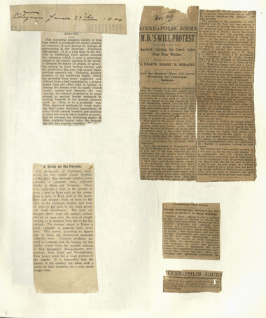
Appalachian National Park Association Newspaper Clippings, 1899-1902
NCWRA_019_02_033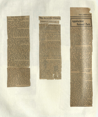
Appalachian National Park Association Newspaper Clippings, 1899-1902
NCWRA_019_02_034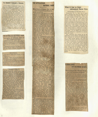
Appalachian National Park Association Newspaper Clippings, 1899-1902
NCWRA_019_02_035
Appalachian National Park Association Newspaper Clippings, 1899-1902
NCWRA_019_02_036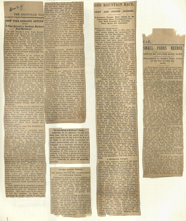
Appalachian National Park Association Newspaper Clippings, 1899-1902
NCWRA_019_02_037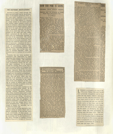
Appalachian National Park Association Newspaper Clippings, 1899-1902
NCWRA_019_02_038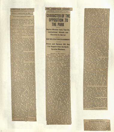
Appalachian National Park Association Newspaper Clippings, 1899-1902
NCWRA_019_02_039
Appalachian National Park Association Newspaper Clippings, 1899-1902
NCWRA_019_02_040
Appalachian National Park Association Newspaper Clippings, 1899-1902
NCWRA_019_02_041
Appalachian National Park Association Newspaper Clippings, 1899-1902
NCWRA_019_02_042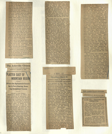
Appalachian National Park Association Newspaper Clippings, 1899-1902
NCWRA_019_02_043
Appalachian National Park Association Newspaper Clippings, 1899-1902
NCWRA_019_02_044
Appalachian National Park Association Newspaper Clippings, 1899-1902
NCWRA_019_02_045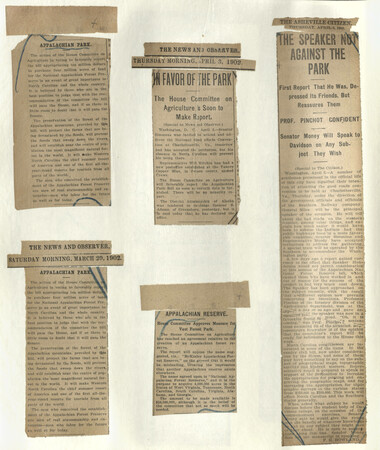
Appalachian National Park Association Newspaper Clippings, 1899-1902
NCWRA_019_02_046
Appalachian National Park Association Newspaper Clippings, 1899-1902
NCWRA_019_02_047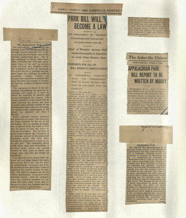
Appalachian National Park Association Newspaper Clippings, 1899-1902
NCWRA_019_02_048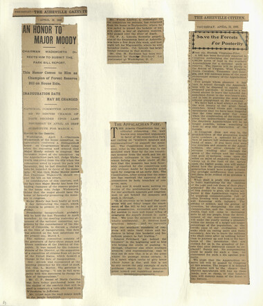
Appalachian National Park Association Newspaper Clippings, 1899-1902
NCWRA_019_02_049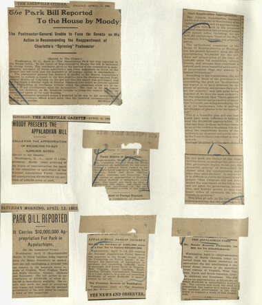
Appalachian National Park Association Newspaper Clippings, 1899-1902
NCWRA_019_02_050
Appalachian National Park Association Newspaper Clippings, 1899-1902
NCWRA_019_02_051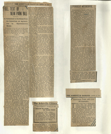
Appalachian National Park Association Newspaper Clippings, 1899-1902
NCWRA_019_02_052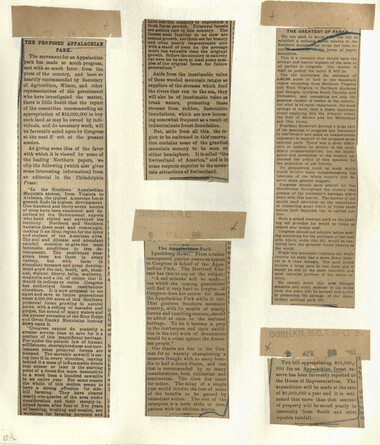
Appalachian National Park Association Newspaper Clippings, 1899-1902
NCWRA_019_02_053
Appalachian National Park Association Newspaper Clippings, 1899-1902
NCWRA_019_02_054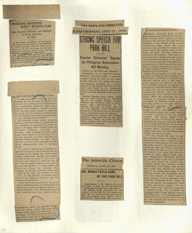
Appalachian National Park Association Newspaper Clippings, 1899-1902
NCWRA_019_02_055
Appalachian National Park Association Newspaper Clippings, 1899-1902
NCWRA_019_02_056
Appalachian National Park Association Newspaper Clippings, 1899-1902
NCWRA_019_02_057
Appalachian National Park Association Newspaper Clippings, 1899-1902
NCWRA_019_02_058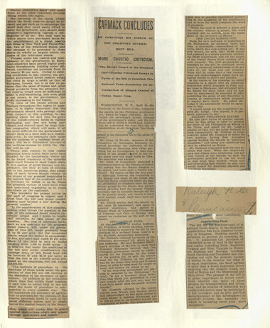
Appalachian National Park Association Newspaper Clippings, 1899-1902
NCWRA_019_02_059
Appalachian National Park Association Newspaper Clippings, 1899-1902
NCWRA_019_02_060
Appalachian National Park Association Newspaper Clippings, 1899-1902
NCWRA_019_02_061
Appalachian National Park Association Newspaper Clippings, 1899-1902
NCWRA_019_02_062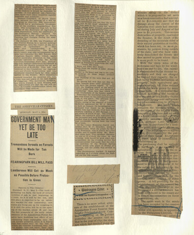
Appalachian National Park Association Newspaper Clippings, 1899-1902
NCWRA_019_02_063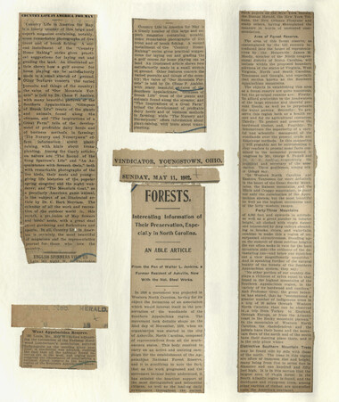
Appalachian National Park Association Newspaper Clippings, 1899-1902
NCWRA_019_02_064
Appalachian National Park Association Newspaper Clippings, 1899-1902
NCWRA_019_02_065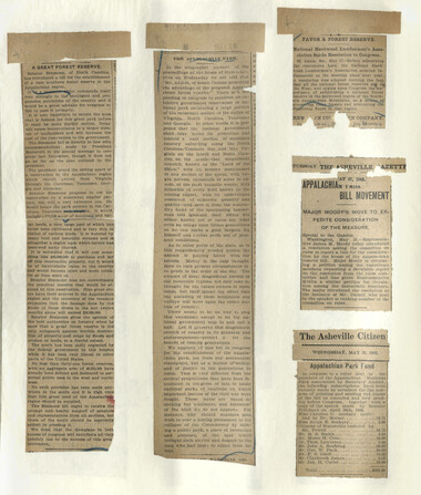
Appalachian National Park Association Newspaper Clippings, 1899-1902
NCWRA_019_02_066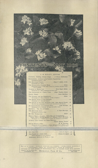
Appalachian National Park Association Newspaper Clippings, 1899-1902
NCWRA_019_02_067_a
Appalachian National Park Association Newspaper Clippings, 1899-1902
NCWRA_019_02_067_b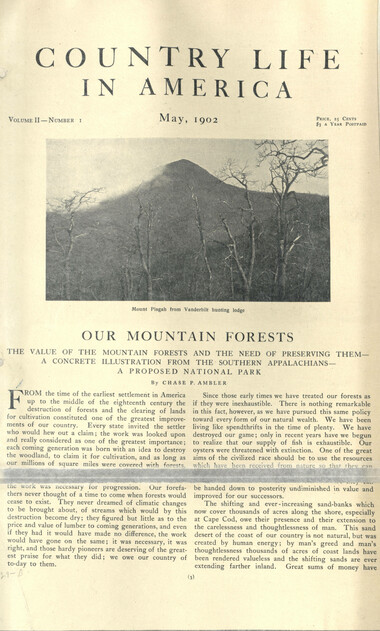
Appalachian National Park Association Newspaper Clippings, 1899-1902
NCWRA_019_02_067_c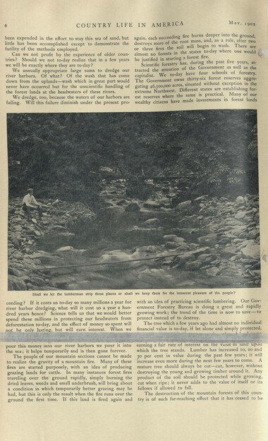
Appalachian National Park Association Newspaper Clippings, 1899-1902
NCWRA_019_02_067_d
Appalachian National Park Association Newspaper Clippings, 1899-1902
NCWRA_019_02_067_e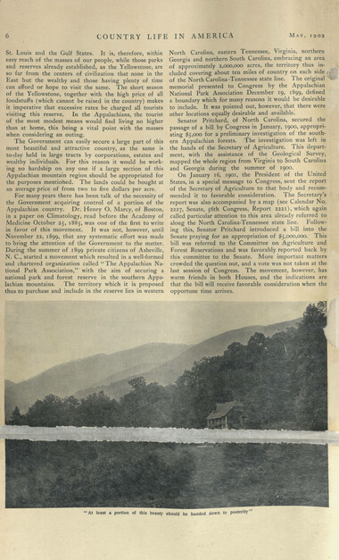
Appalachian National Park Association Newspaper Clippings, 1899-1902
NCWRA_019_02_067_f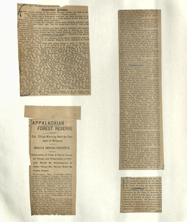
Appalachian National Park Association Newspaper Clippings, 1899-1902
NCWRA_019_02_068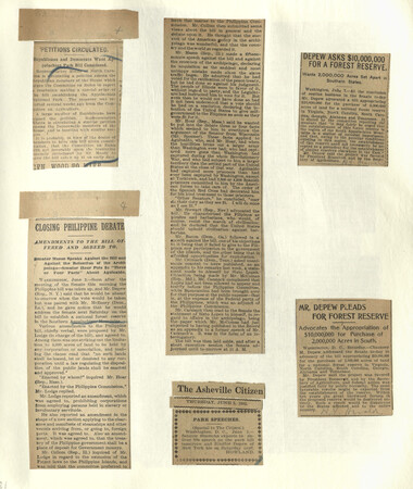
Appalachian National Park Association Newspaper Clippings, 1899-1902
NCWRA_019_02_069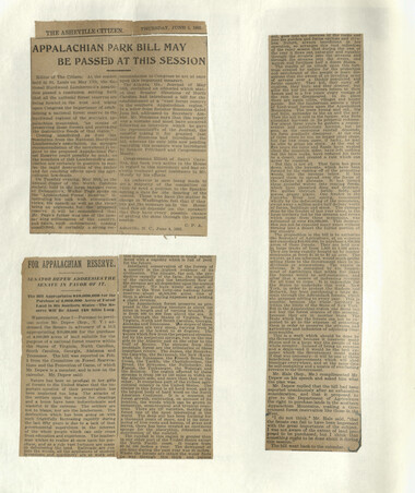
Appalachian National Park Association Newspaper Clippings, 1899-1902
NCWRA_019_02_070
Appalachian National Park Association Newspaper Clippings, 1899-1902
NCWRA_019_02_071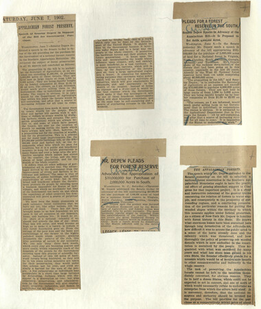
Appalachian National Park Association Newspaper Clippings, 1899-1902
NCWRA_019_02_072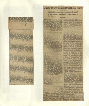
Appalachian National Park Association Newspaper Clippings, 1899-1902
NCWRA_019_02_073
Appalachian National Park Association Newspaper Clippings, 1899-1902
NCWRA_019_02_074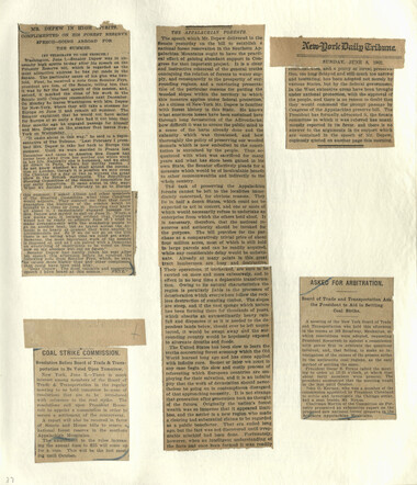
Appalachian National Park Association Newspaper Clippings, 1899-1902
NCWRA_019_02_075
Appalachian National Park Association Newspaper Clippings, 1899-1902
NCWRA_019_02_076
Appalachian National Park Association Newspaper Clippings, 1899-1902
NCWRA_019_02_077_a
Appalachian National Park Association Newspaper Clippings, 1899-1902
NCWRA_019_02_077_b
Appalachian National Park Association Newspaper Clippings, 1899-1902
NCWRA_019_02_077_c
Appalachian National Park Association Newspaper Clippings, 1899-1902
NCWRA_019_02_077_d
Appalachian National Park Association Newspaper Clippings, 1899-1902
NCWRA_019_02_077_e
Appalachian National Park Association Newspaper Clippings, 1899-1902
NCWRA_019_02_077_f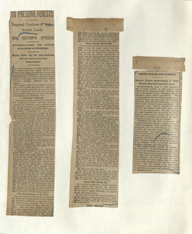
Appalachian National Park Association Newspaper Clippings, 1899-1902
NCWRA_019_02_078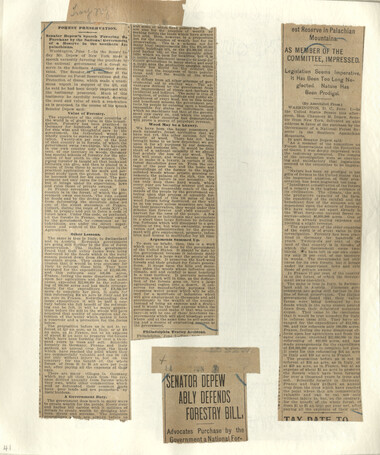
Appalachian National Park Association Newspaper Clippings, 1899-1902
NCWRA_019_02_079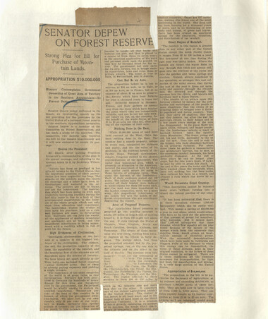
Appalachian National Park Association Newspaper Clippings, 1899-1902
NCWRA_019_02_080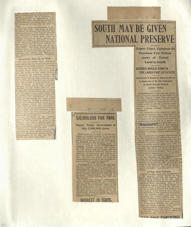
Appalachian National Park Association Newspaper Clippings, 1899-1902
NCWRA_019_02_081
Appalachian National Park Association Newspaper Clippings, 1899-1902
NCWRA_019_02_082
Appalachian National Park Association Newspaper Clippings, 1899-1902
NCWRA_019_02_083
Appalachian National Park Association Newspaper Clippings, 1899-1902
NCWRA_019_02_084
Appalachian National Park Association Newspaper Clippings, 1899-1902
NCWRA_019_02_085
Appalachian National Park Association Newspaper Clippings, 1899-1902
NCWRA_019_02_086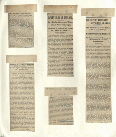
Appalachian National Park Association Newspaper Clippings, 1899-1902
NCWRA_019_02_087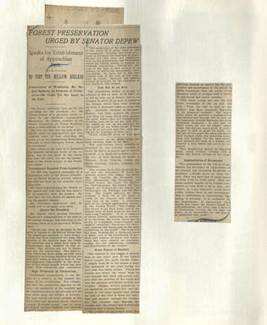
Appalachian National Park Association Newspaper Clippings, 1899-1902
NCWRA_019_02_088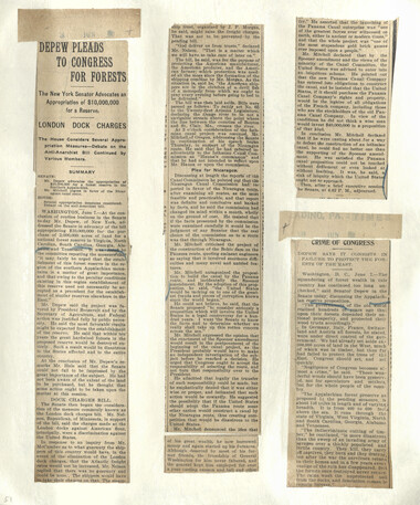
Appalachian National Park Association Newspaper Clippings, 1899-1902
NCWRA_019_02_089
Appalachian National Park Association Newspaper Clippings, 1899-1902
NCWRA_019_02_090
Appalachian National Park Association Newspaper Clippings, 1899-1902
NCWRA_019_02_091
Appalachian National Park Association Newspaper Clippings, 1899-1902
NCWRA_019_02_092
Appalachian National Park Association Newspaper Clippings, 1899-1902
NCWRA_019_02_093
Appalachian National Park Association Newspaper Clippings, 1899-1902
NCWRA_019_02_094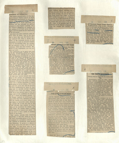
Appalachian National Park Association Newspaper Clippings, 1899-1902
NCWRA_019_02_095
Appalachian National Park Association Newspaper Clippings, 1899-1902
NCWRA_019_02_096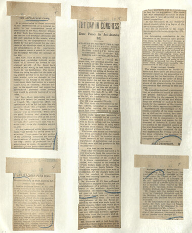
Appalachian National Park Association Newspaper Clippings, 1899-1902
NCWRA_019_02_097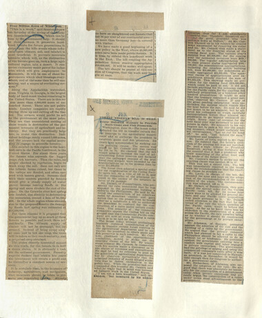
Appalachian National Park Association Newspaper Clippings, 1899-1902
NCWRA_019_02_098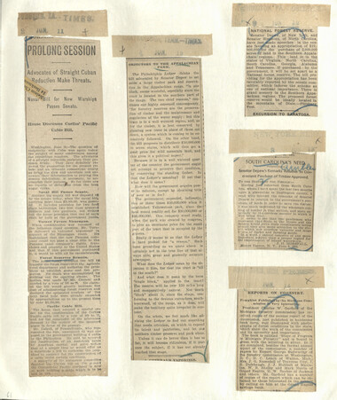
Appalachian National Park Association Newspaper Clippings, 1899-1902
NCWRA_019_02_099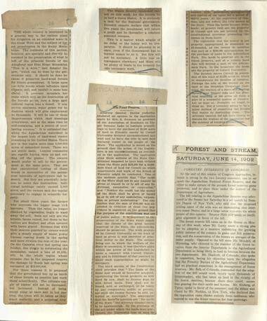
Appalachian National Park Association Newspaper Clippings, 1899-1902
NCWRA_019_02_100
Appalachian National Park Association Newspaper Clippings, 1899-1902
NCWRA_019_02_101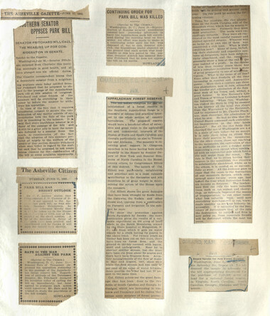
Appalachian National Park Association Newspaper Clippings, 1899-1902
NCWRA_019_02_102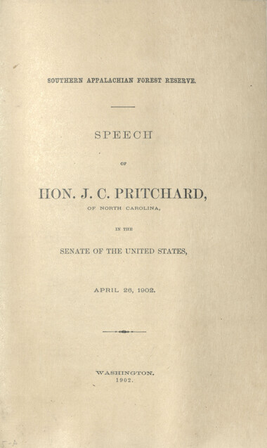
Appalachian National Park Association Newspaper Clippings, 1899-1902
NCWRA_019_02_103_01
Appalachian National Park Association Newspaper Clippings, 1899-1902
NCWRA_019_02_103_02
Appalachian National Park Association Newspaper Clippings, 1899-1902
NCWRA_019_02_103_03
Appalachian National Park Association Newspaper Clippings, 1899-1902
NCWRA_019_02_103_04
Appalachian National Park Association Newspaper Clippings, 1899-1902
NCWRA_019_02_103_05
Appalachian National Park Association Newspaper Clippings, 1899-1902
NCWRA_019_02_103_06
Appalachian National Park Association Newspaper Clippings, 1899-1902
NCWRA_019_02_103_07
Appalachian National Park Association Newspaper Clippings, 1899-1902
NCWRA_019_02_103_08
Appalachian National Park Association Newspaper Clippings, 1899-1902
NCWRA_019_02_103_09
Appalachian National Park Association Newspaper Clippings, 1899-1902
NCWRA_019_02_103_10
Appalachian National Park Association Newspaper Clippings, 1899-1902
NCWRA_019_02_103_11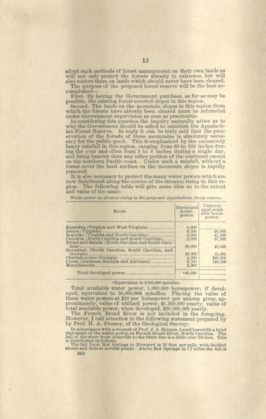
Appalachian National Park Association Newspaper Clippings, 1899-1902
NCWRA_019_02_103_12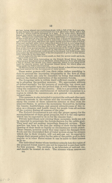
Appalachian National Park Association Newspaper Clippings, 1899-1902
NCWRA_019_02_103_13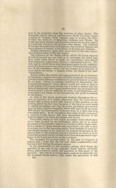
Appalachian National Park Association Newspaper Clippings, 1899-1902
NCWRA_019_02_103_14
Appalachian National Park Association Newspaper Clippings, 1899-1902
NCWRA_019_02_103_15
Appalachian National Park Association Newspaper Clippings, 1899-1902
NCWRA_019_02_104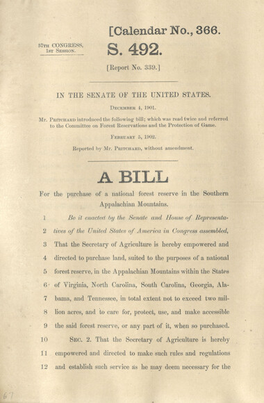
Appalachian National Park Association Newspaper Clippings, 1899-1902
NCWRA_019_02_105_01
Appalachian National Park Association Newspaper Clippings, 1899-1902
NCWRA_019_02_105_02
Appalachian National Park Association Newspaper Clippings, 1899-1902
NCWRA_019_02_105_03
Appalachian National Park Association Newspaper Clippings, 1899-1902
NCWRA_019_02_105_04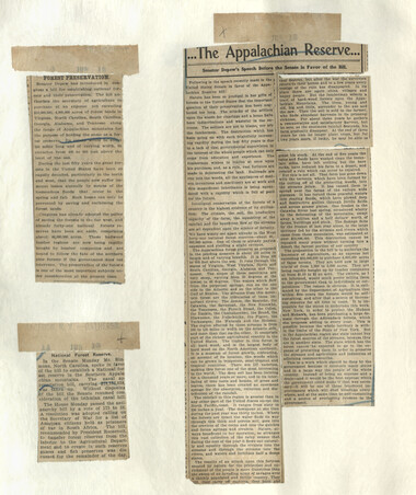
Appalachian National Park Association Newspaper Clippings, 1899-1902
NCWRA_019_02_106
Appalachian National Park Association Newspaper Clippings, 1899-1902
NCWRA_019_02_107_01
Appalachian National Park Association Newspaper Clippings, 1899-1902
NCWRA_019_02_107_02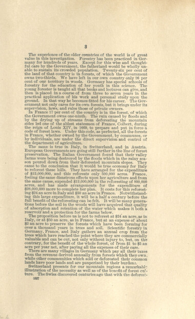
Appalachian National Park Association Newspaper Clippings, 1899-1902
NCWRA_019_02_107_03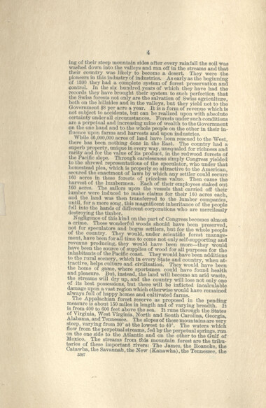
Appalachian National Park Association Newspaper Clippings, 1899-1902
NCWRA_019_02_107_04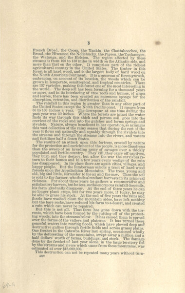
Appalachian National Park Association Newspaper Clippings, 1899-1902
NCWRA_019_02_107_05
Appalachian National Park Association Newspaper Clippings, 1899-1902
NCWRA_019_02_107_06
Appalachian National Park Association Newspaper Clippings, 1899-1902
NCWRA_019_02_107_07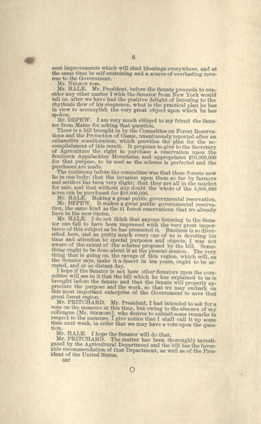
Appalachian National Park Association Newspaper Clippings, 1899-1902
NCWRA_019_02_107_08
Appalachian National Park Association Newspaper Clippings, 1899-1902
NCWRA_019_02_108
Appalachian National Park Association Newspaper Clippings, 1899-1902
NCWRA_019_02_109
Appalachian National Park Association Newspaper Clippings, 1899-1902
NCWRA_019_02_110
Appalachian National Park Association Newspaper Clippings, 1899-1902
NCWRA_019_02_111
Appalachian National Park Association Newspaper Clippings, 1899-1902
NCWRA_019_02_112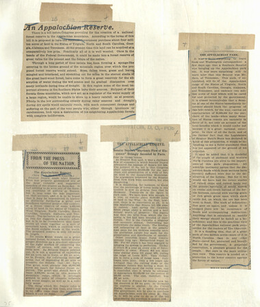
Appalachian National Park Association Newspaper Clippings, 1899-1902
NCWRA_019_02_113
Appalachian National Park Association Newspaper Clippings, 1899-1902
NCWRA_019_02_114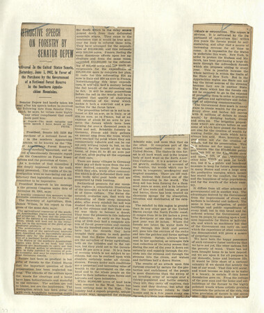
Appalachian National Park Association Newspaper Clippings, 1899-1902
NCWRA_019_02_115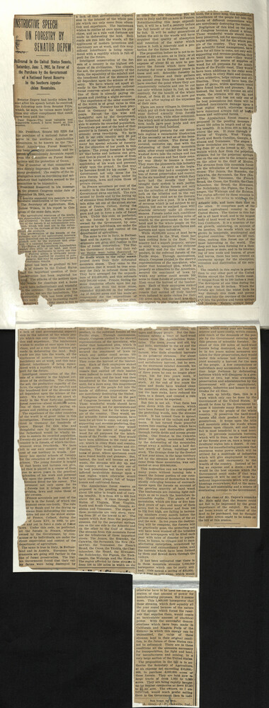
Appalachian National Park Association Newspaper Clippings, 1899-1902
NCWRA_019_02_116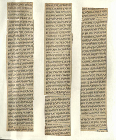
Appalachian National Park Association Newspaper Clippings, 1899-1902
NCWRA_019_02_117
Appalachian National Park Association Newspaper Clippings, 1899-1902
NCWRA_019_02_118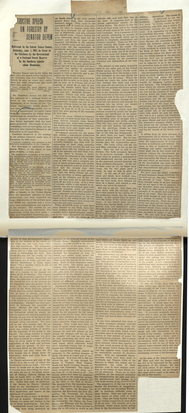
Appalachian National Park Association Newspaper Clippings, 1899-1902
NCWRA_019_02_119
Appalachian National Park Association Newspaper Clippings, 1899-1902
NCWRA_019_02_120
Appalachian National Park Association Newspaper Clippings, 1899-1902
NCWRA_019_02_121
Appalachian National Park Association Newspaper Clippings, 1899-1902
NCWRA_019_02_122
Appalachian National Park Association Newspaper Clippings, 1899-1902
NCWRA_019_02_123
Appalachian National Park Association Newspaper Clippings, 1899-1902
NCWRA_019_02_124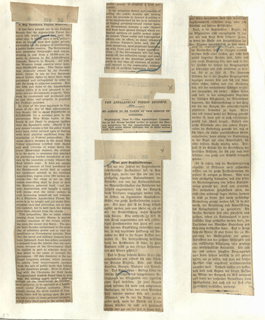
Appalachian National Park Association Newspaper Clippings, 1899-1902
NCWRA_019_02_125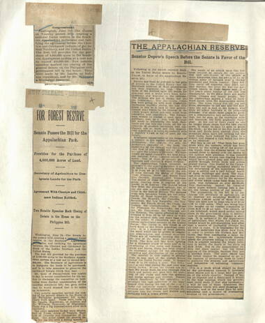
Appalachian National Park Association Newspaper Clippings, 1899-1902
NCWRA_019_02_126
Appalachian National Park Association Newspaper Clippings, 1899-1902
NCWRA_019_02_127
Appalachian National Park Association Newspaper Clippings, 1899-1902
NCWRA_019_02_128
Appalachian National Park Association Newspaper Clippings, 1899-1902
NCWRA_019_02_129
Appalachian National Park Association Newspaper Clippings, 1899-1902
NCWRA_019_02_130
Appalachian National Park Association Newspaper Clippings, 1899-1902
NCWRA_019_02_131
Appalachian National Park Association Newspaper Clippings, 1899-1902
NCWRA_019_02_132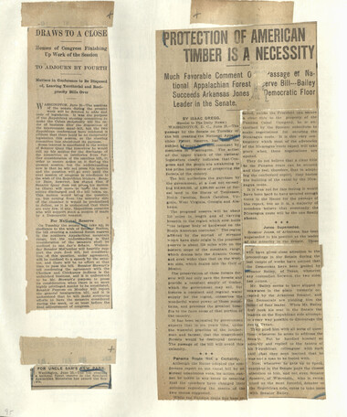
Appalachian National Park Association Newspaper Clippings, 1899-1902
NCWRA_019_02_133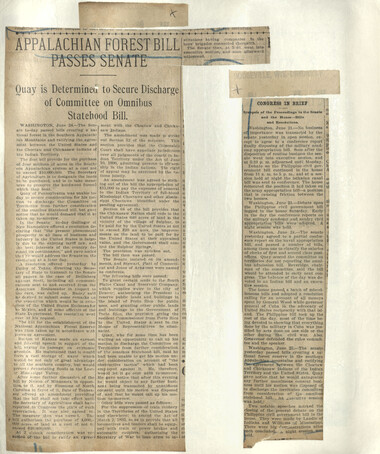
Appalachian National Park Association Newspaper Clippings, 1899-1902
NCWRA_019_02_134
Appalachian National Park Association Newspaper Clippings, 1899-1902
NCWRA_019_02_135
Appalachian National Park Association Newspaper Clippings, 1899-1902
NCWRA_019_02_136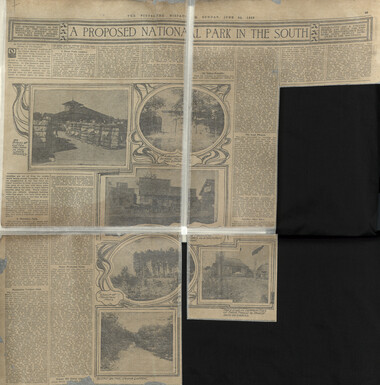
Appalachian National Park Association Newspaper Clippings, 1899-1902
NCWRA_019_02_137_a
Appalachian National Park Association Newspaper Clippings, 1899-1902
NCWRA_019_02_137_b
Appalachian National Park Association Newspaper Clippings, 1899-1902
NCWRA_019_02_138
Appalachian National Park Association Newspaper Clippings, 1899-1902
NCWRA_019_02_139_a
Appalachian National Park Association Newspaper Clippings, 1899-1902
NCWRA_019_02_139_b
Appalachian National Park Association Newspaper Clippings, 1899-1902
NCWRA_019_02_140
Appalachian National Park Association Newspaper Clippings, 1899-1902
NCWRA_019_02_141
Appalachian National Park Association Newspaper Clippings, 1899-1902
NCWRA_019_02_142
Appalachian National Park Association Newspaper Clippings, 1899-1902
NCWRA_019_02_143
Appalachian National Park Association Newspaper Clippings, 1899-1902
NCWRA_019_02_144
Appalachian National Park Association Newspaper Clippings, 1899-1902
NCWRA_019_02_145
Appalachian National Park Association Newspaper Clippings, 1899-1902
NCWRA_019_02_146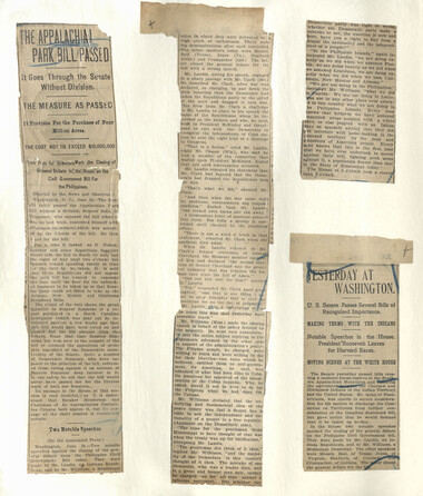
Appalachian National Park Association Newspaper Clippings, 1899-1902
NCWRA_019_02_147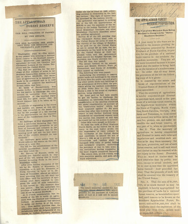
Appalachian National Park Association Newspaper Clippings, 1899-1902
NCWRA_019_02_148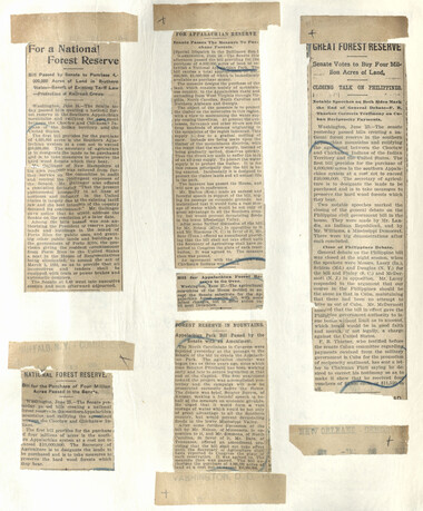
Appalachian National Park Association Newspaper Clippings, 1899-1902
NCWRA_019_02_149
Appalachian National Park Association Newspaper Clippings, 1899-1902
NCWRA_019_02_150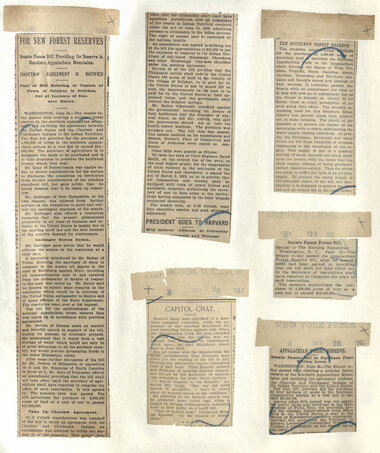
Appalachian National Park Association Newspaper Clippings, 1899-1902
NCWRA_019_02_151
Appalachian National Park Association Newspaper Clippings, 1899-1902
NCWRA_019_02_152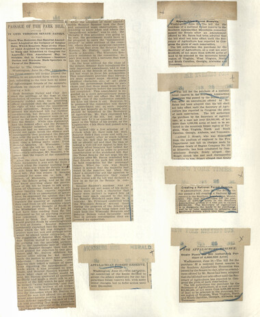
Appalachian National Park Association Newspaper Clippings, 1899-1902
NCWRA_019_02_153
Appalachian National Park Association Newspaper Clippings, 1899-1902
NCWRA_019_02_154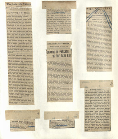
Appalachian National Park Association Newspaper Clippings, 1899-1902
NCWRA_019_02_155
Appalachian National Park Association Newspaper Clippings, 1899-1902
NCWRA_019_02_156_a
Appalachian National Park Association Newspaper Clippings, 1899-1902
NCWRA_019_02_156_b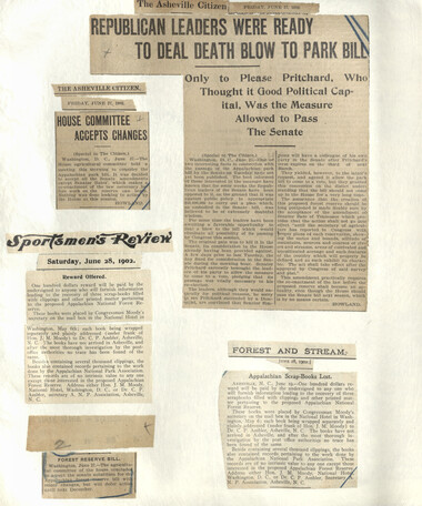
Appalachian National Park Association Newspaper Clippings, 1899-1902
NCWRA_019_02_157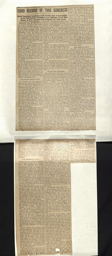
Appalachian National Park Association Newspaper Clippings, 1899-1902
NCWRA_019_02_158
Appalachian National Park Association Newspaper Clippings, 1899-1902
NCWRA_019_02_159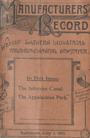
Appalachian National Park Association Newspaper Clippings, 1899-1902
NCWRA_019_02_160_a
Appalachian National Park Association Newspaper Clippings, 1899-1902
NCWRA_019_02_160_b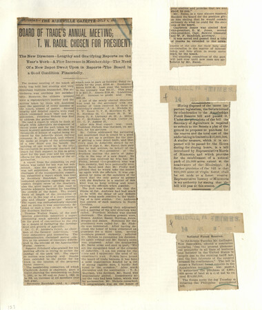
Appalachian National Park Association Newspaper Clippings, 1899-1902
NCWRA_019_02_161
Appalachian National Park Association Newspaper Clippings, 1899-1902
NCWRA_019_02_162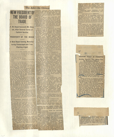
Appalachian National Park Association Newspaper Clippings, 1899-1902
NCWRA_019_02_163
Appalachian National Park Association Newspaper Clippings, 1899-1902
NCWRA_019_02_164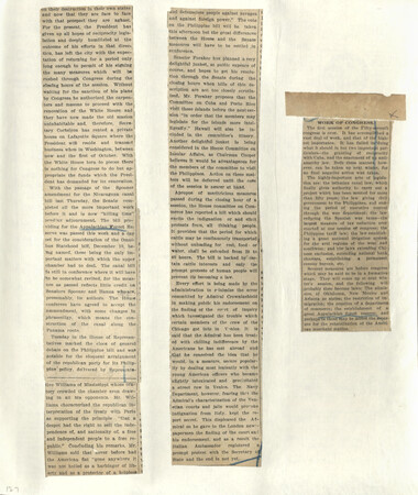
Appalachian National Park Association Newspaper Clippings, 1899-1902
NCWRA_019_02_165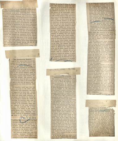
Appalachian National Park Association Newspaper Clippings, 1899-1902
NCWRA_019_02_166
Appalachian National Park Association Newspaper Clippings, 1899-1902
NCWRA_019_02_167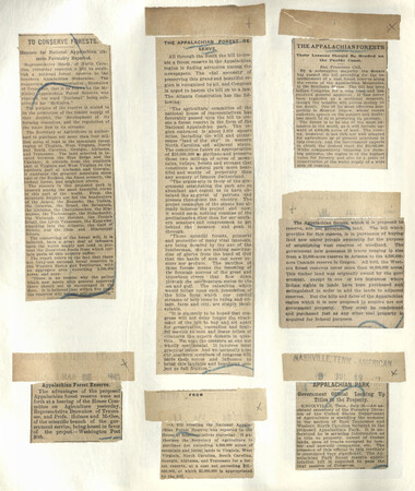
Appalachian National Park Association Newspaper Clippings, 1899-1902
NCWRA_019_02_168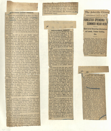
Appalachian National Park Association Newspaper Clippings, 1899-1902
NCWRA_019_02_169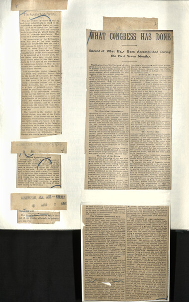
Appalachian National Park Association Newspaper Clippings, 1899-1902
NCWRA_019_02_170
Appalachian National Park Association Newspaper Clippings, 1899-1902
NCWRA_019_02_171
Appalachian National Park Association Newspaper Clippings, 1899-1902
NCWRA_019_02_172
Appalachian National Park Association Newspaper Clippings, 1899-1902
NCWRA_019_02_173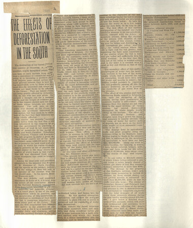
Appalachian National Park Association Newspaper Clippings, 1899-1902
NCWRA_019_02_174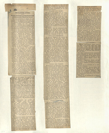
Appalachian National Park Association Newspaper Clippings, 1899-1902
NCWRA_019_02_175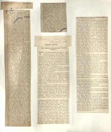
Appalachian National Park Association Newspaper Clippings, 1899-1902
NCWRA_019_02_176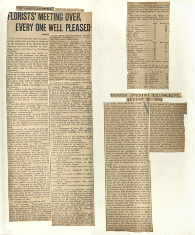
Appalachian National Park Association Newspaper Clippings, 1899-1902
NCWRA_019_02_177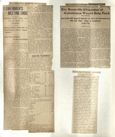
Appalachian National Park Association Newspaper Clippings, 1899-1902
NCWRA_019_02_178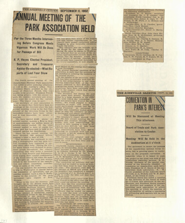
Appalachian National Park Association Newspaper Clippings, 1899-1902
NCWRA_019_02_179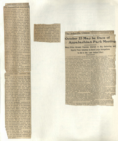
Appalachian National Park Association Newspaper Clippings, 1899-1902
NCWRA_019_02_180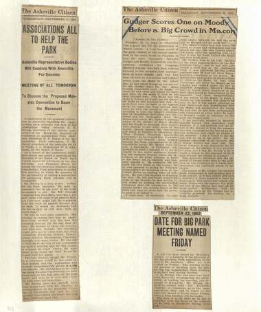
Appalachian National Park Association Newspaper Clippings, 1899-1902
NCWRA_019_02_181
Appalachian National Park Association Newspaper Clippings, 1899-1902
NCWRA_019_02_182
Appalachian National Park Association Newspaper Clippings, 1899-1902
NCWRA_019_02_183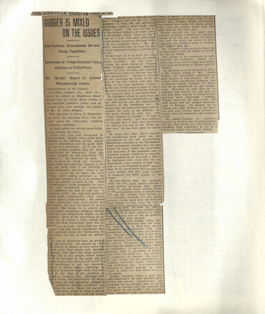
Appalachian National Park Association Newspaper Clippings, 1899-1902
NCWRA_019_02_184
Appalachian National Park Association Newspaper Clippings, 1899-1902
NCWRA_019_02_185
Appalachian National Park Association Newspaper Clippings, 1899-1902
NCWRA_019_02_186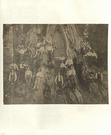
Appalachian National Park Association Newspaper Clippings, 1899-1902
NCWRA_019_02_187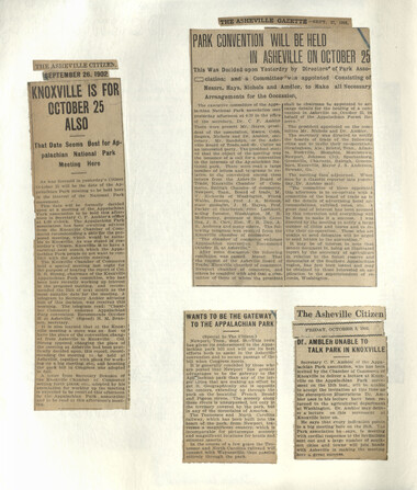
Appalachian National Park Association Newspaper Clippings, 1899-1902
NCWRA_019_02_188
Appalachian National Park Association Newspaper Clippings, 1899-1902
NCWRA_019_02_189
Appalachian National Park Association Newspaper Clippings, 1899-1902
NCWRA_019_02_190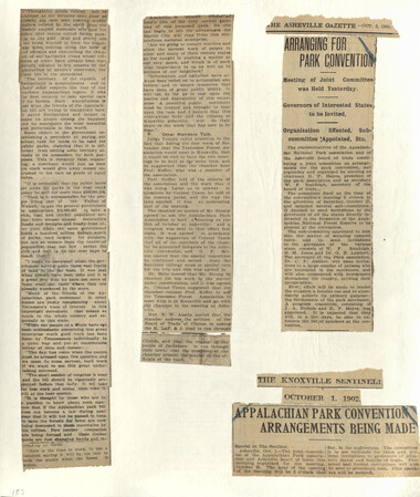
Appalachian National Park Association Newspaper Clippings, 1899-1902
NCWRA_019_02_191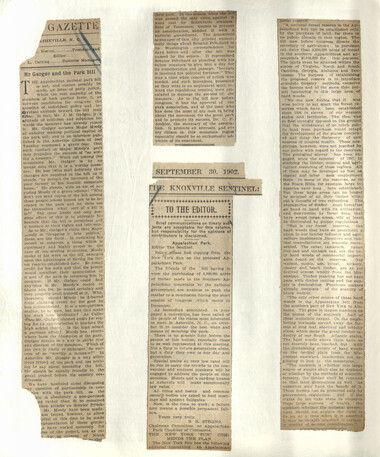
Appalachian National Park Association Newspaper Clippings, 1899-1902
NCWRA_019_02_192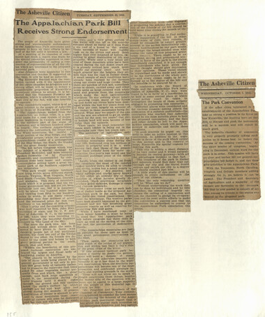
Appalachian National Park Association Newspaper Clippings, 1899-1902
NCWRA_019_02_193
Appalachian National Park Association Newspaper Clippings, 1899-1902
NCWRA_019_02_194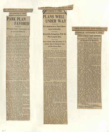
Appalachian National Park Association Newspaper Clippings, 1899-1902
NCWRA_019_02_195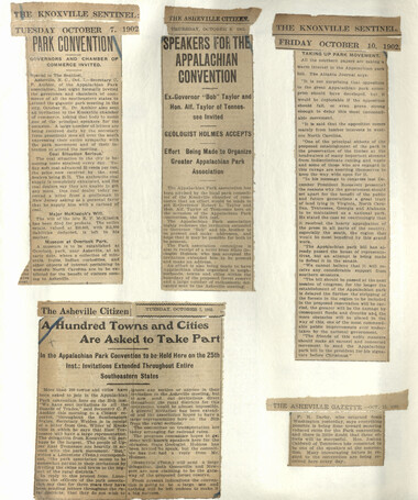
Appalachian National Park Association Newspaper Clippings, 1899-1902
NCWRA_019_02_196
Appalachian National Park Association Newspaper Clippings, 1899-1902
NCWRA_019_02_197
Appalachian National Park Association Newspaper Clippings, 1899-1902
NCWRA_019_02_198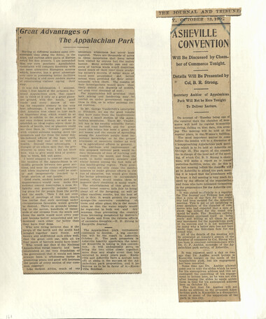
Appalachian National Park Association Newspaper Clippings, 1899-1902
NCWRA_019_02_199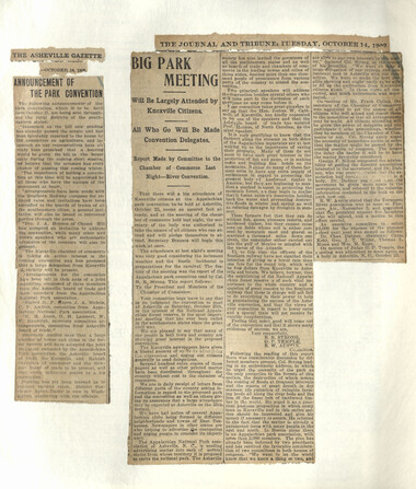
Appalachian National Park Association Newspaper Clippings, 1899-1902
NCWRA_019_02_200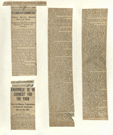
Appalachian National Park Association Newspaper Clippings, 1899-1902
NCWRA_019_02_201
Appalachian National Park Association Newspaper Clippings, 1899-1902
NCWRA_019_02_202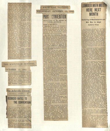
Appalachian National Park Association Newspaper Clippings, 1899-1902
NCWRA_019_02_203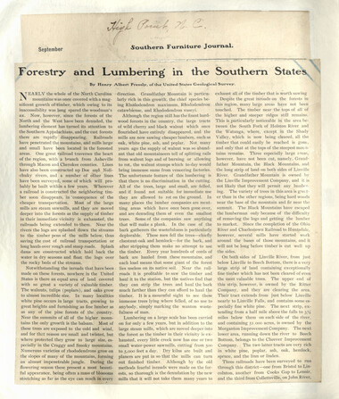
Appalachian National Park Association Newspaper Clippings, 1899-1902
NCWRA_019_02_204
Appalachian National Park Association Newspaper Clippings, 1899-1902
NCWRA_019_02_205
Appalachian National Park Association Newspaper Clippings, 1899-1902
NCWRA_019_02_206
Appalachian National Park Association Newspaper Clippings, 1899-1902
NCWRA_019_02_207
Appalachian National Park Association Newspaper Clippings, 1899-1902
NCWRA_019_02_208Item’s are ‘child’ level descriptions to ‘parent’ objects, (e.g. one page of a whole book).
-
-
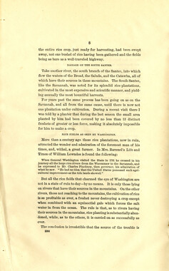
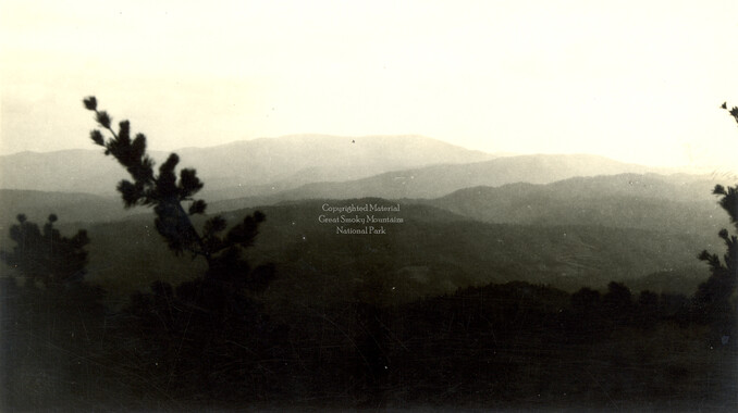
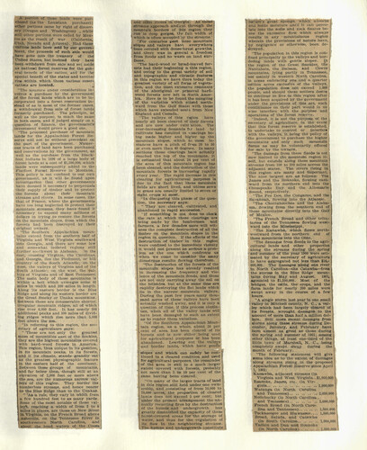
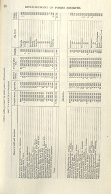
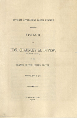
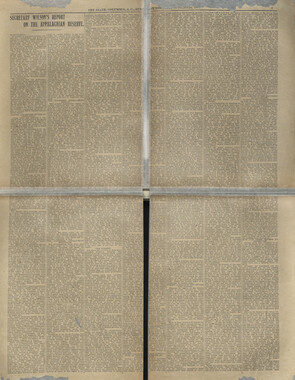
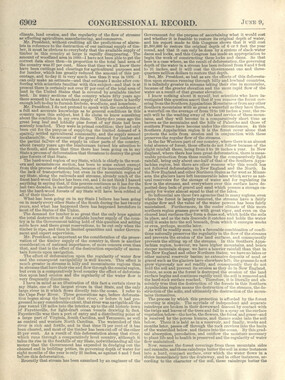
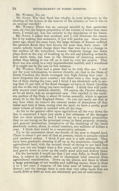
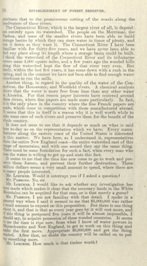
A portion of these lands were purchased (as the Louisiana purchase); other portions came by right of discovery (Oregon and Washington) , while still other portions were ceded by Mexico as the result of war (California, Utah, Nevada and Arizona). Had these ! various lands been sold by our govern- tment, the proceeds of such sale would . have gone into the treasury of the United States, but instead they have been iwithdawn from sale and set aside as national forest reserves for the general benefit of the nation, and for the special benefit of the states and territo- , ries within, which these various reservations are located. "The measure under consideration involves a purchase by the government of the forest Hands Which are to be incorporated into a forest reservation instead of as in most of the former cases, a withdrawal from sale of forest lands formerly purchased. The principle, as well as the purpose, is much the same in both cases, and if Judged simply on a question of finance, the government's investment would prove a good one. "The proposed purchase of mountain lands for the Appalachian Forest Reserve Willi not be without .precedent on the part of the government. Numerous tracts of land have been purchased and reservations by the government, as well as the purchase from the Black- toot Indians in 1896 of a large body of forest lands at a cost of $1,500,000, which lands were subsequently added to the Flatfoot Forest Reserve in Montana. This policy is not confined to 'our own government, as it will be found upon Investigation that other governments have deemed it necessary to perpetuate their supply of itimber and to iprotect •the forests about their mountain streams and rivers. In some cases, like that of France, where the governments . have too long neglected to protect their mountain streams, they have found it ' necessary to expend many millions of dollars in trying to restore the forests on the mountain slopes, from which the forests had been destroyed by their i original owners. ■"The Southern Appalachian moun- ■ i a ins extend from the southern half of Virginia and West Virginia southward into Georgia, and there are some low and somewhat isolated regions still further southwest in Alabama. On the t, crossing Virginia, the Carollnas, anil Georgia, lies the Piedmont, or hill country of the South Atlantic; on the west, the valleys ot Virginia and of the Smith Atlantic; on the west, the val- i leys of Virginia and of Blast Tennessee. The main body of these mountains is within a belt which averages some 40 miles "in width and 200 miles in length. Along 'its eastern border is the Blue Ridge and along its western border are | the Great Smoky or Unaka mountains. | Between these are innumerable shorter, ! irregular mountain ridges, all of which rise over 6,000 feet. It has nearly 300 additional peaks and 300 miles of dividing ridges which rise more than 5,000 feet above the sea. "In referring to this region, the secretary of agriculaure says: " 'These are not only the greatest mass of mountains east of the Rockies, they are the highest mountains covered with hard-wood forests in America. This region, thus unique in its position, in its mountain peaks, in its forests, and it its climate, stands grandly out as the greatest physiographic feature in the eastern half of the continent. Between these groups of mountains, and far below them, 'though still at an elevation of 2,000 feet or more above the sea, are the numerous narrow valleys of this region. They border the numberless streams, and hence nearer to the Blue Ridge than to the Unakas. " 'As a rule, they vary in iwidth from a few hundred feet to as many yards. Some of the most notable of these val- ley%, reaching a width of from 2 to i miles in places, are those on New River in Virginia, on the French Broad above Asheville, on the Tennessee River in southwestern North Carolina, and about the head waters of the Coosa j and othei rivers in Georgia'. As these streams approach and.cut through the i mountain borders of -this region they i run in deep gorges, tie full width of ' which is often occupied by the streams.' "For centuries past ihese mountain j slopes and valleys havj everywhere i been covered with dense forest growths, ; and 'there was in general a freedom < from floods and no wasU on land surfaces. "The hard-wood or bread-leaved forests had their beginning n this region, and owing to the great -variety of soil and topographic and cltnatic features in this region we have ttare today the greatest variety of all foins of vegetation, and the most extensive remnants of the aboriginal or primeval hardwood forests now left in North America. Here is to be found the mingling of the varieties which ettend northward from the Gulf State! with those which have extended sout-i from New England and Canada. 'The valleys of this r«gion have nearly all been cleared of their forests and are now under culti ution. The ever-increasing demands fir land to cultivate has resulted in cearings being made higher and higner up the 'mountain slopes, which in most instances have a pitch of ffumi 20 to 30 or even more than 40 degree*. In many • sections these clearings ha/e acBually. i reached the top of the mountains. It ' is estimated that about 24 per cent of the area of this mountain region has | been cleared, and the destruction of the ; mountain forests is increasing rapidly every year. The rapid increase in this clearing for agricultureal purposes Is due to the fact that these mountain fields are short lived, and unless sown in grass are usually limited to seven or eight crops at most. "In discussing this phase of the question, the secretary says: " 'They are cleared, cultivated, and abandoned in rapid succession.' "If something is not done >to check •the rate at 'Which these clearings are being made by the lumbermen and farmers, a few decades more 'will witness the complete destruction of all the timber on the mountain slopes in the region in question. If the effects of the destruction of timber in ithis region were confined to the immediate vicinity it would not present as serious a problem as the one which confronts us when we come to consider the many disastrous results flowing therefrom. "The d estimation of the forests of the mountain slopes has already resulted in increasing the frequency and violence of the mountain floods, and these are not only carrying away the soil on the hillsides, but at the same time are rapidly destroying the flat lands which lie in the narrow mountain valleys. During the past few years many thousand acres of these valleys have been 'actually washed away, and it is only a question of time, if this process continues, when all of the valley lands will have been damaged to such an extent as to render them valueless. "Of the Southern Appalachian Mountain -region, as a whole, about 24 per cent of area has been cleared of its forests and is now either being used for 'agricultural purposes or has been abandoned. Leaving out the valleys :i ml border lands, which have gentle slopes and which can safely ibe con- , tinued in a cleared condition and used for agricultural purposes, the remainder of the 'area is sbill to a much larger extent covered with forests, probably not more than 5 to 10 per cent of the same having been cleared.. "On many of the la.rger tracts of land In this region still held under one ownership, and consisting of from- 10,000 to 70,000 acres, the proportion of cleared j lands does not exceed 5 per cent; but under the present arrangement the annually recurring fires by the destruction of the humus and undergrowth has greatly diminished the capacity of these forest-covered areas for the storage of water, and thus for the regulation of its flow in the neighboring streams. The humus and undergrowth constitute nature's great sponge, which' absorbs and hoids moisture until it can percolate Into the soils and rock fisures below the excessive flow 'which always results in any ■ mountainous 'region wherein the provisions of nature have, by negligence or otherwise, been destroyed. "The population in this region is confined principally to the valleys and bordering lands with gentle slopes. In the region of the Great Smokies, trie Nantahala, the Balsam, and Oowee i mountains, lying partly in Tennessee, i I but mainly in western North Carolina, . j in areas embracing one and a quarter ■ million acres exclusive of the valleys, j the population does not exceed 1,000 I people, and should these settlers desire j to continue to live In this region after ! it has been acquired by the government i under the provisions of this act, such i continuance on their part would in no wise Interfere with the purpose and operations of the forest reserve. , "Indeed, it Is not the purpose of the secretary of agriculture, in the event that this forest reserve is established, i to undertake to control or interlere with the valleys, it being the policy of i I 'the government to purchase the higher j mountains and only such mountain ' farms as may be voluntarily offered I for sale by the owners. "The damage from these floods is not now limited to the mountain region itself, but extends along these mountain - streams from 100 to 200 miles across the 1 adjacent states. The rivers rising in this region are many and important. . The nine largest are as lollows: The James and the Roanoke, flowing eastward from its northern end into the , Chesapeake Bay and the Albemarle I • Sound, respectively. "The Pee Dee, the Congaree, and the , Savannah, flowing into the Atlantic. "The Chattahoochee and the Alabama, flowing from the southern end of these mountains directly into the Gulf of Mexico. "The French Broad and other tributaries of the Tennessee flowing westward into the Mississippi. "The Kanawha, which flows northwestward from the northern end of these mountains into the Ohio. "The damages from floods to the agricultural lands and other properties along the streams during the spring ' and summer of the year 1900 were estimated by the secretary of agriculture to have aggregated not less than J10,- 000,000. The damages along one river in North Carolina—the Catawbai—from the storms in the Blue Ridge mountains during May and August, 1901, agounted to $1,500,000. Most of the bridges, the mills, the crops, and the farm lands for nearly 200 miles were swept away in the course ot a few hours. "A single storm last year in one small valley in Mitchell county, N. C, a valley which had been largely cleared of Its forests, wrought damages to the amount of more than half a million dollars, still more recent damages from storms along these streams during December, January, and February have been almost as great as those during the spring and suimimer Of 1901; among other things, at least one-third of the little town of Marshall, N. C, being completely swept away during the month of February. "The following statement will give some idea as to the extent of damages along streams rising in the proposed Appalachian Forest Reserve since April 1, 1901: Kanawha, adjacent streams (in Virginia and West Virginia..$1,000,000 Roanoke, James, etc. (in Virginia 1,000,000 Watauga (in North Carolina and Tennessee) 2,000,000 Nolichucky (in North Carolina. and Tennessee) 2,000,000 French Broad (in North Carolina and Tennessee) 1,500,000 Tuckaseegee and H'iawossee 1,500,000 Broad, Saluda, and Catawba. (in South Carolina 1,000,000 Yadkin and Dan and Roanoke (in North Carolina) 1,000,000
Object’s are ‘parent’ level descriptions to ‘children’ items, (e.g. a book with pages).
-
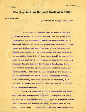
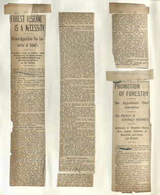
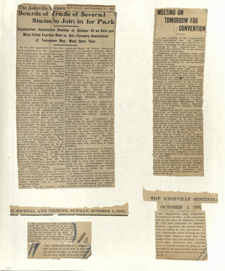
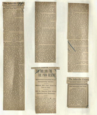
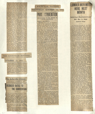
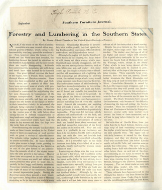
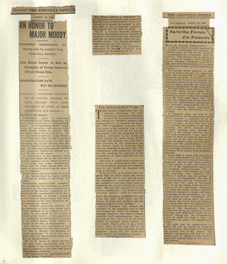
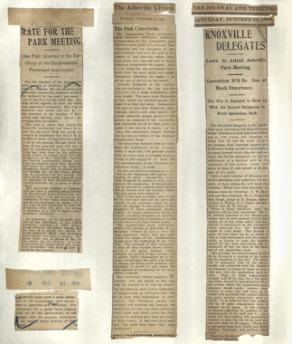
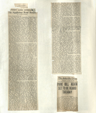
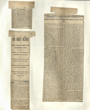
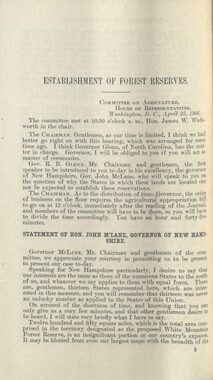
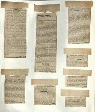
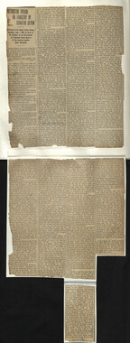
This is one of two notebooks assembled by the Appalachian National Park Association that includes documents and news clipping about the organization. The Appalachian National Park Association was formed in 1899 for the purpose of promoting the idea of a national park in the eastern U.S. Although housed in Asheville, North Carolina, the organization was a multi-state effort, attracting representatives from seven southern states. One of the highlights of the group’s activities was a convention held in 1902 to which 1,500 people attended. The association lobbied Congress for the creation of a park, but with limited success. The association disbanded in 1905.
-


Part of Collection
Great Smoky Mountains - A Park for America