- Western North Carolina Regional Maps (51)
- Canton Champion Fibre Company (0)
- Cherokee Traditions (0)
- Civil War in Southern Appalachia (0)
- Craft Revival (0)
- Great Smoky Mountains - A Park for America (0)
- Highlights from Western Carolina University (0)
- Horace Kephart (0)
- Journeys Through Jackson (0)
- LGBTQIA+ Archive of Jackson County (0)
- Oral Histories of Western North Carolina (0)
- Picturing Appalachia (0)
- Stories of Mountain Folk (0)
- Travel Western North Carolina (0)
- Western Carolina University Fine Art Museum Vitreograph Collection (0)
- Western Carolina University Herbarium (0)
- Western Carolina University: Making Memories (0)
- Western Carolina University Publications (0)
- Western Carolina University Restricted Electronic Theses and Dissertations (0)
- World War II in Southern Appalachia (0)
- Faces of Asheville (0)
- Forestry in Western North Carolina (0)
- Grove Park Inn Photograph Collection (0)
- Isaiah Rice Photograph Collection (0)
- Morse Family Chimney Rock Park Collection (0)
- Picturing Asheville and Western North Carolina (0)
- Appalachian Region, Southern (2)
- Asheville (N.C.) (2)
- Buncombe County (N.C.) (5)
- Cherokee County (N.C.) (4)
- Clay County (N.C.) (2)
- Graham County (N.C.) (3)
- Great Smoky Mountains National Park (N.C. and Tenn.) (1)
- Haywood County (N.C.) (2)
- Jackson County (N.C.) (12)
- Macon County (N.C.) (4)
- Qualla Boundary (1)
- Swain County (N.C.) (7)
- Transylvania County (N.C.) (2)
- Avery County (N.C.) (0)
- Blount County (Tenn.) (0)
- Henderson County (N.C.) (0)
- Knox County (Tenn.) (0)
- Knoxville (Tenn.) (0)
- Lake Santeetlah (N.C.) (0)
- Madison County (N.C.) (0)
- McDowell County (N.C.) (0)
- Mitchell County (N.C.) (0)
- Polk County (N.C.) (0)
- Rutherford County (N.C.) (0)
- Watauga County (N.C.) (0)
- Waynesville (N.C.) (0)
- Yancey County (N.C.) (0)
- Aerial Photographs (1)
- Facsimiles (reproductions) (1)
- Maps (documents) (51)
- Aerial Views (0)
- Albums (books) (0)
- Articles (0)
- Artifacts (object Genre) (0)
- Biography (general Genre) (0)
- Cards (information Artifacts) (0)
- Clippings (information Artifacts) (0)
- Crafts (art Genres) (0)
- Depictions (visual Works) (0)
- Design Drawings (0)
- Drawings (visual Works) (0)
- Envelopes (0)
- Fiction (general Genre) (0)
- Financial Records (0)
- Fliers (printed Matter) (0)
- Glass Plate Negatives (0)
- Guidebooks (0)
- Internegatives (0)
- Interviews (0)
- Land Surveys (0)
- Letters (correspondence) (0)
- Manuscripts (documents) (0)
- Memorandums (0)
- Minutes (administrative Records) (0)
- Negatives (photographs) (0)
- Newsletters (0)
- Newspapers (0)
- Occupation Currency (0)
- Paintings (visual Works) (0)
- Pen And Ink Drawings (0)
- Periodicals (0)
- Personal Narratives (0)
- Photographs (0)
- Plans (maps) (0)
- Poetry (0)
- Portraits (0)
- Postcards (0)
- Programs (documents) (0)
- Publications (documents) (0)
- Questionnaires (0)
- Scrapbooks (0)
- Sheet Music (0)
- Slides (photographs) (0)
- Sound Recordings (0)
- Specimens (0)
- Speeches (documents) (0)
- Text Messages (0)
- Tintypes (photographs) (0)
- Transcripts (0)
- Video Recordings (physical Artifacts) (0)
- Vitreographs (0)
- Great Smoky Mountains National Park (N.C. and Tenn.) (2)
- North Carolina -- Maps (6)
- African Americans (0)
- Appalachian Trail (0)
- Artisans (0)
- Cherokee art (0)
- Cherokee artists -- North Carolina (0)
- Cherokee language (0)
- Cherokee pottery (0)
- Cherokee women (0)
- Church buildings (0)
- Civilian Conservation Corps (U.S.) (0)
- College student newspapers and periodicals (0)
- Dams (0)
- Dance (0)
- Education (0)
- Floods (0)
- Folk music (0)
- Forced removal, 1813-1903 (0)
- Forest conservation (0)
- Forests and forestry (0)
- Gender nonconformity (0)
- Hunting (0)
- Landscape photography (0)
- Logging (0)
- Maps (0)
- Mines and mineral resources (0)
- Paper industry (0)
- Postcards (0)
- Pottery (0)
- Railroad trains (0)
- Rural electrification -- North Carolina, Western (0)
- School integration -- Southern States (0)
- Segregation -- North Carolina, Western (0)
- Slavery (0)
- Sports (0)
- Storytelling (0)
- Waterfalls -- Great Smoky Mountains (N.C. and Tenn.) (0)
- Weaving -- Appalachian Region, Southern (0)
- Wood-carving -- Appalachian Region, Southern (0)
- World War, 1939-1945 (0)
- StillImage (50)
- Text (1)
- MovingImage (0)
- Sound (0)
-
link
WCU - Western North Carolina Regional Maps
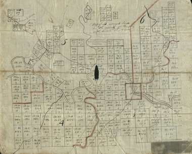
Map of old surveyed lands in the vicinity of Murphy, with district lines & roads
-
link

WCU - Western North Carolina Regional Maps
North Carolina, major railroads
-
link

WCU - Western North Carolina Regional Maps
Pine Burr Park
-
link

WCU - Western North Carolina Regional Maps
Plan for proposed white way, Franklin, N.C.
-
link
WCU - Western North Carolina Regional Maps
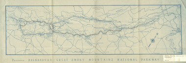
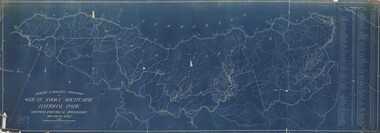
Proposed Shenandoah - Great Smoky Mountains National Parkway
-
link
WCU - Western North Carolina Regional Maps
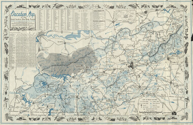
Vacation map of the Great Smokies-Blue Ridge region (1951)
-
link
WCU - Western North Carolina Regional Maps
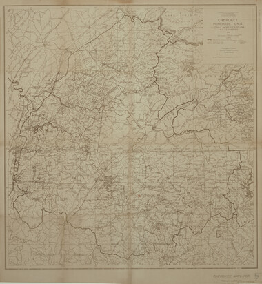
Cherokee Purchase Unit, Georgia, North Carolina and Tennessee
-
link
WCU - Western North Carolina Regional Maps
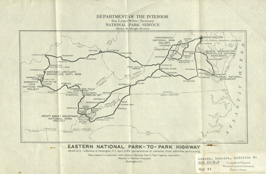
Eastern national park-to-park highway
-
link
WCU - Western North Carolina Regional Maps
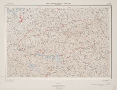
Great Smoky Mountains National Park and vicinity : Tennessee and North Carolina, 1949
-
link

WCU - Western North Carolina Regional Maps
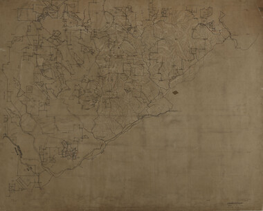
Jackson County, North Carolina : compiled from original surveys and USGS data
-
link
WCU - Western North Carolina Regional Maps
Lands of the Southern Improvement Co., Asheville, N.C.
-
link

WCU - Western North Carolina Regional Maps
Map of Swannanoa River
-
link
WCU - Western North Carolina Regional Maps
Timber lands, Mead Corporation, Sylva Division, Jackson County, N.C.
-
link
WCU - Western North Carolina Regional Maps
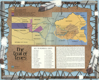
Trail of Tears
-
link
WCU - Western North Carolina Regional Maps
Adams, Westfeldt, Fontana Mine area, Swain County, N.C
-
link

WCU - Western North Carolina Regional Maps
Carolina Riteco lands, Jackson County, North Carolina
-
link
WCU - Western North Carolina Regional Maps
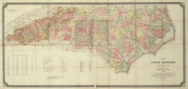
Map of North Carolina
-
link
WCU - Western North Carolina Regional Maps
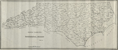
North Carolina, physiographic regions
-
link
WCU - Western North Carolina Regional Maps
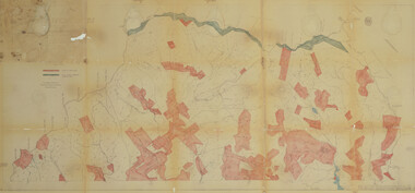
North Carolina portion of Great Smoky Mountains National Park : showing individual ownership, 228 582.48 acres
-
link
WCU - Western North Carolina Regional Maps
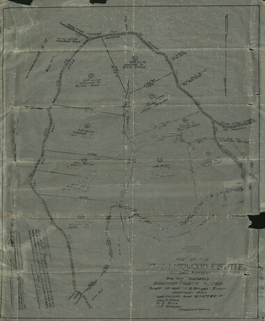
Part of the A.J. Harwood Estate on Haw Branch, Big Ivy Township, Buncombe County, North Carolina
-
link
WCU - Western North Carolina Regional Maps
Pisgah
-
link
WCU - Western North Carolina Regional Maps
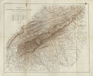
Relief map of the southern Appalachian region : showing the distribution of the mountains
-
link

WCU - Western North Carolina Regional Maps
W.H. Thomas lands
-
link

WCU - Western North Carolina Regional Maps
General plan for development of campus of Western Carolina Teachers College, Cullowhee, N.C.
-
link
WCU - Western North Carolina Regional Maps
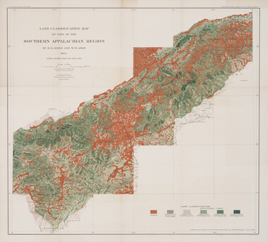
Land classification map of part of the southern Appalachian region
-
link

WCU - Western North Carolina Regional Maps
Love survey of 1820 districts: with included sections, comprising parts of Jackson, Transylvania, Swain and Macon counties
-
link
WCU - Western North Carolina Regional Maps
Nantahala National Forest, North Carolina, 1938
-
link
WCU - Western North Carolina Regional Maps
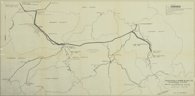
Nantahala Power and Light Co. : transmission system with portion of distribution system
-
link

WCU - Western North Carolina Regional Maps
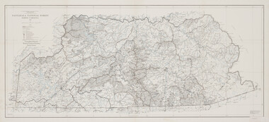
North Carolina portion of Great Smoky Mountains National Park
-
link

WCU - Western North Carolina Regional Maps
Old land surveys in Cherokee County, N.C. : map of third district