- Canton Champion Fibre Company (2308)
- Cherokee Traditions (293)
- Civil War in Southern Appalachia (165)
- Craft Revival (1942)
- Great Smoky Mountains - A Park for America (2683)
- Highlights from Western Carolina University (430)
- Horace Kephart (941)
- Journeys Through Jackson (154)
- LGBTQIA+ Archive of Jackson County (15)
- Oral Histories of Western North Carolina (314)
- Picturing Appalachia (6679)
- Stories of Mountain Folk (413)
- Travel Western North Carolina (160)
- Western Carolina University Fine Art Museum Vitreograph Collection (129)
- Western Carolina University Herbarium (92)
- Western Carolina University: Making Memories (708)
- Western Carolina University Publications (2283)
- Western Carolina University Restricted Electronic Theses and Dissertations (146)
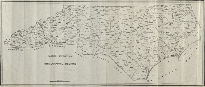
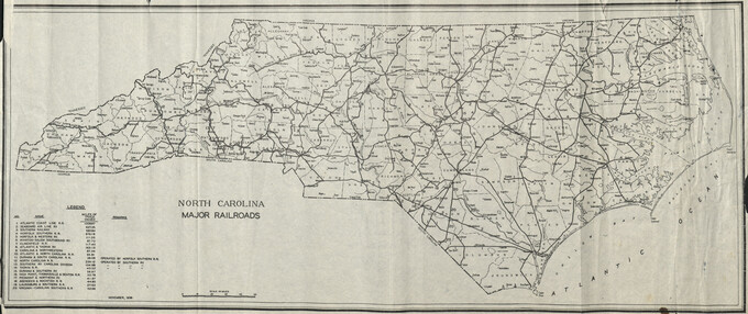
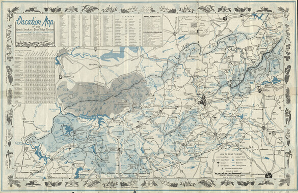
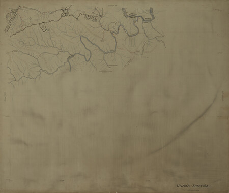
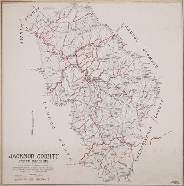
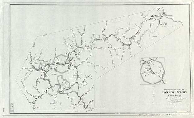
- Western North Carolina Regional Maps (71)
- World War II in Southern Appalachia (131)
- Allanstand Cottage Industries (62)
- Appalachian National Park Association (53)
- Bennett, Kelly, 1890-1974 (1295)
- Berry, Walter (76)
- Brasstown Carvers (40)
- Carver, George Washington, 1864?-1943 (26)
- Cathey, Joseph, 1803-1874 (1)
- Champion Fibre Company (233)
- Champion Paper and Fibre Company (297)
- Cherokee Indian Fair Association (16)
- Cherokee Language Program (22)
- Crowe, Amanda (40)
- Edmonston, Thomas Benton, 1842-1907 (7)
- Ensley, A. L. (Abraham Lincoln), 1865-1948 (275)
- Fromer, Irving Rhodes, 1913-1994 (70)
- George Butz (BFS 1907) (46)
- Goodrich, Frances Louisa (120)
- Grant, George Alexander, 1891-1964 (96)
- Heard, Marian Gladys (60)
- Kephart, Calvin, 1883-1969 (15)
- Kephart, Horace, 1862-1931 (313)
- Kephart, Laura, 1862-1954 (39)
- Laney, Gideon Thomas, 1889-1976 (439)
- Masa, George, 1881-1933 (61)
- McElhinney, William Julian, 1896-1953 (44)
- Niggli, Josephina, 1910-1983 (10)
- North Carolina Park Commission (105)
- Osborne, Kezia Stradley (9)
- Owens, Samuel Robert, 1918-1995 (11)
- Penland Weavers and Potters (36)
- Roberts, Vivienne (15)
- Roth, Albert, 1890-1974 (142)
- Schenck, Carl Alwin, 1868-1955 (1)
- Sherrill's Photography Studio (2565)
- Southern Highland Handicraft Guild (127)
- Southern Highlanders, Inc. (71)
- Stalcup, Jesse Bryson (46)
- Stearns, I. K. (213)
- Thompson, James Edward, 1880-1976 (226)
- United States. Indian Arts and Crafts Board (130)
- USFS (683)
- Vance, Zebulon Baird, 1830-1894 (1)
- Weaver, Zebulon, 1872-1948 (58)
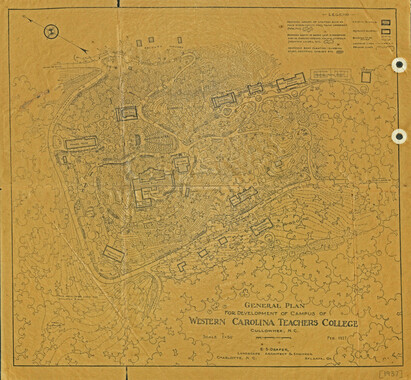
- Western Carolina College (230)
- Western Carolina Teachers College (282)
- Western Carolina University (1794)
- Western Carolina University. Mountain Heritage Center (18)
- Whitman, Walt, 1819-1892 (10)
- Wilburn, Hiram Coleman, 1880-1967 (73)
- Williams, Isadora (3)
- Cain, Doreyl Ammons (0)
- Crittenden, Lorraine (0)
- Rhodes, Judy (0)
- Smith, Edward Clark (0)
- Appalachian Region, Southern (2393)
- Asheville (N.C.) (1886)
- Avery County (N.C.) (26)
- Blount County (Tenn.) (147)
- Buncombe County (N.C.) (1664)
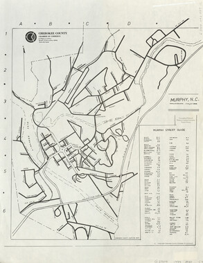
- Cherokee County (N.C.) (283)
- Clay County (N.C.) (555)
- Graham County (N.C.) (233)
- Great Smoky Mountains National Park (N.C. and Tenn.) (478)
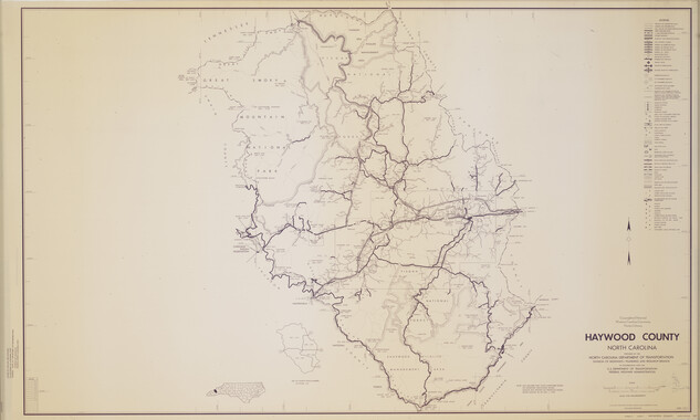
- Haywood County (N.C.) (3522)
- Henderson County (N.C.) (70)
- Jackson County (N.C.) (4692)
- Knox County (Tenn.) (21)
- Knoxville (Tenn.) (9)
- Lake Santeetlah (N.C.) (10)
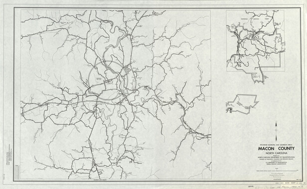
- Macon County (N.C.) (420)
- Madison County (N.C.) (211)
- McDowell County (N.C.) (39)
- Mitchell County (N.C.) (132)
- Polk County (N.C.) (35)
- Qualla Boundary (981)
- Rutherford County (N.C.) (76)
- Swain County (N.C.) (2017)
- Transylvania County (N.C.) (247)
- Watauga County (N.C.) (12)
- Waynesville (N.C.) (68)
- Yancey County (N.C.) (72)
- Aerial Photographs (3)
- Aerial Views (60)
- Albums (books) (4)
- Articles (1)
- Artifacts (object Genre) (228)
- Biography (general Genre) (2)
- Cards (information Artifacts) (38)
- Clippings (information Artifacts) (191)
- Crafts (art Genres) (622)
- Depictions (visual Works) (21)
- Design Drawings (1)
- Drawings (visual Works) (184)
- Envelopes (73)
- Facsimiles (reproductions) (1)
- Fiction (general Genre) (4)
- Financial Records (12)
- Fliers (printed Matter) (67)
- Glass Plate Negatives (381)
- Guidebooks (2)
- Internegatives (10)
- Interviews (811)
- Land Surveys (102)
- Letters (correspondence) (1013)
- Manuscripts (documents) (619)
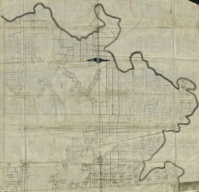
- Maps (documents) (159)
- Memorandums (25)
- Minutes (administrative Records) (59)
- Negatives (photographs) (5651)
- Newsletters (1285)
- Newspapers (2)
- Occupation Currency (1)
- Paintings (visual Works) (1)
- Pen And Ink Drawings (1)
- Periodicals (193)
- Personal Narratives (7)
- Photographs (12982)
- Plans (maps) (1)
- Poetry (5)
- Portraits (1654)
- Postcards (329)
- Programs (documents) (151)
- Publications (documents) (2237)
- Questionnaires (65)
- Scrapbooks (282)
- Sheet Music (1)
- Slides (photographs) (402)
- Sound Recordings (796)
- Specimens (92)
- Speeches (documents) (15)
- Tintypes (photographs) (8)
- Transcripts (322)
- Video Recordings (physical Artifacts) (23)
- Vitreographs (129)
- Text Messages (0)
- A.L. Ensley Collection (275)
- Appalachian Industrial School Records (7)
- Appalachian National Park Association Records (336)
- Axley-Meroney Collection (2)
- Bayard Wootten Photograph Collection (20)
- Bethel Rural Community Organization Collection (7)
- Blumer Collection (5)
- C.W. Slagle Collection (20)
- Canton Area Historical Museum (2110)
- Carlos C. Campbell Collection (198)
- Cataloochee History Project (65)
- Cherokee Studies Collection (4)
- Daisy Dame Photograph Album (5)
- Daniel Boone VI Collection (1)
- Doris Ulmann Photograph Collection (112)
- Elizabeth H. Lasley Collection (1)
- Elizabeth Woolworth Szold Fleharty Collection (4)
- Frank Fry Collection (95)
- George Masa Collection (173)
- Gideon Laney Collection (452)
- Hazel Scarborough Collection (2)
- Hiram C. Wilburn Papers (28)
- Historic Photographs Collection (236)
- Horace Kephart Collection (861)
- Humbard Collection (33)
- Hunter and Weaver Families Collection (1)
- I. D. Blumenthal Collection (4)
- Isadora Williams Collection (4)
- Jesse Bryson Stalcup Collection (47)
- Jim Thompson Collection (224)
- John B. Battle Collection (7)
- John C. Campbell Folk School Records (80)
- John Parris Collection (6)
- Judaculla Rock project (2)
- Kelly Bennett Collection (1314)
- Love Family Papers (11)
- Major Wiley Parris Civil War Letters (3)
- Map Collection (12)
- McFee-Misemer Civil War Letters (34)
- Mountain Heritage Center Collection (4)
- Norburn - Robertson - Thomson Families Collection (44)
- Pauline Hood Collection (7)
- Pre-Guild Collection (2)
- Qualla Arts and Crafts Mutual Collection (12)
- R.A. Romanes Collection (681)
- Rosser H. Taylor Collection (1)
- Samuel Robert Owens Collection (94)
- Sara Madison Collection (144)
- Sherrill Studio Photo Collection (2558)
- Smoky Mountains Hiking Club Collection (616)
- Stories of Mountain Folk - Radio Programs (374)
- The Reporter, Western Carolina University (510)
- Venoy and Elizabeth Reed Collection (16)
- WCU Gender and Sexuality Oral History Project (32)
- WCU Mountain Heritage Center Oral Histories (25)
- WCU Oral History Collection - Mountain People, Mountain Lives (71)
- WCU Students Newspapers Collection (1744)
- Western North Carolina Tomorrow Black Oral History Project (69)
- William Williams Stringfield Collection (2)
- Zebulon Weaver Collection (109)
- African Americans (388)
- Appalachian Trail (32)
- Artisans (521)
- Cherokee art (84)
- Cherokee artists -- North Carolina (10)
- Cherokee language (21)
- Cherokee pottery (101)
- Cherokee women (208)
- Church buildings (166)
- Civilian Conservation Corps (U.S.) (110)
- College student newspapers and periodicals (1830)
- Dams (94)
- Dance (1023)
- Education (222)
- Floods (60)
- Folk music (1015)
- Forced removal, 1813-1903 (2)
- Forest conservation (220)
- Forests and forestry (905)
- Gender nonconformity (4)
- Great Smoky Mountains National Park (N.C. and Tenn.) (154)
- Hunting (38)
- Landscape photography (10)
- Logging (103)
- Maps (84)
- Mines and mineral resources (8)
- North Carolina -- Maps (18)
- Paper industry (38)
- Postcards (255)
- Pottery (135)
- Railroad trains (69)
- Rural electrification -- North Carolina, Western (3)
- School integration -- Southern States (2)
- Segregation -- North Carolina, Western (5)
- Slavery (5)
- Sports (452)
- Storytelling (245)
- Waterfalls -- Great Smoky Mountains (N.C. and Tenn.) (66)
- Weaving -- Appalachian Region, Southern (280)
- Wood-carving -- Appalachian Region, Southern (328)
- World War, 1939-1945 (173)
Orthophoto map of Jackson County, North Carolina sheet 7559(13) c.3


Orthophoto map of Jackson County, North Carolina sheet 7559(14) c.2
HL_3_0470_1047243_Z
Orthophoto map of Jackson County, North Carolina sheet 7559(10) c.2
HL_3_0470_1047246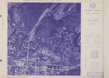
Orthophoto map of Jackson County, North Carolina sheet 7641(05) c.2
HL_3_0470_1047248_/
Orthophoto map of Jackson County, North Carolina sheet 7559(17)
HL_3_0470_1047255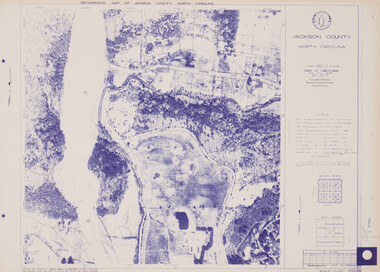
Orthophoto map of Jackson County, North Carolina sheet 7559(09) c.2
HL_3_0470_1047264
Orthophoto map of Jackson County, North Carolina sheet 7559(18)
HL_3_0470_1047267_+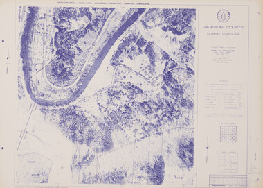
Orthophoto map of Jackson County, North Carolina sheet 7559(05)
HL_3_0470_1047276_+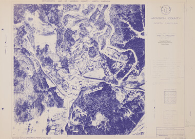
Orthophoto map of Jackson County, North Carolina sheet 7559(06)
HL_3_0470_1047288_1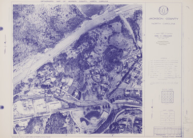
Orthophoto map of Jackson County, North Carolina sheet 7631(08)
HL_3_0470_1047291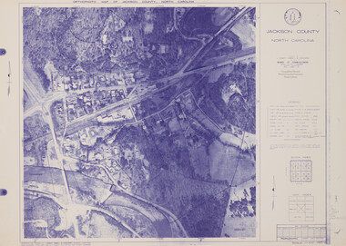
Orthophoto map of Jackson County, North Carolina sheet 7631(10)
HL_3_0470_1048922_/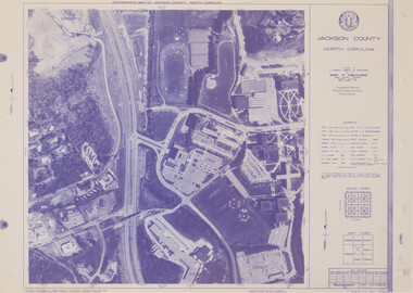
Orthophoto map of Jackson County, North Carolina sheet 7559(13) 1988
HL_3_0470_1048928_3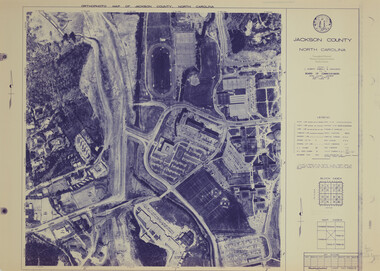
Orthophoto map of Jackson County, North Carolina sheet 7559(13) c.3
HL_3_0470_1048927_2Item’s are ‘child’ level descriptions to ‘parent’ objects, (e.g. one page of a whole book).
-
-
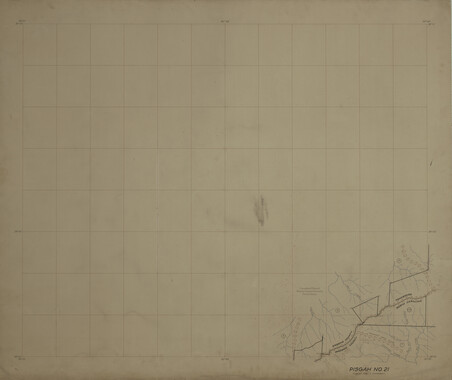
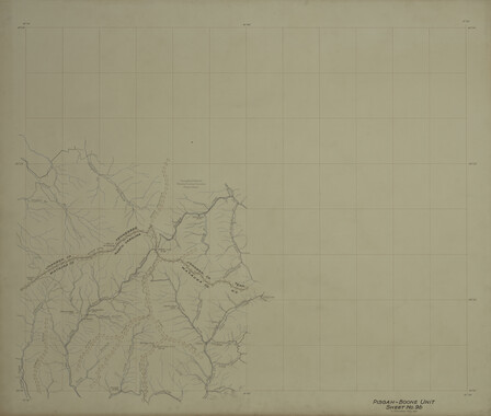
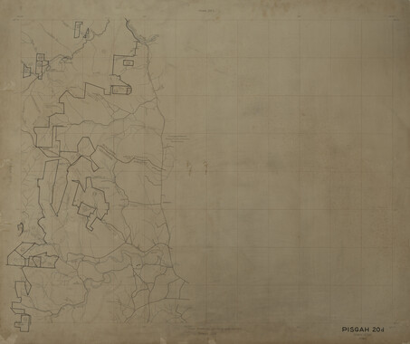
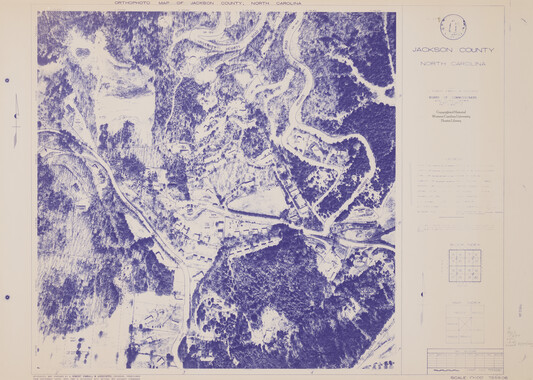
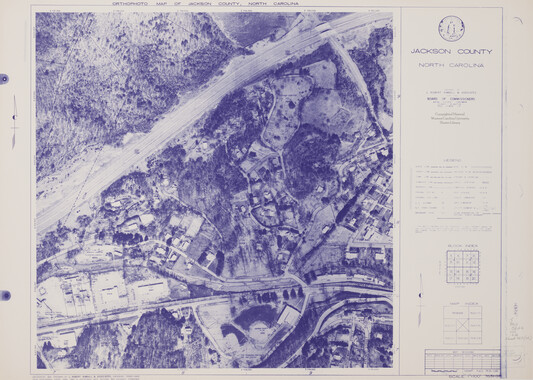
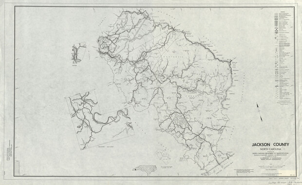
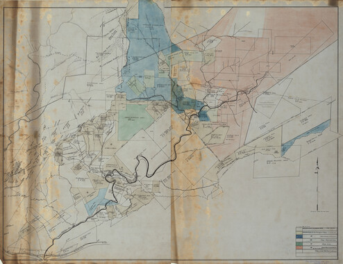
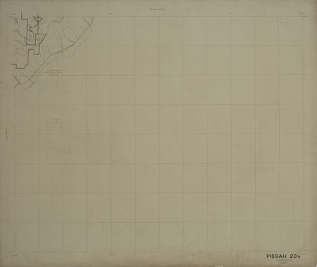
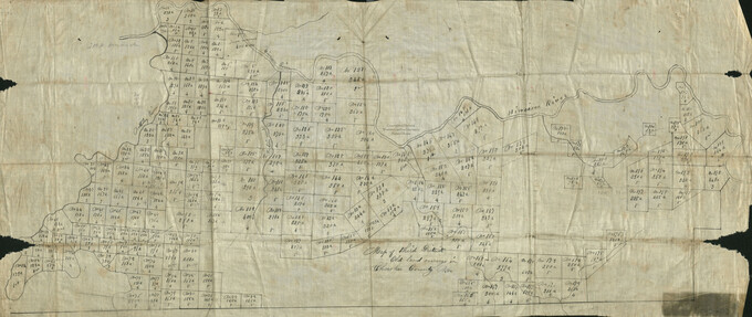
ORTHOPHOTO MAP OF JACKSON COUNTY. NORTH CAROLINA JACKSON COUNTY NORTH CAROLINA L. ROBERT KIMBALL 8 ASSOCIATES BOARD OF COMMISSIONERS Copy riglited Material Western Carolina University Hunter Library LEGEND BLOCK INDEX b 6 r\ b 9 K> i 1? 3 14 5 lb 7 £J MAP INDEX 7549(02) 7559(09) 7559(10) - X 7559(14) 7559(17) 7559(18) HBiS0 MAP N0.7559(I3) ■ SCAI F I" = 100' 7RSQ-l'F^ 0 MAP PREPARED BY L. ROBERT KIMBALL & ASSOCIATES, EBENSBURG, PEI
Object’s are ‘parent’ level descriptions to ‘children’ items, (e.g. a book with pages).
-
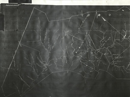
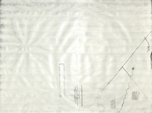
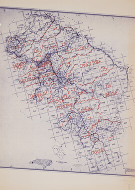
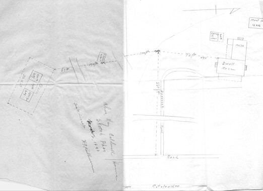
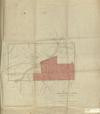
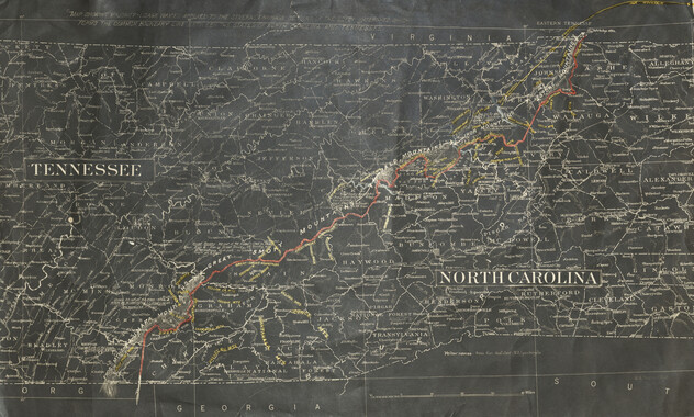
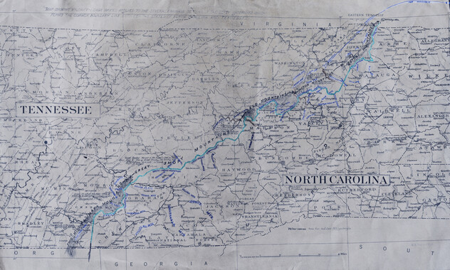
Each sheet includes block index and map index diagrams, also shows parcel identifiers, computed acreage, and deed acreage. "Orthophoto map prepared by L. Robert Kimball & Associates, Ebensburg, Pennsylvania, from photography dated April, 1980 in accordance with national map accuracy standards." Statement on a small number of maps: "Orthophoto map prepared by L. Robert Kimball & Associates, Ebensburg, Pennsylvania, from photography dated March & April, 1988 in accordance with national map accuracy standards." "The map is prepared for the inventory of real property based on the utilization of deeds, plats, and/or supportive data. The county and the company assume no legal responsibility for information delineated hereon." The Special Collection copy of the Index map shows in red ink the names and numbers, and the borders of the townships.
-


Part of Collection
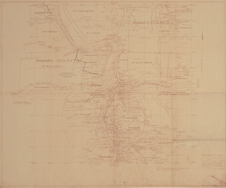
Western North Carolina Regional Maps