- Canton Champion Fibre Company (2308)
- Cherokee Traditions (293)
- Civil War in Southern Appalachia (165)
- Craft Revival (1942)
- Great Smoky Mountains - A Park for America (2683)
- Highlights from Western Carolina University (430)
- Horace Kephart (941)
- Journeys Through Jackson (154)
- LGBTQIA+ Archive of Jackson County (15)
- Oral Histories of Western North Carolina (314)
- Picturing Appalachia (6679)
- Stories of Mountain Folk (413)
- Travel Western North Carolina (160)
- Western Carolina University Fine Art Museum Vitreograph Collection (129)
- Western Carolina University Herbarium (92)
- Western Carolina University: Making Memories (708)
- Western Carolina University Publications (2283)
- Western Carolina University Restricted Electronic Theses and Dissertations (146)
- Western North Carolina Regional Maps (71)
- World War II in Southern Appalachia (131)
- Appalachian National Park Association (53)
- Berry, Walter (76)
- Champion Fibre Company (5)
- Fromer, Irving Rhodes, 1913-1994 (70)
- Grant, George Alexander, 1891-1964 (96)
- Kephart, Horace, 1862-1931 (23)
- Masa, George, 1881-1933 (17)
- North Carolina Park Commission (105)
- Roth, Albert, 1890-1974 (142)
- Schenck, Carl Alwin, 1868-1955 (1)
- Stearns, I. K. (2)
- Thompson, James Edward, 1880-1976 (45)
- Weaver, Zebulon, 1872-1948 (55)
- Wilburn, Hiram Coleman, 1880-1967 (72)
- Allanstand Cottage Industries (0)
- Bennett, Kelly, 1890-1974 (0)
- Brasstown Carvers (0)
- Cain, Doreyl Ammons (0)
- Carver, George Washington, 1864?-1943 (0)
- Cathey, Joseph, 1803-1874 (0)
- Champion Paper and Fibre Company (0)
- Cherokee Indian Fair Association (0)
- Cherokee Language Program (0)
- Crittenden, Lorraine (0)
- Crowe, Amanda (0)
- Edmonston, Thomas Benton, 1842-1907 (0)
- Ensley, A. L. (Abraham Lincoln), 1865-1948 (0)
- George Butz (BFS 1907) (0)
- Goodrich, Frances Louisa (0)
- Heard, Marian Gladys (0)
- Kephart, Calvin, 1883-1969 (0)
- Kephart, Laura, 1862-1954 (0)
- Laney, Gideon Thomas, 1889-1976 (0)
- McElhinney, William Julian, 1896-1953 (0)
- Niggli, Josephina, 1910-1983 (0)
- Osborne, Kezia Stradley (0)
- Owens, Samuel Robert, 1918-1995 (0)
- Penland Weavers and Potters (0)
- Rhodes, Judy (0)
- Roberts, Vivienne (0)
- Sherrill's Photography Studio (0)
- Smith, Edward Clark (0)
- Southern Highland Handicraft Guild (0)
- Southern Highlanders, Inc. (0)
- Stalcup, Jesse Bryson (0)
- United States. Indian Arts and Crafts Board (0)
- USFS (0)
- Vance, Zebulon Baird, 1830-1894 (0)
- Western Carolina College (0)
- Western Carolina Teachers College (0)
- Western Carolina University (0)
- Western Carolina University. Mountain Heritage Center (0)
- Whitman, Walt, 1819-1892 (0)
- Williams, Isadora (0)
- 1810s (1)
- 1840s (1)
- 1850s (2)
- 1860s (3)
- 1870s (4)
- 1880s (7)
- 1890s (64)
- 1900s (294)
- 1910s (227)
- 1920s (461)
- 1930s (1501)
- 1940s (82)
- 1950s (15)
- 1960s (13)
- 1970s (47)
- 1980s (14)
- 1990s (17)
- 2000s (31)
- 2010s (1)
- 1600s (0)
- 1700s (0)
- 1800s (0)
- 1820s (0)
- 1830s (0)
- 2020s (0)
- Appalachian Region, Southern (80)
- Asheville (N.C.) (1)
- Avery County (N.C.) (6)
- Blount County (Tenn.) (145)
- Buncombe County (N.C.) (204)
- Cherokee County (N.C.) (10)
- Clay County (N.C.) (3)
- Graham County (N.C.) (108)
- Great Smoky Mountains National Park (N.C. and Tenn.) (416)
- Haywood County (N.C.) (263)
- Henderson County (N.C.) (13)
- Jackson County (N.C.) (58)
- Knox County (Tenn.) (17)
- Knoxville (Tenn.) (8)
- Lake Santeetlah (N.C.) (10)
- Macon County (N.C.) (25)
- Madison County (N.C.) (14)
- McDowell County (N.C.) (5)
- Mitchell County (N.C.) (7)
- Polk County (N.C.) (2)
- Qualla Boundary (22)
- Rutherford County (N.C.) (16)
- Swain County (N.C.) (513)
- Transylvania County (N.C.) (36)
- Watauga County (N.C.) (2)
- Waynesville (N.C.) (2)
- Yancey County (N.C.) (34)
- Aerial Views (3)
- Articles (1)
- Artifacts (object Genre) (4)
- Clippings (information Artifacts) (77)
- Drawings (visual Works) (174)
- Envelopes (2)
- Financial Records (9)
- Fliers (printed Matter) (34)
- Guidebooks (1)
- Interviews (11)
- Land Surveys (102)
- Letters (correspondence) (219)
- Manuscripts (documents) (91)
- Maps (documents) (69)
- Memorandums (14)
- Minutes (administrative Records) (20)
- Negatives (photographs) (198)
- Newsletters (12)
- Paintings (visual Works) (1)
- Pen And Ink Drawings (1)
- Photographs (1657)
- Portraits (36)
- Postcards (15)
- Publications (documents) (107)
- Scrapbooks (3)
- Sound Recordings (7)
- Speeches (documents) (11)
- Transcripts (46)
- Aerial Photographs (0)
- Albums (books) (0)
- Biography (general Genre) (0)
- Cards (information Artifacts) (0)
- Crafts (art Genres) (0)
- Depictions (visual Works) (0)
- Design Drawings (0)
- Facsimiles (reproductions) (0)
- Fiction (general Genre) (0)
- Glass Plate Negatives (0)
- Internegatives (0)
- Newspapers (0)
- Occupation Currency (0)
- Periodicals (0)
- Personal Narratives (0)
- Plans (maps) (0)
- Poetry (0)
- Programs (documents) (0)
- Questionnaires (0)
- Sheet Music (0)
- Slides (photographs) (0)
- Specimens (0)
- Text Messages (0)
- Tintypes (photographs) (0)
- Video Recordings (physical Artifacts) (0)
- Vitreographs (0)
- Appalachian National Park Association Records (336)
- Carlos C. Campbell Collection (198)
- Cataloochee History Project (65)
- George Masa Collection (89)
- Hiram C. Wilburn Papers (28)
- Historic Photographs Collection (236)
- Horace Kephart Collection (126)
- Humbard Collection (33)
- Jim Thompson Collection (44)
- Love Family Papers (11)
- Map Collection (12)
- R.A. Romanes Collection (10)
- Smoky Mountains Hiking Club Collection (616)
- Zebulon Weaver Collection (107)
- A.L. Ensley Collection (0)
- Appalachian Industrial School Records (0)
- Axley-Meroney Collection (0)
- Bayard Wootten Photograph Collection (0)
- Bethel Rural Community Organization Collection (0)
- Blumer Collection (0)
- C.W. Slagle Collection (0)
- Canton Area Historical Museum (0)
- Cherokee Studies Collection (0)
- Daisy Dame Photograph Album (0)
- Daniel Boone VI Collection (0)
- Doris Ulmann Photograph Collection (0)
- Elizabeth H. Lasley Collection (0)
- Elizabeth Woolworth Szold Fleharty Collection (0)
- Frank Fry Collection (0)
- Gideon Laney Collection (0)
- Hazel Scarborough Collection (0)
- Hunter and Weaver Families Collection (0)
- I. D. Blumenthal Collection (0)
- Isadora Williams Collection (0)
- Jesse Bryson Stalcup Collection (0)
- John B. Battle Collection (0)
- John C. Campbell Folk School Records (0)
- John Parris Collection (0)
- Judaculla Rock project (0)
- Kelly Bennett Collection (0)
- Major Wiley Parris Civil War Letters (0)
- McFee-Misemer Civil War Letters (0)
- Mountain Heritage Center Collection (0)
- Norburn - Robertson - Thomson Families Collection (0)
- Pauline Hood Collection (0)
- Pre-Guild Collection (0)
- Qualla Arts and Crafts Mutual Collection (0)
- Rosser H. Taylor Collection (0)
- Samuel Robert Owens Collection (0)
- Sara Madison Collection (0)
- Sherrill Studio Photo Collection (0)
- Stories of Mountain Folk - Radio Programs (0)
- The Reporter, Western Carolina University (0)
- Venoy and Elizabeth Reed Collection (0)
- WCU Gender and Sexuality Oral History Project (0)
- WCU Mountain Heritage Center Oral Histories (0)
- WCU Oral History Collection - Mountain People, Mountain Lives (0)
- WCU Students Newspapers Collection (0)
- Western North Carolina Tomorrow Black Oral History Project (0)
- William Williams Stringfield Collection (0)
- Appalachian Trail (19)
- Church buildings (9)
- Civilian Conservation Corps (U.S.) (91)
- Dams (20)
- Floods (1)
- Forest conservation (11)
- Forests and forestry (42)
- Great Smoky Mountains National Park (N.C. and Tenn.) (64)
- Hunting (2)
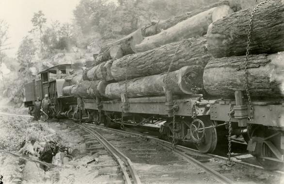
- Logging (25)
- Maps (74)
- North Carolina -- Maps (5)
- Postcards (15)
- Railroad trains (8)
- Sports (4)
- Storytelling (2)
- Waterfalls -- Great Smoky Mountains (N.C. and Tenn.) (39)
- African Americans (0)
- Artisans (0)
- Cherokee art (0)
- Cherokee artists -- North Carolina (0)
- Cherokee language (0)
- Cherokee pottery (0)
- Cherokee women (0)
- College student newspapers and periodicals (0)
- Dance (0)
- Education (0)
- Folk music (0)
- Forced removal, 1813-1903 (0)
- Gender nonconformity (0)
- Landscape photography (0)
- Mines and mineral resources (0)
- Paper industry (0)
- Pottery (0)
- Rural electrification -- North Carolina, Western (0)
- School integration -- Southern States (0)
- Segregation -- North Carolina, Western (0)
- Slavery (0)
- Weaving -- Appalachian Region, Southern (0)
- Wood-carving -- Appalachian Region, Southern (0)
- World War, 1939-1945 (0)
- Sound (7)
- StillImage (2088)
- Text (655)
- MovingImage (0)
Handbook/ 1932/ Smoky Mountains Hiking Club

Handbook/ 1932/ Smoky Mountains Hiking Club
GSMNP_13150_53_03_1139_00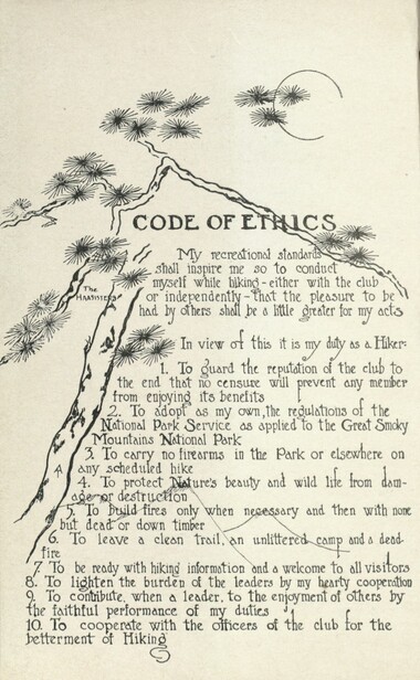
Handbook/ 1932/ Smoky Mountains Hiking Club
GSMNP_13150_53_03_1139_00_a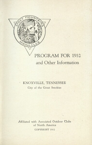
Handbook/ 1932/ Smoky Mountains Hiking Club
GSMNP_13150_53_03_1139_01
Handbook/ 1932/ Smoky Mountains Hiking Club
GSMNP_13150_53_03_1139_02
Handbook/ 1932/ Smoky Mountains Hiking Club
GSMNP_13150_53_03_1139_03
Handbook/ 1932/ Smoky Mountains Hiking Club
GSMNP_13150_53_03_1139_03_a
Handbook/ 1932/ Smoky Mountains Hiking Club
GSMNP_13150_53_03_1139_04
Handbook/ 1932/ Smoky Mountains Hiking Club
GSMNP_13150_53_03_1139_04_a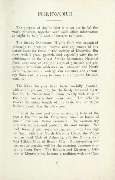
Handbook/ 1932/ Smoky Mountains Hiking Club
GSMNP_13150_53_03_1139_05
Handbook/ 1932/ Smoky Mountains Hiking Club
GSMNP_13150_53_03_1139_06
Handbook/ 1932/ Smoky Mountains Hiking Club
GSMNP_13150_53_03_1139_07
Handbook/ 1932/ Smoky Mountains Hiking Club
GSMNP_13150_53_03_1139_08
Handbook/ 1932/ Smoky Mountains Hiking Club
GSMNP_13150_53_03_1139_11
Handbook/ 1932/ Smoky Mountains Hiking Club
GSMNP_13150_53_03_1139_12
Handbook/ 1932/ Smoky Mountains Hiking Club
GSMNP_13150_53_03_1139_13
Handbook/ 1932/ Smoky Mountains Hiking Club
GSMNP_13150_53_03_1139_14
Handbook/ 1932/ Smoky Mountains Hiking Club
GSMNP_13150_53_03_1139_15
Handbook/ 1932/ Smoky Mountains Hiking Club
GSMNP_13150_53_03_1139_16
Handbook/ 1932/ Smoky Mountains Hiking Club
GSMNP_13150_53_03_1139_16_a
Handbook/ 1932/ Smoky Mountains Hiking Club
GSMNP_13150_53_03_1139_16_b
Handbook/ 1932/ Smoky Mountains Hiking Club
GSMNP_13150_53_03_1139_17
Handbook/ 1932/ Smoky Mountains Hiking Club
GSMNP_13150_53_03_1139_18
Handbook/ 1932/ Smoky Mountains Hiking Club
GSMNP_13150_53_03_1139_19
Handbook/ 1932/ Smoky Mountains Hiking Club
GSMNP_13150_53_03_1139_20
Handbook/ 1932/ Smoky Mountains Hiking Club
GSMNP_13150_53_03_1139_21
Handbook/ 1932/ Smoky Mountains Hiking Club
GSMNP_13150_53_03_1139_22
Handbook/ 1932/ Smoky Mountains Hiking Club
GSMNP_13150_53_03_1139_22_a
Handbook/ 1932/ Smoky Mountains Hiking Club
GSMNP_13150_53_03_1139_22_b
Handbook/ 1932/ Smoky Mountains Hiking Club
GSMNP_13150_53_03_1139_23
Handbook/ 1932/ Smoky Mountains Hiking Club
GSMNP_13150_53_03_1139_24
Handbook/ 1932/ Smoky Mountains Hiking Club
GSMNP_13150_53_03_1139_25
Handbook/ 1932/ Smoky Mountains Hiking Club
GSMNP_13150_53_03_1139_26
Handbook/ 1932/ Smoky Mountains Hiking Club
GSMNP_13150_53_03_1139_27
Handbook/ 1932/ Smoky Mountains Hiking Club
GSMNP_13150_53_03_1139_28
Handbook/ 1932/ Smoky Mountains Hiking Club
GSMNP_13150_53_03_1139_29
Handbook/ 1932/ Smoky Mountains Hiking Club
GSMNP_13150_53_03_1139_30
Handbook/ 1932/ Smoky Mountains Hiking Club
GSMNP_13150_53_03_1139_31
Handbook/ 1932/ Smoky Mountains Hiking Club
GSMNP_13150_53_03_1139_32
Handbook/ 1932/ Smoky Mountains Hiking Club
GSMNP_13150_53_03_1139_32_a
Handbook/ 1932/ Smoky Mountains Hiking Club
GSMNP_13150_53_03_1139_32_b
Handbook/ 1932/ Smoky Mountains Hiking Club
GSMNP_13150_53_03_1139_33
Handbook/ 1932/ Smoky Mountains Hiking Club
GSMNP_13150_53_03_1139_34
Handbook/ 1932/ Smoky Mountains Hiking Club
GSMNP_13150_53_03_1139_35
Handbook/ 1932/ Smoky Mountains Hiking Club
GSMNP_13150_53_03_1139_36
Handbook/ 1932/ Smoky Mountains Hiking Club
GSMNP_13150_53_03_1139_36_a
Handbook/ 1932/ Smoky Mountains Hiking Club
GSMNP_13150_53_03_1139_36_b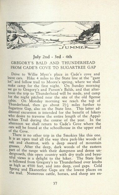
Handbook/ 1932/ Smoky Mountains Hiking Club
GSMNP_13150_53_03_1139_37
Handbook/ 1932/ Smoky Mountains Hiking Club
GSMNP_13150_53_03_1139_38
Handbook/ 1932/ Smoky Mountains Hiking Club
GSMNP_13150_53_03_1139_39
Handbook/ 1932/ Smoky Mountains Hiking Club
GSMNP_13150_53_03_1139_40
Handbook/ 1932/ Smoky Mountains Hiking Club
GSMNP_13150_53_03_1139_40_a
Handbook/ 1932/ Smoky Mountains Hiking Club
GSMNP_13150_53_03_1139_40_b
Handbook/ 1932/ Smoky Mountains Hiking Club
GSMNP_13150_53_03_1139_41
Handbook/ 1932/ Smoky Mountains Hiking Club
GSMNP_13150_53_03_1139_42
Handbook/ 1932/ Smoky Mountains Hiking Club
GSMNP_13150_53_03_1139_43
Handbook/ 1932/ Smoky Mountains Hiking Club
GSMNP_13150_53_03_1139_44
Handbook/ 1932/ Smoky Mountains Hiking Club
GSMNP_13150_53_03_1139_45
Handbook/ 1932/ Smoky Mountains Hiking Club
GSMNP_13150_53_03_1139_46
Handbook/ 1932/ Smoky Mountains Hiking Club
GSMNP_13150_53_03_1139_47
Handbook/ 1932/ Smoky Mountains Hiking Club
GSMNP_13150_53_03_1139_48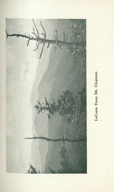
Handbook/ 1932/ Smoky Mountains Hiking Club
GSMNP_13150_53_03_1139_48_a
Handbook/ 1932/ Smoky Mountains Hiking Club
GSMNP_13150_53_03_1139_48_b
Handbook/ 1932/ Smoky Mountains Hiking Club
GSMNP_13150_53_03_1139_49
Handbook/ 1932/ Smoky Mountains Hiking Club
GSMNP_13150_53_03_1139_50
Handbook/ 1932/ Smoky Mountains Hiking Club
GSMNP_13150_53_03_1139_51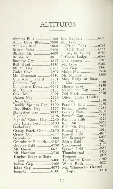
Handbook/ 1932/ Smoky Mountains Hiking Club
GSMNP_13150_53_03_1139_52
Handbook/ 1932/ Smoky Mountains Hiking Club
GSMNP_13150_53_03_1139_52_a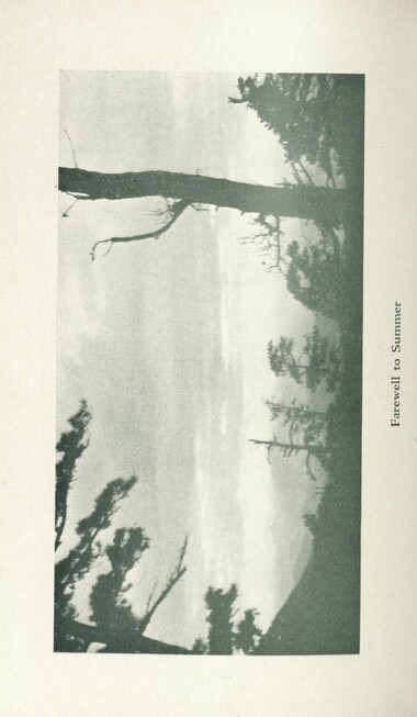
Handbook/ 1932/ Smoky Mountains Hiking Club
GSMNP_13150_53_03_1139_52_b
Handbook/ 1932/ Smoky Mountains Hiking Club
GSMNP_13150_53_03_1139_53
Handbook/ 1932/ Smoky Mountains Hiking Club
GSMNP_13150_53_03_1139_54
Handbook/ 1932/ Smoky Mountains Hiking Club
GSMNP_13150_53_03_1139_55
Handbook/ 1932/ Smoky Mountains Hiking Club
GSMNP_13150_53_03_1139_56
Handbook/ 1932/ Smoky Mountains Hiking Club
GSMNP_13150_53_03_1139_57
Handbook/ 1932/ Smoky Mountains Hiking Club
GSMNP_13150_53_03_1139_58
Handbook/ 1932/ Smoky Mountains Hiking Club
GSMNP_13150_53_03_1139_59
Handbook/ 1932/ Smoky Mountains Hiking Club
GSMNP_13150_53_03_1139_60
Handbook/ 1932/ Smoky Mountains Hiking Club
GSMNP_13150_53_03_1139_61
Handbook/ 1932/ Smoky Mountains Hiking Club
GSMNP_13150_53_03_1139_62
Handbook/ 1932/ Smoky Mountains Hiking Club
GSMNP_13150_53_03_1139_63
Handbook/ 1932/ Smoky Mountains Hiking Club
GSMNP_13150_53_03_1139_64
Handbook/ 1932/ Smoky Mountains Hiking Club
GSMNP_13150_53_03_1139_65
Handbook/ 1932/ Smoky Mountains Hiking Club
GSMNP_13150_53_03_1139_66
Handbook/ 1932/ Smoky Mountains Hiking Club
GSMNP_13150_53_03_1139_67
Handbook/ 1932/ Smoky Mountains Hiking Club
GSMNP_13150_53_03_1139_68
Handbook/ 1932/ Smoky Mountains Hiking Club
GSMNP_13150_53_03_1139_69_a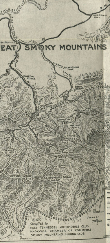
Handbook/ 1932/ Smoky Mountains Hiking Club
GSMNP_13150_53_03_1139_69_b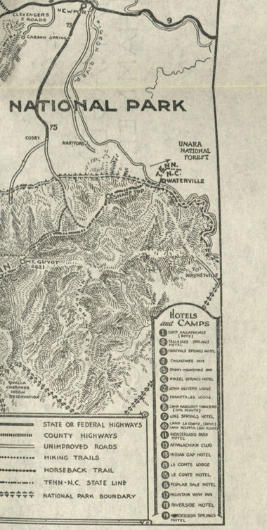
Handbook/ 1932/ Smoky Mountains Hiking Club
GSMNP_13150_53_03_1139_69_c
Handbook/ 1932/ Smoky Mountains Hiking Club
GSMNP_13150_53_03_1139_70Item’s are ‘child’ level descriptions to ‘parent’ objects, (e.g. one page of a whole book).
-
-
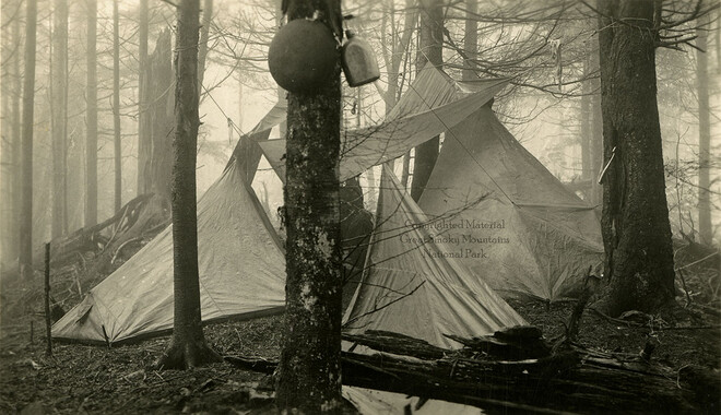
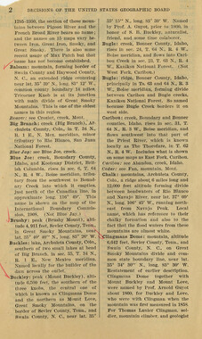
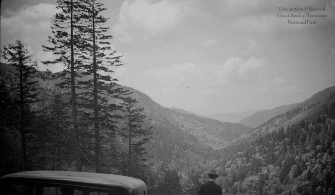
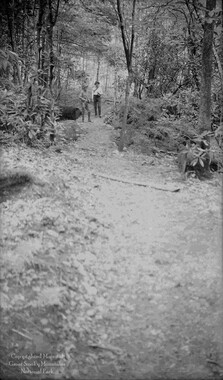
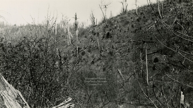
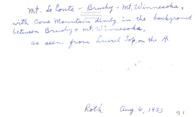
of an already fine hike. Leave Dixie System at 8 A. M. and drive to New Found Gap. Take candle-lantern, canteen and food for one meal. Round trip hiking distance 6.8 miles. Trail smooth and relatively easy. Elevation about 6200 feet. Leaders: GEORGE HACKMAN (5-8189) MARGUERITE PRESTON (2-8846) // May 1st BRUSHY MOUNTAIN FROM GREENBRIER To many of us May is the loveliest month in the Smokies, with the wild flowers in bloom, the new green or the forests, and the balmy air—a delightful time for hiking, so on May Day we climb the picturesque "Brcshy" Mountain (4911 feet). Our route takes us thru Sevierville and along the beautiful East Prong of the Little Pigeon River to Pittman Center. Here is located a community school, sponsored by the Methodist Church, where weaving, basketry and other mountain industries are taught. This point is also the end of our rock road, and we go about 8 miles over a mountain road thru Greenbrier Cove to MesserY Cabin (2230 ft.) where the trail up Brushy begins. Messer's Cabin is very well built with huge beams, tight floors and walls—an excellent camping site, on the end of a cleared Spur. Take a look here at pinnacle Mountain and Saw Tooth Range before going up the steep side of Brushy. The trail is open most of the way and there are splendid views all along. The top of the mountain is now covered with laurel, huckleberries, and small shrubs, tho it was once well timbered with big trees, but has been cut over and burned. The humus was so thick here that the glow of the fire could be seen by the mountaineers for many days. When we top out we can sec all three peaks of LeConte to the south east. To the north west is Round Top (4316 ft.), originally 26
Object’s are ‘parent’ level descriptions to ‘children’ items, (e.g. a book with pages).
-
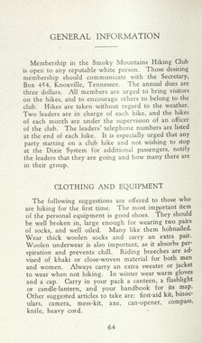
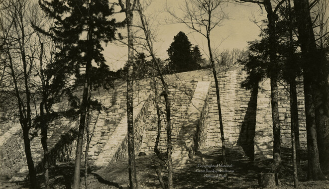
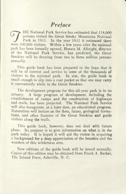
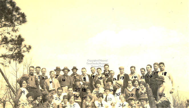
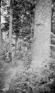
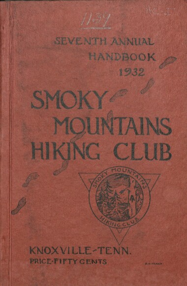
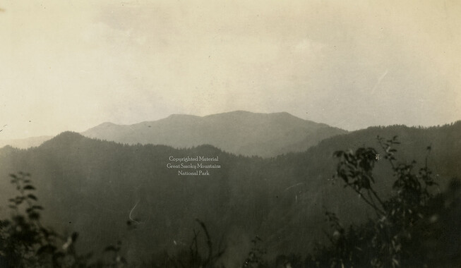
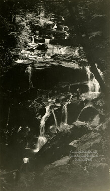
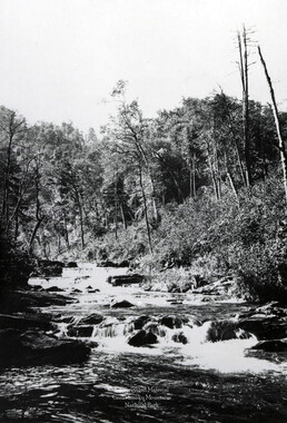
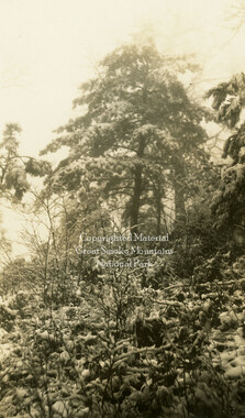
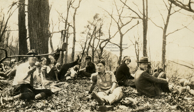
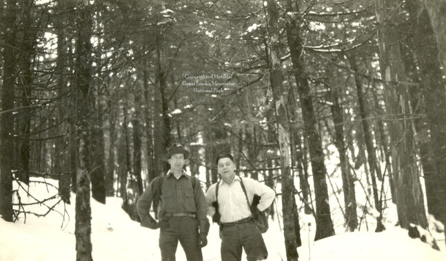
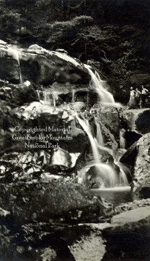
In 1926, the Smoky Mountains Hiking Club began to print an annual handbook that outlined scheduled hikes for each month of the year, including winter. This 1932 handbook was collected by George Masa (1881-1933), a photographer active in the Appalachian Trail Club and in the movement to establish the Great Smoky Mountains National Park. The Smoky Mountains Hiking Club was formed after a group of outdoor enthusiasts hiked up to Mount LeConte in October 1924. Enjoying the spectacular views, the group returned to establish a formal hiking club to sponsor regularly-scheduled hikes into the Great Smoky Mountains.
-


Part of Collection
Great Smoky Mountains - A Park for America