Western Carolina University (20)
View all
- Canton Champion Fibre Company (2308)
- Cherokee Traditions (293)
- Civil War in Southern Appalachia (165)
- Craft Revival (1942)
- Great Smoky Mountains - A Park for America (2683)
- Highlights from Western Carolina University (430)
- Horace Kephart (941)
- Journeys Through Jackson (154)
- LGBTQIA+ Archive of Jackson County (15)
- Oral Histories of Western North Carolina (314)
- Picturing Appalachia (6679)
- Stories of Mountain Folk (413)
- Travel Western North Carolina (160)
- Western Carolina University Fine Art Museum Vitreograph Collection (129)
- Western Carolina University Herbarium (92)
- Western Carolina University: Making Memories (708)
- Western Carolina University Publications (2283)
- Western Carolina University Restricted Electronic Theses and Dissertations (146)
- Western North Carolina Regional Maps (71)
- World War II in Southern Appalachia (131)
University of North Carolina Asheville (6)
View all
- Appalachian National Park Association (53)
- Berry, Walter (76)
- Champion Fibre Company (5)
- Fromer, Irving Rhodes, 1913-1994 (70)
- Grant, George Alexander, 1891-1964 (96)
- Kephart, Horace, 1862-1931 (23)
- Masa, George, 1881-1933 (17)
- North Carolina Park Commission (105)
- Roth, Albert, 1890-1974 (142)
- Schenck, Carl Alwin, 1868-1955 (1)
- Stearns, I. K. (2)
- Thompson, James Edward, 1880-1976 (45)
- Weaver, Zebulon, 1872-1948 (55)
- Wilburn, Hiram Coleman, 1880-1967 (72)
- Allanstand Cottage Industries (0)
- Bennett, Kelly, 1890-1974 (0)
- Brasstown Carvers (0)
- Cain, Doreyl Ammons (0)
- Carver, George Washington, 1864?-1943 (0)
- Cathey, Joseph, 1803-1874 (0)
- Champion Paper and Fibre Company (0)
- Cherokee Indian Fair Association (0)
- Cherokee Language Program (0)
- Crittenden, Lorraine (0)
- Crowe, Amanda (0)
- Edmonston, Thomas Benton, 1842-1907 (0)
- Ensley, A. L. (Abraham Lincoln), 1865-1948 (0)
- George Butz (BFS 1907) (0)
- Goodrich, Frances Louisa (0)
- Heard, Marian Gladys (0)
- Kephart, Calvin, 1883-1969 (0)
- Kephart, Laura, 1862-1954 (0)
- Laney, Gideon Thomas, 1889-1976 (0)
- McElhinney, William Julian, 1896-1953 (0)
- Niggli, Josephina, 1910-1983 (0)
- Osborne, Kezia Stradley (0)
- Owens, Samuel Robert, 1918-1995 (0)
- Penland Weavers and Potters (0)
- Rhodes, Judy (0)
- Roberts, Vivienne (0)
- Sherrill's Photography Studio (0)
- Smith, Edward Clark (0)
- Southern Highland Handicraft Guild (0)
- Southern Highlanders, Inc. (0)
- Stalcup, Jesse Bryson (0)
- United States. Indian Arts and Crafts Board (0)
- USFS (0)
- Vance, Zebulon Baird, 1830-1894 (0)
- Western Carolina College (0)
- Western Carolina Teachers College (0)
- Western Carolina University (0)
- Western Carolina University. Mountain Heritage Center (0)
- Whitman, Walt, 1819-1892 (0)
- Williams, Isadora (0)
- 1810s (1)
- 1840s (1)
- 1850s (2)
- 1860s (3)
- 1870s (4)
- 1880s (7)
- 1890s (64)
- 1900s (294)
- 1910s (227)
- 1920s (461)
- 1930s (1501)
- 1940s (82)
- 1950s (15)
- 1960s (13)
- 1970s (47)
- 1980s (14)
- 1990s (17)
- 2000s (31)
- 2010s (1)
- 1600s (0)
- 1700s (0)
- 1800s (0)
- 1820s (0)
- 1830s (0)
- 2020s (0)
- Appalachian Region, Southern (80)
- Asheville (N.C.) (1)
- Avery County (N.C.) (6)
- Blount County (Tenn.) (145)
- Buncombe County (N.C.) (204)
- Cherokee County (N.C.) (10)
- Clay County (N.C.) (3)
- Graham County (N.C.) (108)
- Great Smoky Mountains National Park (N.C. and Tenn.) (416)
- Haywood County (N.C.) (263)
- Henderson County (N.C.) (13)
- Jackson County (N.C.) (58)
- Knox County (Tenn.) (17)
- Knoxville (Tenn.) (8)
- Lake Santeetlah (N.C.) (10)
- Macon County (N.C.) (25)
- Madison County (N.C.) (14)
- McDowell County (N.C.) (5)
- Mitchell County (N.C.) (7)
- Polk County (N.C.) (2)
- Qualla Boundary (22)
- Rutherford County (N.C.) (16)
- Swain County (N.C.) (513)
- Transylvania County (N.C.) (36)
- Watauga County (N.C.) (2)
- Waynesville (N.C.) (2)
- Yancey County (N.C.) (34)
- Aerial Views (3)
- Articles (1)
- Artifacts (object Genre) (4)
- Clippings (information Artifacts) (77)
- Drawings (visual Works) (174)
- Envelopes (2)
- Financial Records (9)
- Fliers (printed Matter) (34)
- Guidebooks (1)
- Interviews (11)
- Land Surveys (102)
- Letters (correspondence) (219)
- Manuscripts (documents) (91)
- Maps (documents) (69)
- Memorandums (14)
- Minutes (administrative Records) (20)
- Negatives (photographs) (198)
- Newsletters (12)
- Paintings (visual Works) (1)
- Pen And Ink Drawings (1)
- Photographs (1657)
- Portraits (36)
- Postcards (15)
- Publications (documents) (107)
- Scrapbooks (3)
- Sound Recordings (7)
- Speeches (documents) (11)
- Transcripts (46)
- Aerial Photographs (0)
- Albums (books) (0)
- Biography (general Genre) (0)
- Cards (information Artifacts) (0)
- Crafts (art Genres) (0)
- Depictions (visual Works) (0)
- Design Drawings (0)
- Facsimiles (reproductions) (0)
- Fiction (general Genre) (0)
- Glass Plate Negatives (0)
- Internegatives (0)
- Newspapers (0)
- Occupation Currency (0)
- Periodicals (0)
- Personal Narratives (0)
- Plans (maps) (0)
- Poetry (0)
- Programs (documents) (0)
- Questionnaires (0)
- Sheet Music (0)
- Slides (photographs) (0)
- Specimens (0)
- Text Messages (0)
- Tintypes (photographs) (0)
- Video Recordings (physical Artifacts) (0)
- Vitreographs (0)
- Appalachian National Park Association Records (336)
- Carlos C. Campbell Collection (198)
- Cataloochee History Project (65)
- George Masa Collection (89)
- Hiram C. Wilburn Papers (28)
- Historic Photographs Collection (236)
- Horace Kephart Collection (126)
- Humbard Collection (33)
- Jim Thompson Collection (44)
- Love Family Papers (11)
- Map Collection (12)
- R.A. Romanes Collection (10)
- Smoky Mountains Hiking Club Collection (616)
- Zebulon Weaver Collection (107)
- A.L. Ensley Collection (0)
- Appalachian Industrial School Records (0)
- Axley-Meroney Collection (0)
- Bayard Wootten Photograph Collection (0)
- Bethel Rural Community Organization Collection (0)
- Blumer Collection (0)
- C.W. Slagle Collection (0)
- Canton Area Historical Museum (0)
- Cherokee Studies Collection (0)
- Daisy Dame Photograph Album (0)
- Daniel Boone VI Collection (0)
- Doris Ulmann Photograph Collection (0)
- Elizabeth H. Lasley Collection (0)
- Elizabeth Woolworth Szold Fleharty Collection (0)
- Frank Fry Collection (0)
- Gideon Laney Collection (0)
- Hazel Scarborough Collection (0)
- Hunter and Weaver Families Collection (0)
- I. D. Blumenthal Collection (0)
- Isadora Williams Collection (0)
- Jesse Bryson Stalcup Collection (0)
- John B. Battle Collection (0)
- John C. Campbell Folk School Records (0)
- John Parris Collection (0)
- Judaculla Rock project (0)
- Kelly Bennett Collection (0)
- Major Wiley Parris Civil War Letters (0)
- McFee-Misemer Civil War Letters (0)
- Mountain Heritage Center Collection (0)
- Norburn - Robertson - Thomson Families Collection (0)
- Pauline Hood Collection (0)
- Pre-Guild Collection (0)
- Qualla Arts and Crafts Mutual Collection (0)
- Rosser H. Taylor Collection (0)
- Samuel Robert Owens Collection (0)
- Sara Madison Collection (0)
- Sherrill Studio Photo Collection (0)
- Stories of Mountain Folk - Radio Programs (0)
- The Reporter, Western Carolina University (0)
- Venoy and Elizabeth Reed Collection (0)
- WCU Gender and Sexuality Oral History Project (0)
- WCU Mountain Heritage Center Oral Histories (0)
- WCU Oral History Collection - Mountain People, Mountain Lives (0)
- WCU Students Newspapers Collection (0)
- Western North Carolina Tomorrow Black Oral History Project (0)
- William Williams Stringfield Collection (0)
- Appalachian Trail (19)
- Church buildings (9)
- Civilian Conservation Corps (U.S.) (91)
- Dams (20)
- Floods (1)
- Forest conservation (11)
- Forests and forestry (42)
- Great Smoky Mountains National Park (N.C. and Tenn.) (64)
- Hunting (2)
- Logging (25)
- Maps (74)
- North Carolina -- Maps (5)
- Postcards (15)
- Railroad trains (8)
- Sports (4)
- Storytelling (2)
- Waterfalls -- Great Smoky Mountains (N.C. and Tenn.) (39)
- African Americans (0)
- Artisans (0)
- Cherokee art (0)
- Cherokee artists -- North Carolina (0)
- Cherokee language (0)
- Cherokee pottery (0)
- Cherokee women (0)
- College student newspapers and periodicals (0)
- Dance (0)
- Education (0)
- Folk music (0)
- Forced removal, 1813-1903 (0)
- Gender nonconformity (0)
- Landscape photography (0)
- Mines and mineral resources (0)
- Paper industry (0)
- Pottery (0)
- Rural electrification -- North Carolina, Western (0)
- School integration -- Southern States (0)
- Segregation -- North Carolina, Western (0)
- Slavery (0)
- Weaving -- Appalachian Region, Southern (0)
- Wood-carving -- Appalachian Region, Southern (0)
- World War, 1939-1945 (0)
- Sound (7)
- StillImage (2088)
- Text (655)
- MovingImage (0)
Cataloochee tract 299: D. J. Boyd

Cataloochee tract 299: D. J. Boyd
GSMNP_Cata-299
Item
Item’s are ‘child’ level descriptions to ‘parent’ objects, (e.g. one page of a whole book).
-
-
\ \ \ \ SMOKY MTN PARK D.J. BOYD THACT /J/.84 ACHES St:ALC 1''::20 CHA/N.S 8 $VIt'I"£Y ~r /.,Ztl 41" #'VoN S~O,;<fN' --\ ' \ '--.___/ Page ............... 2.8.8. .. NORTH CAROLINA PARK COMMISSION ABSTRACT OF TITLE of Lands of ........................................... .......... .D .•. :J. ...... ll.QYd .......................................................................................................................... . .......................................................................... ..... ............ Township ·························uaywoo·d···································· County. STATE OF NORTH CAROLINA DESCRIPTION Tract (299 ) :~:JL: ; l-ll :~~.nr1t\{:n 1 ·~ ~i1ln tlO:~»~~~-:·irJt i on wa·1~ ~tUned fl.. ..... :b'':. t:to t!.~~ r~r1"~1£m 8.-!'4 t:.U tU Dtt.nooa are ~Jtpi:ussod itt 011!! 1:'!1 .-::;;: ~-~Q f +lOt • .l.ytnr~ j~:Jt <Y ••. rt of t ~·;n l!Ji v1d¢ ~. at-.1100:1 .Johr.ta:tll.an C:Nek <:t..d t:,[f,tul.~;oo...,•.:>O Cm ol:, and 0""-:ot ik'~$ lmown as ·tne Uong• J.r.,zul tr~ot , L.::.L¥1:~1 ':;vtmts! rrq; c . Cou~:n:;• ~ 10 wlJ..o',l 'tt; ~(Jl.~JO.r G af' ·tro ..... moraat tur.::l:tw Co., !'I"e.et {!'; C), e.\ r~·i"" ct:. o~:rm1ut w1 ~ I;;.;• .- ~ ii':o and. a tne5oos, c"!l c. i:lwb _;:;ot-.11 of tho :ut .:.loool..Je :~.::ed , blazed ~4 &~riboo ~; -)! ~; J:..ur.'Jt:>or Co. at a roil Cor:1 .... r 4 , w:t.icll :1,s cor~ 1"' Vi tho .::Ju.ncruat Lumt"'()r c.;:; •. '21-UO~G (200), l\ pl ..... "'oo ntonO ~ith \1i$. tn&f:H:l&G 1 besUe a w1 ro ron~o on a r l~t w;nXlti l."' 1%--e; 1~0l~lQr 5 , w:·r· elk ! Clv:i:'UitA,, ll b£ tl:te cn:m:ero:st Lumtor Co. t·~eu ( 2U) 1, a, rYJint nt ~!H,lt 1nt~r;Jou t1oo w1 tb the top o'f tl10 £l1 v :!do bot oon Ct.,t.ul o ·l:.-eo CrcOlt nnt Wh1 te Oak C~-ok ., · ~ v ·---\ e.OI 2.06 .n. .. so ' 4.84 ·"" u.m s.lO s • 80-99 E. A Point s. e•u E. A i'Oint a. 83-66 :&. A Poin't s. 80•13 J;. A P.:,iut $ . &1."115 z. A Point rt. (18~ L A 3\ln. a. 132•11 3. A Potat ,,. ..; ., 66·-ot I. Ocm• e, eta 1• nl.GQ eo..- & 01t ~· SUOJMt LuabOJ' co. ·!fl'aft taoo}, a 30" obea'hm• w11k alb . -· ....... f)!\· til• &1"fte b~ OetalbOctllllt o.tt4 mute oa1: C~ks, blaMd aa4 to#lbd Bt:1i 'lllOO.CGt l&artq 'ba It 44e s. 221V w. The plaoo (If b-'tm1DEh etO'l~ 131.&1 ao~U. . 289 ' / . ANALYSIS ,OF TITLE TRACT NO. 299 l; Tract No• 299 18 llOW owned by n: :r. Boyd and ia 290 a portion or State Grant l\!o~ 252~ As we have ab"eady treated state Grant No• 252 trom the ttme aa1d Grant was issued by the State to John Gray Blount up and throUgh the tlme said Grant passed by the will Qf James R• Love to his executors, the saino will not be repeated herein• but may be seen by reference to the analysis ot title of the Sidney Nelson tra.ct beginning with paragraph one, and ending W1 th paragl-aph ten of said anatyats, pago tlu"ee of t his abstract. We have been unable to find from the records, a conveyance trom James R.- Love, his executors, or either t~stee, appointed by the coua.-t, ooliV"Gying to anyone traot 1-To. 2~ 9. We presume that e1 th.er a bond or a deed to t his tract waes made by .some one in authority tor the Love eatate. and that the same was never filed tor record. 3. The firs.t traoEJ we have been able to find of traot No .. 299 is tn a deed from IUenor c • .Howell et al, being all the hetrs of Wi .lliam Ferguson,. to w.. J. G. B~ Boyd.. see affidavit on pa~29t':t of thl$ abstract. The first twc> ~~ots in t his deed e• braoe traot No. 299, This deed ts dUly reoorded in }!aywood county. see page §9ii of this abatraot. 4. · Thereafter, w. ;r. G. ,B,, Boyd died intestate• never having disposed of Traot No .. 299 .• 291 On November 29, 1913, the heirs at law of w.J.c.B.· Boyd1 deceased, riled a petition with the Clerk of the superior court for partition of the lands belonging to the estate or w.·J.G.B. Boyd, deceased. In this petition, and the SUlJJmOns issued, we notice that the wi 'Ves of J. H; Boyd, D. L. Boyd, R. \h A.; Love, J. R. Boyd, :rr • 1 n. ·'1'• Boyd, w. R • .Boyd and D; 1. Boyd were not made parties. Since. in said petition, the heirs petitioned either for a division of said estate, or tor a sale of' same, we are or the opinion that the wives or the above named parties e.re ·necessary and essential parties to said proceeding. This petition is duly recorded in the office cr the Clerk Of the su• perior Court for Haywood County. See page 295 of this abstract. e. On Decem'ber 30 1 1913, a judgment was. signed in the above named partition proceedings, and the oourt having . found as a raot that an actual partition of said estate would be detrimental to the parties, and that a sale ot said estate would be advantageotr.S to all parties concerned, John H. Boyd and Robert T. Boyd were appointed comm1as1oners by the court to sell all the lands belonging to the estate or w. J. o. B, Boyd, deooasedt and were to make sales either publically or privately; but in all cases were to report any and all sales so made by them to the oourt for confirmation.. This judgment is duly recorded in the office ot the Clerk of the Superior Court for Haywood County. See page 502 · ot this abstract. 7. on Oo tober 301 19211 R• T. Boyd, colm111ss1oner, CJc;»nveyed to D. J. Boyd two tracts of land whioh two tracts embrace the lanl ·> . 3f• ·~~·.· under investigation. n. T, Boyd lOOkes this deed as commissioner, appointed by the court to dispose of the estate of w.r.G.B. Boyd,decease4. u This deed os. tes. tha1 a report waLJ filed by said commissioner in aeoordenee w1 tb the ~dgxnent e1sne4 in said ca••• The sale to-n. 1. Boyd was duly oontirtned by th$ Olerk ·of the superior court,. see page ~015 . ot t his abstract •. The above deed is d1~l7 recor~ecl in F...a :ywood Countr~ See page 304 ot this abstract, a. As we are depending absolu1$ly u:ptm possession1 292 to"~: tt tle to tract No, ~99 1 we have obtained affidavits to the et:tect that D• J, B.ord and thoae Ullder whom he claims, have been in the open, · continuous adverse posses~d.on or said lan.d.s1 un.der known and V1aibl.e metes and bomtdt, tor a pe:r1o4 ot thirtr years and mor9• said atr1• dav1 te mar ·~ t;Jeen bf refetence to page, i'97 through ~10 ot this abstract., ~h surveyor'e affidavit on .this tract may be aeen by retereuoe to page No. 311- ot 1his abstract• L EJ.enor o" Howel.l Fannie E. Howell and husband, Nelson Howell ') ·' p Page-. ........... ..G;,.S .r.-1 .... . w. B. FergN~lillil(t:AROLINA PARK COMMISSION L;; H. Fergison .a. M. Fergison G. s. Fergison (;!nd wife s. F, Fergison AB~TRACT OF DEED OR GRANT John Lw 'Fergison and wife As Signed As Acknowledged "'-Thoznas M. tei'gison ani wife I l5 Barbra T. Fergison do ~ Mary A. Moore · c .Joseph Moore t w.a. .:ze. Re•e ve.es e sband, 1· 1: Lewellyn C" Reeves husband, ~ J'runes Reeves OL---------~~----------~-------------------------~----------------------- 1. W !~~ qt 16~nv!3y'ilc4... .................. D~.e.d ..... .. 2. Date of Conveyance ..... ....... '7.:008~92. ........................ .. 3. Is it properly executed ..................... .......... ..... .................. . 5. Before what Officer acknowledged ........ .. .. J .tti' ......... . 4. Date of Entry and No ...... .... ............... . ....... .. .................. . G. Acknowledgments, r egular ..... .. ..... Yes ......................... . 7. If irregular, copy in full on b a ck.~c, ............................... .. 8. Did all grantors acknowledge .................................... .. .. !!. Date of acknowledgment.. .... .V.azilous ...... . 10. Was privy examination of wife t aken ... ........ ........... .. 11. Did officer affix SeaL ................... .. ................. .............. .. 12. Was order of probate correct.. .............. Ye.S ............ .. 13. Does conveyance contain convenants- 14. Date of filing for record ...... ...... 7:-:-J...3.~. ~3 ............. . (a) of seizin .................... .Yes ....... . 15. Book ......... ......... 4. ... . .. .... Page ....... 461 ...... .. (b) power to convey ...... .... ..... Yes... .. ................... . f or ... . .. ... J:la;y-:Y'IfOOQ.. .. ........ County. (c) against encumbrances ................. Ye.S ...................... .. l G. Does deed contain any special limitations, provisions . (d) against ch ims of all others ...... .... ... .Ye.S ............. .. or restrictions ........................ ......... ............. ............ ......... .. 17. Habendum clause (Quote fully) ........ T.OJI!'~v:E .. . AND ... TOilOI,D ·tJ1ea.f..orosa.1d.traat .... or ........... .. ......... ;parce~ ... of ... land ... a nd ... all ... p.r.ivi.leges ... !?.nd ... app.ttrtena.no.es .... t llereto .... be~ . ......... ing. ..t o. ... t he .... s.B.id. ..w : .......r •....G . ..... n• ... Bo.yd., ....h i.s ..h eirs. ..a nd ... ass.i.gns.,. .... to. .. .their. ..... .. ..... only ... use ... and ... h.eh oof ... forever . ............................................................................................................................... . Exact Descri ptio n of Property First Tract. Lying on t he waters of Ca t aloocha creek, and ·t'he turn "p"fke road - BEGDTI-TING at a chestnut on top of a knob West of turnpike road, and runs . South ?2 F~ast crossing said 1, road 100 poles to t v-tO dogwoods in a hollow near gap o.f ridge; l. thence North 20 East 160 poles to a chestnutoe.k bush; then North ?2 West 100 poles to a dogwood on the side of a ridge; thence south 20 West 160 poles to the beginning. Second 'l)"aet. BEGI NNI NG at o. chestnutoak, the third corner of the first tract, and running North 20 East 64 poles to a bunch of lynna on t he East side of a mo~~tain at a cliff of rocks; t hence North ?2 w. est 125 poles to a stake!' thence .sou.th 20 West 64 poles to a hickory bush on top of a r dge• thence south ?2 East and passing a corner of the first tract and with the line of the same, 125 poles to t he beginning, containing fifty acres, more or less, Third Tract. ON THE HE.AD WATERS OF STEPHENS CREEK, A BRAUCH OF PIGEON RI VER - BEGINNING: on a large chestnut near a small branch, and runs East 90 poles to a small be·eo·h~-:: ; thence North 90 poles to a small sourwood; thence West 90 poles to a stake Gmd from there to the beginning, containing 50 acres• more or less . Sheet B / STATE OF NORTH CAROLINA, HAYWOOD COUNTY. 293•A drs, If TC«Ir/w~l!. being duly sworn, deposes and says: Thatlhe is Z 4 years of age anr 'bas been a citizen and resident or Haylrood County for 2-:7- years; that he waswell acquainted with Willt,am Ferguson during his lifetime and that Elenor c. Howell, Fannie E. Howell and husband, Nelson Rowell, w. B. Ferguson and wite, L. H. Ferguson, A. r.1. Ferguson, G. s. Fe~ guson and wite, s. F. Ferguson, John L. Ferguson and wife Emma A •. Ferguson, Thomas M. FergUson and ~re, Barbra T. Ferguson, Mary A. Moore, JosepJ1 Moore,. Ra.ohel J. Reeves and husband, w. z. Reeves, Lewellyn c. Reeves and husband, James Reeves, are the only heirs at law ot William Ferguson, ?~ sworn to and subscribed before me this = day of January, 1930. My Connnission Expires, May 27, 1931. ~· aa14 traota ot lancl. 4eecen4.._ to Laura F. Fersnaon ~rom her tather1 .1. 1. Fl:rguaon. and ••• bequeathed to hll' tather's brothers aDA a1•t•r• • and the land• are known aa the Hannah plaoe · oa the mol:Ulta1n e.n4 susu CoYe on the head or Stephena oreek. · 294 \ · ·r:· Page __ ----- ----2.!}_5 _ _ NORTH CAROLINA PARK COMMISSION JUDICIAL PROCEEDINGS 1. Proceedings in all courts affecting the title of the lands abstracted must be set forth and attached hereto in chronological ,order, and in such detail as will show all jurisdictional facts averred in the proceedings, proper parties, sufficient service to bring all necessary parties into court, all orders and decrees up to and including confirmation of sale. 2. \Nhen minors, insane persons or any other per ~ons for whom a guardian ad litem, committee and such like are required to be appointed, are interested, the appointment and acceptance must be shown ; it must appear th at all statutory requirements have been complied with. Give names of all plaintiffs and defendants. :r .n._ Boyd, n.L. Boyd, Charlo te _ 1. Bo:vd Hampton, R. Ch A. Love, .R. Boyd, :rr. • Fannie Welch, wi f o:rz. J. c. Wlch, Lou c. J\f.oody, wi o~t Ct M • . Moody, R.,vsT• Boyd, W. R. Boyd and D. J • BOyd vs CourL--Sup$1!1~-- ---- County - ---Haywo&d----Kind of action_-P--et!-ti--on--f-o-r- -Partiti-en-- - --Date of filing- - - --NE>Vember - -89-.- -l-91-5-- - --------- PROCEEDINGS Maggie E. Marshall, wife of Harry Marshall The plaintiffs, :r. H. Boyd, D. t. Boyd, Charlotte Hampton, wife of D. c. Hampton, R.G.A• IJove, :r. R, Boyd, Jr., Fannie Welch wife of J'. c. Welch, Lou c. Moody wife of s. M, Moody, R. 'l't _ Boyd, w. R.- Boyd and D. J. Boyd by their Attorneys Ferguson and Silver oODr" plain and allege, . First: That the said pla.intiffs above ·nmned together with the defendant, '.Miggie E• Marshall; wife _ ot rrarrr Marshall~ are se1ze4 an4 pos~essed of all the lots, pieces and ·paroels or tracts ot land aituate4 1n the County· of Haywood and state of North Carolina, as tenants in OOlJt"" mon• sa14- lots, pieces, parcels or tract$ of land are ~re particularly desot-1 b~d as tol.l.ows: (All tracts not located v1ithtn the Park fl.r~a are omitted trom this proceeding) Tract No. 5. Being the twenty-f~J;st tract ot Speculation Land. BEGINNING: _ At a sugar maple corner . of tract No. 20 1 and runs North M West crossing Big branch 30 poles to a mountain oakJ thence north 27 East 64 poles to e. spruce at the edge or a laurelf thence North 30 East 110 poles to a stake; thence south 70 poles to a stake; thence south 70 west to the beginning - containing 50 acres. ~act No. 6. Being the twenty-second tract of the Speculation Land. BEGINNING: At a small white oak on the North boundary line of . No. 21, on the East side ot Big b~aneh 1 and runs North 20 East 90 poles to a su_g_e.r mapl_ e_. on the West side or the branohi• thence Nort_ h 70 Eas_t 58 poles to a stake; thence South 20 West 90 po -es to a stake: thexa,oe with tract No, 21, south 70 West to th6 begtnn!ng, containing 25 aor••• All cases and authorities relied upon to cure any defects in this instrument or proceedings thereon or to support any proposition of law must be cited, and short excerpts made therefrom. Sheet F / .;,· Tract No. 27. Being part of Speculation Landt BEGINNING at a stake 2 poles East of the Caldwell Fork where it runs into Cataloochee creek and runs up the creek south 78 West 82 poles to a stake in the bed of' a creek; thence South 10 West 213 poles to a stakei• thence North 78 East e2 poles to a stake; thence North 10 East 2 3 poles to the beginning, containing 100 acres. Traot No. 30. On the waters of Cataloochee. Two Tracts. First Traot. BEGINNtNG on a spanish oak on the point of the ridge above the turn• pike road and running south 70 East crossing said road 72 poles to a white oak on top of said ridge; thenoe North 23 East crossing said road 112 poles to a stake; thence North 20 West 70 poles to a atakea thence south 23 West 112 poles to the beginning, containing 50 aorea. 296 second Tract. BEGINNING on e. stake• the southeast corner or a. H• Pen• liirid' s 55"-~ · acre tract • and then running. North 12 west w1 th Penland line 64 poles to a chestnut Penland's corner; thence North 78 East with said Penland's line 16 poles to a birch in sa1 d line; thence North 12 West 46· poles to a stake; thence west crossing the Caldwell Fork 64 poles to a stake; thence North '78 poles to a stake; thence south 12--79 poles to a stake; thence East crossing said oreek 64 poles to a stake; thence North 12 West 15 poles to the beginning• containing 50 acres. Tract No. 35. Tract or land lying on the head of Laurel branch. BEGINNING at a rock on top or the between the Couchey cove and the head of Laurel brano:V and adjoins one or the Belle Hannah tracts and runs North 21 East 80 poles to a stake in the edge of' a field; thence North 50 East 101 poles and 7 links toa spruoe pine on the North bank of Laurel branch; thenoe North Sf>i West 69 . poles to a stake· on the North side or the mountain between Laurel branoh and stephen creek; thence south 40 West 227 poles to a white oak on top or cove oreek mountain• it being the corner or William Hannah's 50 acre tract; t hence with the top South East eourse 90 poles to the beginning. Tract No. 36, Cattaloochee beginning on the top of a knob on a chest• nut West o.f the turnpike Catalooohee road the Ferguson corner 100 acre tract! now Boyd's runs south corner or the tJ>aOtJ thence south 17 west 80 po es to a stake; south 72 East 100 poles to a dogwood; thence North 72 West 100 poles to a stakeJ thence 17 East 80 poles to the beginning, containing 50 acres. Tract No. 57. B:EG·! NUING at a stoke in the Davis line and a corner ot . Boyd's 50 aore tract on upper ralls ridge on Messer prong of' Cove oreek, runs up the ridge 50 poles to a stake on the top ot a mountain between cove creek and Cattaloochee; t·hence 30 poles to a stake on Bear Pen ridge on West side of mountain; thence west 42 East 100 poles to a stake; thence south 45 East 80 poles to a stake in Boyd's 60 acre traot1 t henoe with said line to the beginning• containing 50 acres. Tract. No. se. BT~GIIDTING on a locust in a basin. on the side of a mountain near Boyd's old lick about 4 rods ·East ot said old liok, and rune \'Jest 45-t poles to a stake; thence !qorth Rt- poles J thence East 45 poles to a stake; thence South ee :poles to the beginning, containing 25 aorea. Traot No. 40. Adjoining the tirst WilliamHannah 50 acre tract, w.J,G.B. Boyd's and William Hannah tract~ BEGTini!NG on a white oak a corner ot the first William Hannah tract in Cove creek GaP or Hannah Ge.Pt and runa 80 East 22 poles to a stake with top of mountain• t hen 82 East 1? po1ea to a stake; then South 45 East to a stake 122 poies; thence south 12 East 70 poles to a stake; then North 45 West 122 poles to a stake t he Wil1iam Hannah line South boundary; then rlorth 50 East 55 poles to the beginning. 297 Tract No. 45, Beine part of Speculation Land. A tract of l and known as t he Ned tick Los Tract. BEGINNING at a mountain spanish oak on ~he North boundary line of the Jeff Cabin Tract and runs North 10 East 73 poles to a ,chestnut, then North eo west io9 poles to a chestnut on t he West side of the tract leading from Ned Lick Log to t he Hemphill Bald; thence south 10 west 73 poles t o a stake; thence south eo East · to the beginning, containing 50 acres., more or less. Tract No, 46. Being part of Speculation Land, OR Eowell's Lick Traqt. D:EG!lil'NING: At a chestnut southeast side ot the mountain about 10 poles above the head of a drain; and runs North 43 West 64 poles to a beeOtiJ thence North 57 East 127 poles to a locust; thence south 53 East 64 poles to a · stake; thence south 57 West 127 poles to the beginriing, con• t a.1ning 50 aores, more, or less. Tract No, , 4'7 .. . Being part of Speculation Landt :Round :cove Tract, BEGI NiiiNG: at two bushei above the ~rorthwest end of Boone's Laurel and on t he lett side of the branch, and runs North 75 West 81 poles to a birch; t hence south 15 West 40 poles to a mountain spanish oe.k about two poles rrom a large roolt; thence south 70 East Bl poles to a stake; t hence north 15 East 40 poles t .o the beginning, containing 20 acres, more or less. · Tract No • . 52. On the waters of Ca.ttalooohee creek. BEGIID1ING at a locust7- the northeast corner ot the Vfilliam Hannah tract ot land• and then runn1ng :north 31 West 90 poles to a hickory on the East side of the mountain; thence South 50 West 90 poles to a pine north ot the turnpike road; thence south 31 East crossing ~aid road 90 poles to a chestnut oak cor11er of said Hannah tract 1 thence north 50 East with said line 90 poles to t he beginning • . 'rr act Ho. 53. On the waters oi' Cattaloochee. BEGIIDITNG at a chestnut on the swag oi' a ridge and then running North 43 East 100 poles to a birch in a Laurel Thicket; t hence south 35 East 16 poles to a stukel t hence south 43 west 100 poles to a stake; thence North 35 West 160 poles to the beginning, containing 100 acres. Tract No. 56.. (First Two 'l'racts) First Tract. BEGINNING at a chestnut on top of a knob West of t urnpike road and rUnning South 72 East crosr 1ng said road 100 poles to two dogwoods in a hollow near a gap ot a ridge; thence North 20 East 160 poles to a chestnut oak bush; thenoe North 72 West 100 poles to a dogwood on the side of a ridge; thence south 20 West 160 poles to the beginning• containing 100 acres. (On the w~t ers of Catalooobee creek and turnpike road) Als~ a Traot beginning at a chestnut oak the t hird corner of ~he thir4 traot ,,(traot following) and running :North 20 East 64 poles to a bunch ot limbs on the East side of the mountain at a cleft rook• thence North '12 West 125 poles to a stake; thenoe south 20 West 64 poies to a hioko17 bush on top of e .ridgeJ thence south 72 West and passing a corner ot the first traot (tract above} and w1 th t he 111'~ or the· same 125 poles to the beginning, oonta1ning .50 acres. Tract No • . 66. Being a part ot the Speculation Land• Being on a spani'sh oak in tlie Shqok Gap, a corner of, E. Lt Shelton•s 50 a()re survey, and runs two lines of same North 34 West 77 poles to a hickory below the cliff; thence South ?6 West 51 poles to a pine on the side of a ridgeJ thence North 39 West 58 poles to a black oak, a corner to E. L. shelton' s l and; t hence with sai d Shelton' a line South 81-! East, 10.6- poles to a spanish oak on a ridge; thence North 65 East 14 poles to a white r oak on a ridge; thence North 5 East 60 poles to a black oak on a ridge; ~· t hence North 35 West 90 poles to a small white oak in a hollow in Sheltons line ; t hence up the hollow North 46 East 20 poles to a large black oak :tn a gap; thence along t he top of a mountain passing t he Hannah Gap at 32 poles 272 poles to the beginning, containing 78 acres. Also another tract adjoining· the tract above described. BEGINNING on a black' gum, the beginning corner of Shelton's 50 acre tract and sam Leatherwood old tract, and runs south 9 East eot poles to a white oak in said line and L. c. Boyd's corneri• the. nee with said line • North . 52 East 77 poles passing the corner to a ooust in a mountain; thence along the :mOuntain southwest ~ poles to a hickory in Shelton's line; thence with same line south 46 West 35 poles to a chestnut on a ridge; thence North 69 West 61 poles to the beginning, containing 19 acres. 298 Tract No. 71. On Little Bald - Speculation Land. BEGINNING on a. spanish oak Piney ~ZOuntain ridge, and runs North 40 West 38 poles to a spanish oak on rocks; thence Nor~h 5 West 40 poles to a stake; thence North 4 West 66 poles to a stake; thence North 45 West 40 poles; thence North 20 West 36 poles to top of Little Bald, Catalooohee Divide; thence down the same North 40 East 30 poles to a stake in Lick Log Tract; thence North · vdth t he line East 17 poles to t he southwest corner; thence down through the cove South 80 East 28 poles; thence South 15 East 48 poles to Balsam Spring; thence dOYII"D. the branch South 55 East 32 poles; thence South 80 East 12 poles to a maple at the forks or the branch; thence south 53 East 24 poles to cliff; thence south 85 East 36 poles to a buckeye on a branoh below rooks; thence south ea East 23 poles to a stake in branch; thence across below a marked line 23 poles North 35 West 172 poles to a stake on Piney Mountain Ridge; thence up t he same North 40 West 23 poles to the beginning, oonta.ining 166 aores. Tract No. 78. Allison Tract - Speculation Lana.. BEGINNING on a spanish oak on t he top of mountain West side of Hemphill Bald corner of Boyd' a round cove tracts and runs w1 th same south eo East 28 poles to a stake tn Boyd's line; thence with said line South 15 West 38 poles to a stake; .. then with another line of said tract south 79 East 82 poles to a stake ooJ;"ner or said tract; thence south 60 East 20 poles to the corner of the BooneLiner's tract; thence south 40 West 120 poles to a stake on ridge; South 5 East 40 poles; South 35 poles to a spanish oak; South 65 West 40 poles to a spanish oak; North 23 West 48 poles; North 77 Vleet 51 poles to a · aarvioe; North 29 West 31 poles to a span1sll oak on t he top of the Cataloochee mountain; North 38 East up the Catte.looohee and nemphill Mountain to the beginning. containing 143 acres~ Tract No. 80, Fork of White Oak Tract .. Snecula t1on Land. BJ:~GINHING on a stake the-Coutheast corner of Jesse PaL"ller' s 50 acre tract . it being the Ncr th end of t he old White Lick survey, and runs South 40 East 90 poles to a black oak i n the North boundary line of t he John Caldwell · ll.PP~r 50 . . acre tract, and runs with t he S alll$ })e.ssing corner South 313 West 90 polee to a stake old Southwest corner of t he side of t he mountain; thence North 40 West 90 poles to a chestnut, Palmer's southwest cor ner; t heno4 with his line across the cove North 38 Jl;ast 90 poles to t he beginning, contain-ing 50 acres • · Tract l'fp. 104. speculation Land - BEGINNING at a chest nut on the divide bet ween Cata!ooohee and Johathans creek near a flint rook• White, North &i East 4 poles 20 links below a white flint rook r unning south 40 West 90 i»Ole to a birch above a small cliff; thence south 50 East 19 poles to a stake West boundary line of round cove tract; thence w1 th said line North 77 East 28 poles to a spanish oak oornert corner or said tract; then with another line or said tract, south 90 East 6? poles to a stake; thence North 40 East 112 poles to a stake; thence North 50 West to the beginning, containing 50 acres. Tract No. 105.. Speculation Land• BEGINNING at a sugar maple on the North boundary line of New Lick Tract above e. . sprin~ head• runs North 25 West 89 poles to a stakeJ thence North 79 West 56 poles to a stakeJ t hence south 25 East 89 poles to a stake; thence with the North bound• ary line of Ned Lick Tract• south '1 East 56 poles to the be~inning, containing 26 acres. . Tract No. 106. Speculation Land, BEGINNING at a cherry ai a rook on t he dl. vide between Cattaloochee an. d Joha:lilSll Creek near tl . • Maggot sprins runs south 13 West 89 poles to a stake; t hence North 77 We t 45 polea to a stake; thence North 13 East 89 poles to a stake; south 77 East 45 poles to the ceginning, containing 25 acres. Tract No. 110.. Speculation Land. BEGINNING at a double chestnut on top of tiie Pinch Gut Ridge, leading to Ned Licks, running south 47 West 58 poles to a stake; the.nce North 83 west 89 poles to a stakei• thence North 47 East 58 poles to a stake; thence North 83 East 89 po es to the beginning; containing 24 acres. Tract No. 1~2., speculation Land, cattalooohee. BEcnmnra at a stake where Catta!oochee Caldwell Fork runs into main rork of Cattalooohee, running up creel; South ?3 West 62 poles to a stake in run of Creek; then south 10 West 213 poles to a stakel thence North ?e East 82 poles to a stake; thence North 10 East 213 po es to t he beginning; containing 130 ~ acres. Tract No • 124. Speculation Land. Cataloochee • A. :r. Murray • Shff' • deed young Bennet t l o.nd on .Turnpike . road-. BEGINNING on a spanish oak a point of a ridge above a ridge runs South 70 East crossing road 72 poles white oak; thence North 23 East crossing road 112 poles to a stake; thence No"h 20 West 70 poles to a stake: thence south 23 i'iast 112 poles to the begin· ning, containing 50 acres-, _ ""' Tract No-• 125• Speculation l .and. Caldwell Fork., ~EGDTNING at a stake southeast co1•ner <Jf D. A. Penland's 55 aore tract, rtms North 12 West 64 poles t o a ohestnut Penland's co111er; thence . no:'1ih 7t3 East 16 poles to a birch ; thence lrorth 12 West 4G poles to a sta_Je; thence West crossins Caldwell Fork 64 polGs to a stake; thenoe North ?8 poles to a stake; then south 12 East '79 poles to a stake; then crossing said creek 64 poles to a stake; t hence North 12 West 15 poles to the beginning, containing 50 acres. Tract No. 12'7. Speculation Land. A tract on t he head or Mount sterlins Cr · el~ on t he . turnpike road B ~GINNH!G at a chestnut Northeast corner o~ Dark :ridge t r tlOt on point of high r idga, and :runs North 35 .East 51 poles to a chestnut near a hollow; thence south 43 East crossing turnpike road 51 poles t o a :po:plar in old Sam Green old tract; south 47 V(9st with said line 12 poles to a chestnut, Green's corne:t"'J south 55 East with Gree_n line 64 poles to a stake; south 53 East with Gre~n 64 poles to a stake; south 47 West 125 poles to a stake; North 23 West 118 poles to Cal line to the be gi1h~ i ng, containing 50 acres~ \__/ Tract t-ro. 128., Speculation Land• Ee.nnah Gap. BEOINNUTG on a chestnut on top Cove Creek mount ain West of road and wuns North 5 East crossing road 20 poles to creek near head of branch; North 20 West 90 poles to a locust bush near top of mountain; South 50 West 90 poles to road to a chestnut; South 20 East 90 poles to the beginning, containing 50 acres. Tract No. 132• On the waters of Cattalooohee ... BEGINNING at a oove spanish oak on the side in the southwest side Caldwell branch, and then running 38 East passing the corner or Whtilook traot; now .Jesse MoGeets and with his line crossing branch 90 poles to a oove spanish oak in said McGee • s linei• thence south 35 East 178 poles to a stakeJ thence North 3e West . 75 poles to the beginning, containing one hundred acres, more or less. 300 Traot No. 46. Being a part or the speculation Land. Round cove Traot - BEG!N1ITNG at a mountain spanish oak on the ridge between the head or HQmPhills creek and the waters of Catalooohee creek and North or a larse stone, and runs south eo . west 5(5 poles to a mountain QP&n"' ish oak; thenee south 10 East 93 poles to a mountain oakJ thence . North so East 30 poles to a locust on a line or the Boone Laurel Tract; thence with said line North 15 East le poles to a birch, corner ot said tract; thence south 75 East 22 poles to a stake on the line; then to the beg1nning, containing thirty acres, more or less, seoondi That the interset of the plaintiff's and or the said defendant as ndi vidual.s is as follows: {A) That the plaintiff; J, !J• Boyd is seized and possessed or an undivided one sixth part of said lands (B) That the plaintitt, D. L. BOyd is seized and possessed of an undiVided one sixth pal't of said lands (C) That the plain\1f:f' Charlotte Hampton, wife of D. c. Ha.mpton is seized and possessed or an undivided one sixth part of said lands (D) That the plaintift,R,G.A.• Love,and the defend• ant, Maggie E. :Marshall wife or Harry Marshall, are eaoh individually seized and possessed or an undivided one twelfth part of said lands as the sole heirs at law of Rachel Love, deceased (E) That the plaint1tf1 ;r, R. Boyd1 .rr,, and Fan ... nie Welch, wife of ~, c, Welch are eaoh in4£v~du• 1ally seized and possesse.d of .an und1 v. ided one twelfth part of said lands as the sole heirs at law of F. A. M. Boyd, deceased (F) That the plaintiffs Lou C. Moody, wife o~ c~ Mt MoOdf, R • . T. Boyd, W., R. Boyd and D., J• Boyd are individually seized and possessed of an. un• divided one twenty-fourth pa.rt of said lands as the sole heirs at law of D. T, J. Boyci, deoeased Third. That all of the parties to this action, plaintiffs and defendant, are or full age Fourth. That the plaintiffs each desire to hold their interest in said lands or the proceeds thereof in severalty; that o\dng to the n~ ber or persons interested, size, location and the great number of said ( tracts of land1 actual partition thereof cannot be made Without in• jury to some or all ot the par1iies interested. Fifth~ Thtlt the plaintiffs desire pal"t1 tion of the eaid land, and to the end that 41v1a1on thereof may be had aocordine to t hqir respective interests as above set i'ol!th; that a sale of said lands would be more advantageous to all the parties interested, and plaintiffs pray that said lands may be sold by a commissioner appointed by the ~ourt upon suoh tel"m$ as the court may direct. j Sixth• P~aintifts further allese that the said Elizabeth B~yd 1 deceased, and the sa id W• J . Q., · B• Boyd1 deceased; a.t the time or their death had various and sundry equitable 1nterests 1n a large number ot tracts or parcels or land situated in the County of Haywood and state of North Carolina,. which sa1 4 equitable int.ere&ts were acquired by and thru certain bonds for title or oontraots to convey executed to them by various and sundry persons• at various and sundry time$: that some ot such 1nte:rests ·are the subjeo.t of pending litigation and others .are dependent on the e~eoution of titles under such bonds or contracts to convey, and plaintiffs pray that when sooh titles are adjudicated or conve¥ttnces l'llf).de thereunder, that t he same may be inserted in pla.intif'fs petition as a. part hereof 301 WHEREFOEE1 the plaintiffs pray juq.gmentthat a partition and division be made or the land hereinbefore deaoribed among the several parties seized or, or entitled t hereto, aocording to their respective estate and interest t herein; or in case : · said lands cannot be divided among the owners thereof without mater1al .1nifury to the parties interested therein, then that the said lands may be adjudged and ordered to be sold by a commissioner appointed by the court upon such terms as the eourt may direct, and the proceeds of suoh sale or sales, after the payment or the cost and the disbursements or this action b~ divided among the parties hereto according to their respect11Je rights and interests, and for such other and further rel1er 1n the premises a$ the court may deem proper,. and as the . nature ot the oase and the ·interests of the respective parties may requiret Ferguson & Silve~t Attorneys for Plaintiff Duly Verified Page ___________ 3_Q_Z _ NORTH CAROLINA PARK COMMISSION JUDICIAL PROCEEDINGS I. Proceedings in all courts affecting the title of the lands abstracted must be set forth and attached hereto in chronological order, and in such detail as will show all jurisdictional facts averred in the proceedings, proper parties, sufficient service to bring all necessary parties into court, all orders and decrees up to and including confirmation of sale. 2. When minors, insane persons or any other persons for whom a guardian ad litem, committee and such like are required to be appointed, are interested, the appointment and acceptance must be shown; it must appear that all statutory requirements have been complied with. Give names of all plaintiffs and defendants. J.n. Boyd,D.L•Boyd,Qharlotte Hampton, wife ot P.C.Hampton, R • G.A.Lov. e t J .R. Bo.yd 1 Jr • ,Fen ... · nieWeloh,wlte oi' J.c. Welch, Lou c.Moo4y., w1'fe or c.M. Moody, R.T.,Boyd, w.n.Boyd, and D. J~o Boyd VS Maggie E. Marshall, wife of Harry Marshall 1. ' CourLSUp:el".iC>r----- --- County ----Ha.ywood----- 2. Kind of action-------0--R-.P.-E-R---- -------------- -- 3. Date of filing __ _l2_~3~~9l.S __________________ __ _ _ 4. Date of filing lis pendens-------- - --------------------- 5. Judgment recorded in Book_ ___ , ___ __ Page--26-------- Speoial Prooaedings PROCEEDINGS This cause c0lll1ns on to be heard on the pEJti t1on of the plaintiff above nemod, and thG verif1$d answer of the defendant; Maggie E. t'fe.rshe.ll in wh1oh said answer Harry Marshall, t he husband of' said defendant joins, and all of t he parties to said action being represented in open oourt in pers_on and by counsel, and after hearing the eVidence andthe ru:gutn9nts of said counsel• it appears to the satisfaction ot the court that e.n actual partition of the lands mentioned and described in the petition cannot be made without injury to some or all o:r the p~tiE.~s interested therein; and it also appearing to the satisfaction of the court that a sale 'of .the said lands \VOuld be more advantageous to the petitioners and the defendant than a division thereof lt is, therefore, ordered by the oourt that John n.. Boyd and P.obert T. Boyd be and they are appointed oolJJiliesioners to sel.l t he lands described in the petition at either public or private saJ.e and on suoh tel"'llS as may be most advantageous to all the parties in All cases and authorities relied upon to cure any defects in this instrument or proceedings thereon or to support any proposition of law must be ciwd, and short excerpts made therefrom. Shut F 303 interest; 1t is ,further ordered by the court that if the said lands be sold at public auotion, then that the same be sold at the courthouse door in the County of Haywood to the highest bidder fo:r;o oash after posting a notice ot said sale at the courthouse, and thl"ee other public places in said Haywood county tor thirty days immediately preceding euoh sale,, and a._\so publishing said notice tor four weeks in the Western carolina Enterprise, a newspaper published in Waynesville, N. c. lt :ts further ordered by the court that the fJaid cornm1ss1onera be and they Ell'& hereby empowered to sell said lands or any of them at pri• vate sale on such terms as to size of parcels or lots. place or manner or sale 1 time ot ored1 t and security of purchase money, as may be most advantageous to t he parties concerned herein; but in no event shall the title to lands so sold be made to purchasers thereof until the purchase price thereof is fully paid It i .s further ordered by the oout>t that the said oomm1ss1onera be and they ~e hereby empowered to sell any timber trees that may be standing on the 1ands described in the petition, separate from thE! ea14 lands tor cash o~ upon such terms as may be to the best ad'!antage ot the ,<r., parties concerned herein, but 1n no event shall the saidt1mber trees be out :trom said land or removed therefrom until the same are ful1y paS.d for by the purchaser or, purQhasers thereof' It is further ordered by the court that the said oomm1ss1onera make report of any and all sales made by them under the orders of this oourt 1 whether euoh sales be made at public or private sale• Within ten days f'rom the date of such s,ale or sales, and this cause is retained tor further orders Done and ordered t his 30th day of December, 1913 .. Jerry R. Leatherwood, Clerk cuperior Court -· I ~ \ / Page ........... . 304 NORTH CAROLINA PARK COMMISSION ABSTRACT OF DEED OR GRANT In Preamble As Signed As Acknowledged "~' R. T. Boyd, ~ CommJ.saioner R. T. _ Boydt Commissioner Fl . T., Boyd, .. Commissioner " ..",,' r-----------------+-----------------~---------------- ~ D. ;r, .Boyd " 1. Kind of Conveyance ..... Coi!lirJ.!ssi.o:ner.~ .s ... Deed 2. Date of Conveyance ....... l.0.~.3~~2~ ........................... .. 3. Is it properly executed ...... .... .................. ........................ .. 4. Date of Entry and No ....................................................... .. 5. Before what Officer acknowledged .............. C. • .S,.C .•. 6. Acknowledgements, regular ............. .Yes ...................... . 7. If irregular, copy in full on back ..................... ............ .. 8. Did all grantors acknowledge ....... .............. YOS ............ . D. Date of acknowledgement .......... 10~.51.,.21. ........... .. 10. Was privy examination of wife taken ..... NO .............. .. 11. Did officer affix SeaL ....................................................... .. 12. Was order of probate correct.. .......... Ye.a ...................... . 13. Does conveyance contain convenants- 14. Date of filing for record ............. l.0.-:-:'.31~.21 ............ . (a) of seizin .................... :N.O ................ : .......................... .. 15. Book ............... J$.0 .................. Page ............ 4!l5 ........... .. (b) power to convey ............. !IO ...................................... . for ........... HilYtWO.d ................................ County. (c) against encumbrances ......... N.O ............................... .. 16. Does deed contain any special limitations, provisions (d) against claims of all others ...... NO ........................ .. or restrictions .................................................................... .. 17. Habendum clause (Quote fully) .. . .. TO .. HAVE . .lllTD .. TO .. HOLD .... t.he ... .said .. l,and.s .... W1th ... 1ta ........... .. ........ apput'tenanae.s ..t o. .. him. .. the. .. said. .. D.• ....J : .... Bo.yd_,. ..J lis. .. he.irs. ...a nd .. aasigna. ............. .. ....... :foreve~----1n ... a."! .. f.ull ... and .. Anlpl.e .. mannel• .... as .... the .... s ai.d ... H ....... 'l: ..... Eoyd., .... C.onr ............ .. ....... tn:L.ssioner, .... as. .. .a:ror.esaid •.... i.s .... Q.u.thot•i.z.e.d ... and ... erll:p_o.wer.e,cl.. .. t.o .... conv~y .................... . the san1e. Exact Description of Property nThat wne1·ea.s in a certain proceeding pending in the superior Co~t of Haywood comtty, N. c •• entitled Joh.'1. H. Boyd, et e.l VS Maggie E, l'!!a:rshall, et ala the said R. T. :noyd was appoint• ed a commissioner with power and authority conferred upon him to maJce s o.les of any 'and all lands belonging to the estate of the said \V• J • G· Boyd_, deceased; and whereas the commissioner, on the 7th day of Ootooer1 1918, filed a report v:i th the Clerk e:f t he superior Court of Haywood County, N. c., that he had agreed and contracted to sell to n. x. noyd, for the sUlll of Tn Thousand ( ~ 2000} Dollars, the land hereinafter described, and the sa1d sal e having been duly confirmed ancl approved by c-. At Haynes_.. Clerk of the superior court of u.aywood county, und direct• ing t na said oom:nd.ssioner to execute a d~ad,, ~row. t heretore,eto'' First Tract. LnNG ON TfrE: WATERS OF CAT.A!.0CCHEE CREEK ANI" THE Tli1U.fPJ!lCE R6AD - BEGllffliNG at a chestnut on to:p of a knob West of turnpike road and runs South 72_ East crossing t he said road 100 poles to two dogwoods in a h.o.llow neu- the gap or a ridge; thenoe 7-To:rth 20 East 160 poles to a chestnut oak bush; t hence North 72 west 100 })olea to a dogwood on side ot ridge; ·thence south 20 Weat 160 poles to tlle beginning, containing 100 acres, more or less., second Tract, BEGINND~G at a chestnut oak, the third corner ot tho above described tract, and running North 20 East 64 poles to a bunch of lynne on the East side of the mountain at a cliff ot rooks; then North 72 West 125 poles to a stake; then south 20 west 64 poles to a hiokory bush on t .op or a ridge; then south '72 East pass1ns the corner of the above tract, and with the line or same . . . _ . . _ . -_ . _ . Shut B 125 noles to the be ~inning. containing 50 acres, more or less--. Page __________3___0__5_ __ NORTH CAROLINA PARK COMMISSION JUDICIAL PROCEEDINGS l. Proceedings in all courts affecting the title of the l ands abstracted must be set forth and attached hereto in chronological order, and in such detail as will show all jurisdictional facts averred in the proceedings, proper parties, sufficient service to bring all necessary parties into court, all orders and decrees up to and including confirmation of sale. · 2. When minors, insane persons or any other persons for whom a guardian ad litem, committee and such like are required to be appointed, are interested, the appointment and acceptance must be shown ; it must appear that all statutory requirements have been complied with. Give names of all plaintiffs and defendants. 1. Court- _.81.tner.io.r ___ ___ County __ ltflyWO.Qd_ _____ _ 2. Kind of action __ __ QOJ'iF.IRMA.TION_.QF_,SAL;E ___ __ _ .10HN H. BOYD J!JT AL vs 3. Date of filing ___ ..l..0.-!21~.21.. -- - - - --------- ----- -- __ +. Date of filing lis pendens_ _____ ______ ___________ ___ ___ _ 5. Judgment recorded in Book_ ___ '] ___ __ Page __ 35_4,_ _____ _ Special Proceedings MAGGIE E MARSHALIJ ET AL PROCEEDINGS This oause coming on to be heard upon the report of sale to J', D. Boyd by R. T, Boyd, oommi.ssioner, heretofore appo1ntff6 tQ make sales of the land of which w ~J,G. B , Boyd deQeasea,· and Elizabeth Boyd• deoeased died seized; a.nd wMoh upon the deaths ot said deceased Boyds who died intestate. the same descended to their heirs who are the plaintiffs and de .. fendants in this action; the plaintiffs and defendants being all the heirs ... and the land hereinafter de sort bed whi.Oh the commissioner has sold to D. J'. Boyd is a part of t he estate of the said w.J'-.G-.B. ·Boyd. deoea.sed, And whereas on the seventh day of october, 1918 , the oomtnissione:r :filed a :report in the supertor court o.t' Haywood County. North Car olina, in the above entitled action stating that he had agl"eed tQ sell at pr ivate sale the land hereinafter desor:lbecl to D. ;r. Boyd tor t he sum of $2,QOO.oo; and the commissioner don• sidered •ne ·bid a tair, adequate and reasonable one, and recomm.end•d that the 'said sale be oonf1rmedJ the $&.14 bid not having been rai,sed after being filed w.i th the court for J11Qre than twenty days; and tll• affidavits ot w. M. Tate and w. c. Morrow having been filed With the Court in which they state that "in our opinion and according to tlut best ot our judgment the st111 or $2,ooo.oo 1s a full, fair and adtYq_ uate prioe for the .land sold to D. J. Boyd and in our opinion it 1• to t he best interest or all the parties interested in said sale" It ts, t herefore . on motion of the said oQnmlissioner; considered., ordered and adjuaged . and decreed by the court t hat th41 said bi4 be and the srune is in all :respects confirmed and approve4 by the Court for th' land hereinafter described: All cases and authorities relied upon to cure any defects in this instrument or proceedings thereon or to support any proposition of law must be cited, and short excerpts made therefrom. Shut F 306 First Tract • . Lying and being in Haywood county, North carolina, in Cate.!oochee township • Lying on the waters of creek and turnpike road, BEGINNING at a chestnut on top ot a knob West of tlll'np1ke road, and running South '12 East crossing said . road 100 poles to no dogwoods in a hollow near the .gap ot a ridge;. thenoe .North 20 East 160 poles to a chestnut oak; thence North '12 West 100 poles to a dogwood on the side at a ri~J thence south 20 \Vest .1&0 poles ta the beg1llll1ng, containing one hundred acres, more or less • .§eoond Trao'h BEGDliU NG at a chestnut oak1 the thir(l eorner ot the above described tract, and running North 20 East . 62 polee to a bunch ot lynns on t he East side ot mountain at a olitt ot rookaJ thence North . '72 west 125 poles to a stake J th~moe south 20 west 64 poles to a h.ickory bush on top or ridge J . thence South '12 East end . pass• 1ng corner or the above . tract and with' the line of t he same 125 poles t o .the .beg1nning, containing fifty acres, more .or· less .... Being the first two tracts of land contained in a deed trom Elenor c. Howell and others to w. J",O.B. Boyd~ as recorded in book No. 41 page 461, Beoord$ of Deeds ro:.r Haywood County, North Carolina It 1s adjudged and deot-eed by the Court that the said b14 ia binding between all the . heirs as tenants in oommcm, . and the .said n,:r. BoydJ 1t is further orctered by the Court that the Pid R, Tt Boyd, courmissioner, as arore~Ja1d 1 is hereby authorized .. and di.reot(!Jd to execute a deed in fee sbtple for the said lands at;~ descr ibed above to the aa14 n. :r. Bc>yd upon the payment of the purchase prioe as above set forth It is further ordered by the court that t he petition, bi~, report, the affidavit and this decree be eiU'Olled in the Minute DOcket ot Special Prooeedings of t his Court. This 31st day of October, 1921. c. A• Haynes, Clerk superior co~t Haywood County, N. c. STATE OF NORTH CAROLINA HAYWOOD COUNTY 307 C. N !1o o c}t , being dUly sworn, deposes and says that he is~years of age and has been a citizen and real· dent of Haywood County for& 2 years: that he 1s well acquainted w1 th the ownership and possession of a tract of land now owned by Dt 1, Boyd s1 tuated in Cataloochee township, Raywood County, North CarOlina, described as follows: Lying just West of the divide between Johnathan Creek and Cataloochee Creek, and sometimes known as the Hoa~ land tract, Haywood County,. North Carolina~. BEGnnr.nra at Corner 1, .. whic.h is corner . 7 of t.he sunc.rest Lumber Com;~any Tract \ 200); a 32" broken topped mountain oak w1 th marks t blazed and sor1 bed B,. 2 • thence t North 69 .. 00 West 24.33 chains to Corner 2t which 1a corner a of the sunorest Lumber Company Tract (aOO) a 24" chestnut w1 th marks and wi tnessos. on a knob Wes~ or t he Cataloochee · road1 blazed and sori bed B~t 3; thence, North 22-38 East 39•08 oheins to Corner 31 whiQh is corner 9 ot tl:.te sun.orest Lumber Company Tract (200), a planted stone with -~;t.~nesses at a rail fence OOrl\GJ'f thence, J!.Torth 69-47 West 6.p34 OhfliDS to Corn.er 4, which i .s corner 10 of the suncrest Lumber Company tract \200), .a planted stone with wttnessea,, b(lside a wire fence on a flat topped ri~eJ thence! North 19•59 East 9•36 chains to Corner 5 . which is corner l of the Sunorest Lumber Company Tract (2~0}, a point at the intersection YJith tho top of the divide between cataloochee oreek and White Oak creek, Set a post; thence along the r1d€;e top as it meanders North 8'1•38 East 2.!5 chains; south ·e<>-09 East S·;i06 ohalns; South 56•15 East 2106 ohainsj south 8:3.-'56 East 2.50 chains; sou·th 86~12 East ~.54 chains, south 61-05 East &.44 chains; :t>Torth 88. .. 04 East 2•13 chains J south 82 ... 19 East a~lO oha1ns; south 66•09 East ::h64 chains to corner t?, which is also corner 6 of the suncrest Lumb~r Company Tract ( 200) a 30~ chestnut with marks and witnesses on the divide be~ween Catalaoohee and White Oak creeks~_ blazed and 'Scribec.\ _ij• l; thenoe, leaving the ridge south 22"-47 West 52~. 20 ohaina to plnce or beginning, containing 131~84 aol!es. . Affiant further states tha:t D. J. Boyd and those under whom he claims, to wit: T. R, Boyd, commissioner~ w. J. a.. 13~ Boyd, ElenorE. IIowell and t he heirs at law of William Ferguson, have been in the 308 opea, continuous• adverse and no~orloua possession ot said land, un4tr knowa and v1si b).e metes and bounds fQr a perlod or thir"y year• al\4 mo:re • oultlvatias same1 taking iimber and firewood theretorm, paatUJtns Samf)t and matins such other U$ts ot aa1d lands . as they. are a~;.. tible ot; attlant fUrther states that he us never heard ot aDJ ooa'h'~ versy as to the title or to the poaseaaiO!l ot aJJ7 portion ot the aboye desori bed land• SWo~ to and subscribed beto:rG lDe t his.Z/ day of July* 1929; STATE OF UORTli CAROLINA HAYWOOD COU:N'TY 309 __J.C V._:__... _Z:'-':-....,._,.7)......,a._v._ ""''.~.5 . ...._ ______, being duly sworn, deposes and says that he is y years of age, end has been a citizen and rest• dent of Haywood County for~years; t hat he is wall acquainted with t he ownership and possession or a tract of land now owned by D. :r. Boyd situated in Cataloochee township• Haywood County, North Carolina, described as follows: Lying just l'fest of t he divide between Jollnathan creek and Cata.loochee Creek• and sometimes kn.own as the Hoagland tract, Haywood county, North Carolina• BEGINNING at Corner 1, whic.h is corner 7 of t he sunc.. r es.t Lumber Company Trqot l200 ) ,_ a 32"' broken topped mo. rmtain oak with marks,. blazed and scr1bed B •. 2; t hence• North 09-00 . West.· 24 . .,33 chains to corner 21, . Which . 1 s corner e of the suncrest Lumber Company Tract (200) 1 a 24" chestnut Ylith marks and witnesses,. on a knob West of t he catal.ooc.hee roadr blazed and scribed B. 3; thence, North 22-38 East 39-08 cha1ns to Corner 31 which is corner 9 of . the suncrest Lumber co.. Tract (200}t a ·p1anted stone .w-lth witnesses at a rail fence corner; thence North 69 ... 47 West 6.34 chains to Corner 4r VIhioh is corner 10 of the Sunorest Lumber Company Tl'o.ot (200) ·a planted stone with witnessast beside a wire renee on a :rlat topped ridge; thence, north 19.•59 East 9 ,36 ohains to .Cor.ner 5•. Which is corner ll of t he Sunorest Lumber Company Tract (200} a point at the intersection with the t~ of the divide between Ca taloochee creek and White Oak creek, set a post; thence, . along the ridge top as it meander•, :North 8?•38 East 2, 15 chains; South ao--09 East s.o6 chains; south 56-15 East 2•06 chains; South 83-56 East 2.50 eha1n~f; South 86•12 East 1.34 chains; south 61""05 East 6.44 chains; North 00-04 East 2,13 chains; s~mth 6~19 East 2.10 chains; south 66 ... 09 Ea st 2.64 chains to Corner e ,~ Whioll .is also corner 6 of the sunorast Lumber company,, Tract (2oO) a 30" chestnut with marks and witnesses on the divii:le between Cataloochee Q.nd Whit.e Oak creeks, blazed and scribed B .. l; t henoel leaving t he ridge south 22•47 West 52•20 chains to plaoe of beg nning1 containing 13l.ef:"' a()l:es. Affiant further .states t h.at D. J. Boyd and t hose under whom he claims, to wit: Tt. R. Boyd, co:mmi'ssioner. w. J. (h :a. Boyd, ElenorE. Howell and the heirs at law of William Ferguson, have btten in the u. 310 open1 eonttauoua, adverse 8114 notoriows poasee$1on ot said land. 1 under knoQ enct Tlslble Mtea and bOu:rtcla te-, a pe::r1o4 ot thirty years and •~• • oul.tll'lltl.ae sru:ne·• tak$q ti.lllbet q.4 tt.:re-.ooa theX"etrom, putur- 1as .~'• fl!ut me.ktq .-neh Othe~ · u.•ea · o1 11814 lands ·as the;r aH suaoer t.1b1e ora ·•tf1aat tunber states tha~ he has ile'teJ:> ·heucl ot any contro• versy as ~o the tlt.lt •r •• the poaaeas1on ot e.ny ponton ot the above deso:ribed land« I \ . ve,~ . - M . . . . · · o ary Publ1o . Y I..Ollu. ......... ., '"''"litiS May 2l,l9Ji I Page ... ........ ..... .. 3Jl ... . NORTH CAROLINA PARK COMMISSION SURVEYOR'S AFFIDAVIT NORTH CAROLINA, .... l;U.YWQOD ............. COUNTY. IN THE MATTER OF THE PURCHASE OF LANDS CLAIMED BY OR BELONGING TO ____.D _,_;r_i.~Ol'U ...~ g._ __ wi_t:~. . J{O.IA ..i 't."Tll! ...l 3.QYD. .. . ..... P..~~-~~~-~-~---~~---~~;r;·_~y--~~---~'-~9-~ ........... . ----~~---~~-~---··························································· AFFIDAVIT • ···---~-~---Q~---~~~---········································• being duly sworn, says: That he is a Civil Engineer and Surveyor, and was employed by the North Carolina Park Commission as such in the survey of the foregoing mentioned tract of land, the deed for which is registered in the Office of Register of Deeds of .... Hi.YWOOD ...............•. County, in Book ....... ~l. ............. , Page .. ~---················· That he knows the lines and boundaries set forth in said deed and from his survey an.. d investiga-tion, he knows that the deed to the State of North Carolina is likewise embraced in the several links of the chain of title shown in the abstract hereinbefore set forth. An actual survey was made of the above tract, the adjoining land owners were called in in every case, and adjustments were made as between adjoining land owners so that there is no dispute or controversy at the present time as to the boundaries of said tract of land . ....... )l .... rt.;-~---······ Sworn to and subscribed before me, this ... ~ay of ..... ~:~P.:f?J~:~ ... , 19.?.~ ... ~~4'~~ My commission expires ... AP..~-~---~Q .. J930 NORTH CAROLINA PARK COMMISSION TAXES • (Fill in all blanks indicating year, and show on lines opposite the year whether or not the taxes have been paid. If paid an affirmative showing must be made by use of the word "Paid." The use of ditto marks is not permissible). The property in question is assessed for taxation for the current year, 19 .......... , at $ ................................ , in the name ...................................... ....................... ....... and the taxes for the past ten years have been paid or not paid as follows: ~- 19J9... _______ _____________ lfot .. .P.U4----------------------------------------- 19 .. 14. -------------------Pa14------------------------·-·'·---·-··'··········------ --- 19.2ft. ___________ _________ :Pd.c1. ________________:_ _ __________________________________ _ 19 . .83.. . ................. :Pe.J..t .......................... : ............................ . 192.7.... . ............... .... Pait------·-·:··------------------·----------------------- 19 .. U . . ------------·····-.hU----------·--------·-·:···-------------------------.. _ _ ~0- --- ....... , ............ Pai4 ..................................................... . 19 .. 11-- ----------- --- -----P~-------·-- · -·············----------------········--· -- 19.~~--- .................... P.a14--------------------·-------------------------······ t9 . .J0.. ·········----~e1.4 ....................................................... . ASSESSMENTS NONB LES PENDENS NON' I MECHANICS LIENS NONE JUDGMENTS N"O N I Snttt G / L · ' Page ................... 3.1.3. .. . NORTH CAROLINA PARK COMMISSION ATTORNEY'S CERTIFICATE AND OPINION IT IS HEREBY CERTIFIED: That the. title to the within described land as disclosed in the attached abstract which contains a full, complete and correct abstract of all instruments and court proceedings of record affecting the same from and including the beginning entry there of has been carefully examined and noted, and that the following named owner ...... : ·······i-ll--seized in fee simple of a good and valid title to the same, subject orily to any lien, charge or encumbrance shown m this abstract and listed hereon. ENCUMBRANCES 1, Texts tor tb.e yeu l9S$. cue l'Iaywood county a. A quit claim -deed shoul.4 be obta1ne4 with the stpturo. of all the heirs or VI. J .G, B. 13074 Who w~re not. ~mae . parties to t he pel"t1 tl.oa p.rooeectt,_ nes authorizing t he sal8 er t he eetatt ot w • .r.a.B. Boyd, deceased. · · A Judgtnent against w· • .r.G.n .. Boyd for the $Ulll ot $tr.4o • docketed Februe.ry 1 , 19 :n in JU«gment Book Y at pa8o No. 9th A ju~nt against fl. t .n.n. BQyd fo~ $4.170 • aookoted october 2$1 1923,. in J'udpent Book l ., pag~ !SO-, 21"1., A . judgment ap1nst w.J.o,n. Boyd tn the 81.111 ot , 1.20- aootete,d .1~ .ruagmQnt ~ok w, »aso N~· 148. A $1ldgmellt ·. ~&1nat D. X. Bo7d1 et' al • dOOkf)te4 Septembe.:r a, 19261 i ,n ,the s.ta ot $4,.lf J\14f#lltnt BoOk No. 1, page *Ot 21'1. Sino• ,. are retnn.s abso-lutelJ upon pois•••l• , tor tltlo, ;o tllaot No. 299, w~ :Jlfllvo fbtaia4 ,.., .attl~vtts ~~ the _eftQot that. %),• J -. Bofd nA4 ,th·· \U'ld•r 'Whom. he claim$, b4vo ootncJ in the adfti'h . 1JO&$$ss1on t>f' said tract f<tl" thizoty Y&t:Ur• alid ....... . This ..... 2$ ............ day of ........... .J:uly ......................................... , 19 ... 2$ 'i' Attorney. Address ....................................................................................... . . ........ ,-· •10- 296 Robert ::~u llner 255.53 X ~ room loe i1ouse \ ' .. 500.00 ,/ - .' ' ' 6J- i · 4 stall barn ) ,..~...... Apple hl)'l.lfle t~ Sprinc, house ; ·. 2 room log house : : . / . 50 acres cultivated lAnd {.5o.oo f [ ~~- i~ 205 aorea woodland c10.00 ,.. 299 Mrs. Addie SUtton Old log hoUBe l'c Shed 10 acres cle ared l:'md <. 30.00 7:5 acres woodland H·12.00 -' J.~ li • .u. Jenkvf{ (_ w . ~.) ~~ .... All "ood~~: lO.OO ~·/ ....... D. J • .Boyd . . 75 nores aleared lnnd ' 5u.OO ~ : . • : j / . ./ ..( 56 acrrm woodland €.iil2.00 ~ , 1 ... ,~;; room houue . , / 3 ::tall b~n No map no. F.ran~~- !( <:al ~r·:st Co. . : 'I Ben ;s. reer • '-' ClJV ill e. s .c. !. ; . i · · · ~0 acr. ~clear ' o.oo . 30 ac eo .-v odl nd ,,,;lOoOJ ~~a~ Little Catnlooohee Church Lot / /\ Building · . :r.ot 83.24 _ .. ~ · · . . ··. 40.33 60.00 I~ o Jf.ap;·• Lit _:.le ·;· )t \loochec : c:hool J,ot . ,. ..Lot. b lOG.OO 125.00 \ . .- 100.00 250:.J .OO 2050.0:i 53'15~ 7b.OO 300.00 876.00 4120.00 672.0(.) 100.00 10'}.00 120~0 300~00 1000.00 200.00 1500.00 200.00 ; _, 1251.00 ! ' ' 4997.00 ..) ·· ·- 1500.00 ,.. 12oo.ou ./ l700.Q·; Bui let 1110 ) / 'Lf'.- ·' ' ··t . '·. . . . /V/" - . ,' f ' .. I ? I ' I . ·;· ~ ( ~;. 0 .'Y\flb ·'f ~ ,o~ i>'t/o ·)/'i. ~ Q · ··· ,. ~ "'-t "' ' : ~ .. Jf {, ' . 'rhe undersi,'¥!ed T. B. I.IT!;:lJ:r.'ORD, AI-m J. L. rtALKEI: hereby cert11) that they have appraiaed the lands in Catalooohee ~ownship, Haywood Co-uDty, north C roli:na, ~ ' listed on the 10 sheets hereto attached and nu:n'Jerin<..; f'rort ; o. 201 to 299 t c ;ether \Vi th tb -.. se tracts un-nur~beredi and the :,_mounts ~et forth .;1-tt<:r each n~~w: ami nurnb · ~l u1•e the valu1:o placed on oui d proper t ies. 0a ld aP)r!"~isnl n:u'ic at t iLe instanoe of thi.~ ;';,;rth Garolina Park Commiosion. '1'his l:!arch 15th, 1929 ~ / ; ). :( :0 -~ (~ ;.: :~~ !),.,L •. -( /~ ' I . . ' . i • -~ ; . I '_. ~ - , ) tJ. "" . :. "'\ ' . IliFORt.; (tt SECURIID BY WOODBURY AND CH .. APM.All ON Sii;PT.!:;!H i~~R 18 AT vu.v . HJ .. L.i::, 1{. C., },ROM. T.d..t.: TA..1. I,IST OF' H.ri.Y' OOD · .t;TY l•'OR 'L .L. ;~A!t 1928 Ol~ 1J.AlW~ ( ll:iT.i!:lUOE :lOLDHiG; } ;~ I'l'lLH1 T~ m '!hHK. ..A.R ;A · Dri G ~.'!:~·. LO•,CH ::;r~ c;u.; r.;K , CA'l' , !,OL)G.Li ; . 'fJ~X 'fl;~iJ~SitiP . J j,! y J ~C i' ~HJ ItiO"v' 150 ·,; u 1 u.e ~ ~~m.ou 1bf>v.Ov 743.0V 1813.00 317~00 231.00 '/02.,00 .-;~~b.OO IO!E: In 1920 Jarvie L. Palmor 11atod 250 aoros on tho old homo plaoe at $4,30o.oo, and 1n the same year l1ato4 166 aorea on Little Oe.talooohee known as tho z.~t1.n Trtt.ct a.t $2.&ou.oo. In ·1920 -roal property was pr6fHlmed to bo liasto{t at ita c ush value • .:. __ l::..1l:::~U .. L~=·~·~- ~~.-~t .. .. Guy PetJee 60 '1 o"'i~ .vv - . L. 1,1. Kiritl ' (Hot listod) -· W. M. Hali 170 " ~, 053.00/ ~;..,,. L _.. J. G. Stikelon.t her(2)994 :r 9,900.00 r r;:::::; ..). *-) ~ D :i ?- "~-' (. .. 'I , Hainbow l!'iehillt~ Clu~ (l~ §t lir.tod), .. / z,?~ ncrea 32,4~-o.OO i ~2,44S.OO I HD I AN C il: t-:: :K Gee. N. Pu.lmcr 200 acres 2,186.00 T. H.• Burris 8~-i 11 1,036.00 J. R.. Hall 135 11 1, 600.00 ~ ~. . C. Cal(tw,Jll 54 11 38f>. 00 .. Carl Sutton uO 11 50o.ou "' J .• , v. Woou.Jr Hei r ~:> 150 n l,luo .oo v V •. A. Campbell · 38 " 500.00 / C. ..T . Palmor.;·(2'}- · • (1~ot lioted )£SA 7,f"!J,lrf> - J. B. Lockman 50 acres ~~?7. ou , I. B. 1~cGahe. 10 " 7'7. 00 ' Jno. H. Pe.lmt!r 108 11 935.ov ~ '878~ " 8,656.00 LIT~rL.;~: CATAT~OOCi .. El.~ . J • .M .• ConrEl.d ,. • 116 &eros 99o.oo- Blaiue Com•ad 1// i::!5 " 242.00 Dave B. Nelaon, (2) 70 11 557.00 J. A. Conrad v 30 " ;)30. 00 W.G.B. :Messer J (~) 334 " .~ ,60 0 .00 J. W. But•gel16 >~ < 44 11 '122 . 00 w. B. BenrJ.ett / 44. 11 788.00 Goo . Bonnet t "'/ 46 " 743.00 M. H • Hall /. / :?0 n 4 9 5. 00 w.. c. Woody .--/ _ 6DBiinot liote d) Jf:ilf·o 0 J. s. Woody ..,r"" 156 acreo 1,650.0J J, • R. .Hatmah:. 150 " 2 , 200. 00 A. c. Ben.lJett ,, 156 " 1,320.00 Jarvis L. Pt:lmor / (.A.l1 listed on Big ea.taloochce ) :t ark w. Ht•nrulh 182 acres 1,602.00 Vi. J. ila.nnah . -· 4!5 II 540.00 J. BlaillO Harmah 55 11 880.00 J e gs-v Smith ...... ·38 " 2'15. Ov \;' . D. Meese~ .. <.35 11 721.00 L. l~. Hall. 5.-;,' ) G<J u l 298.00 J. Hannah -·-··-·· l Z " '116. 00 •:, . H. Hannah .-" 12 " 110.00 I . V. Halmah _,.... 26 " 275.00 .. 1,7Db n ;::Z , 456.00 ·- .. -.. -----. - · ... -·--~ J:J I~ \:,_ t i ~ 0 6,656.00 •..• ii:;,~ 00 GfoJ t • vi:> •
Object
Object’s are ‘parent’ level descriptions to ‘children’ items, (e.g. a book with pages).
-
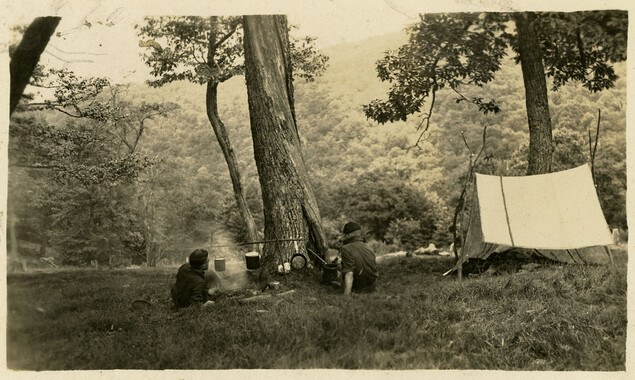
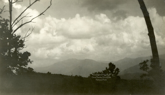
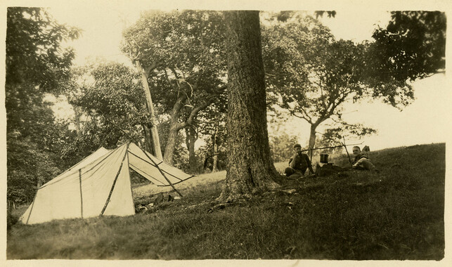
This 132-acre tract 299 in Cataloochee was owned by D. J. Boyd. While, in general, the Great Smoky Mountains region was sparsely populated, the Cataloochee Valley remained an exception. By 1900, the population of Cataloochee had grown to 1,000 residents living in hundreds of log and frame homes. A few historic buildings have been preserved on site, including two churches, a school, several homes, and outbuildings. The North Carolina Park Commission was tasked with purchasing land for the Great Smoky Mountains National Park and people living in Cataloochee were among those displaced. Cataloochee families continue to return for annual reunions. In 2001, the National Park Service re-introduced elk into the valley.
-


Part of Collection
Great Smoky Mountains - A Park for America